
Posted on 07/22/2020 5:45:02 PM PDT by SeekAndFind
Elastic reinforced concrete structure design?
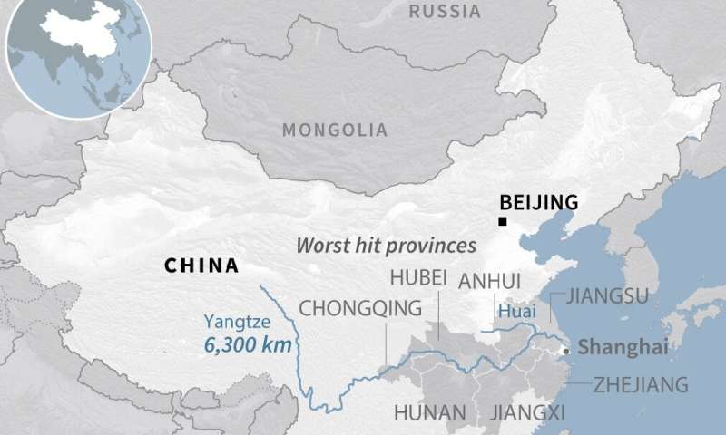
IIRC, the Yangtze River cuts through Wuhan, right in the path of the flood zone. Unless I have the river flow backwards.
When the levee breaks mama you got to move
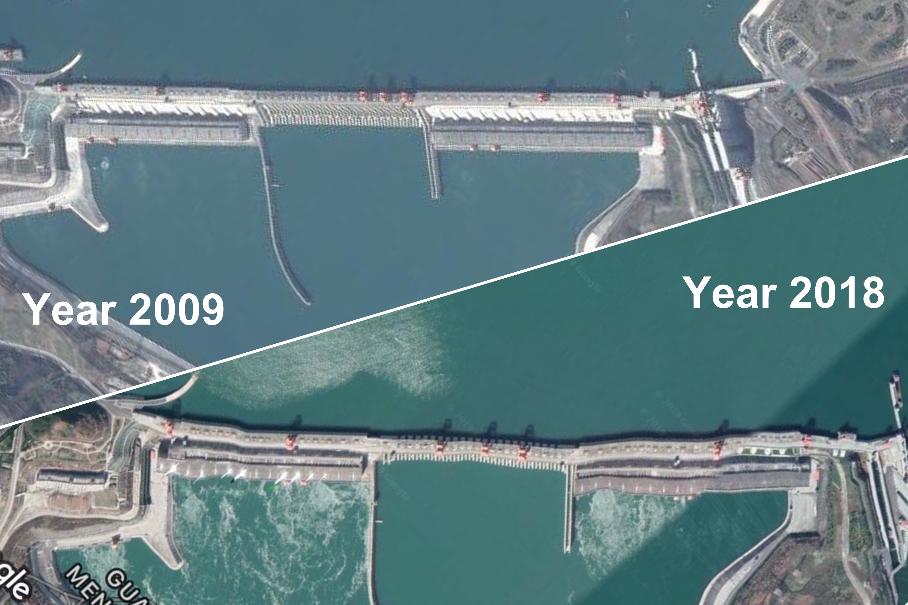
Not sure about the rest of this but the photo they use (link below) looks to me like photo imaging warping, whether accidental (caused by the atmosphere, though I doubt it) or by using puppet warp on Photoshop:
https://img.theepochtimes.com/assets/uploads/2019/07/08/Three-Gorges-Dam-20092018.jpg
There’s no way the dam is that deformed and also other elements in the photo look to be deformed as well.
The latest image on Apple Maps shows “distortion” ... and the overhead power lines are completely straight. I don’t know when that image was taken, but the straight power lines indicates the image is not optically distorted. (Google Earth image from 2018 shows distortion on the power lines as well, indicating only optical distortion - not physical.)
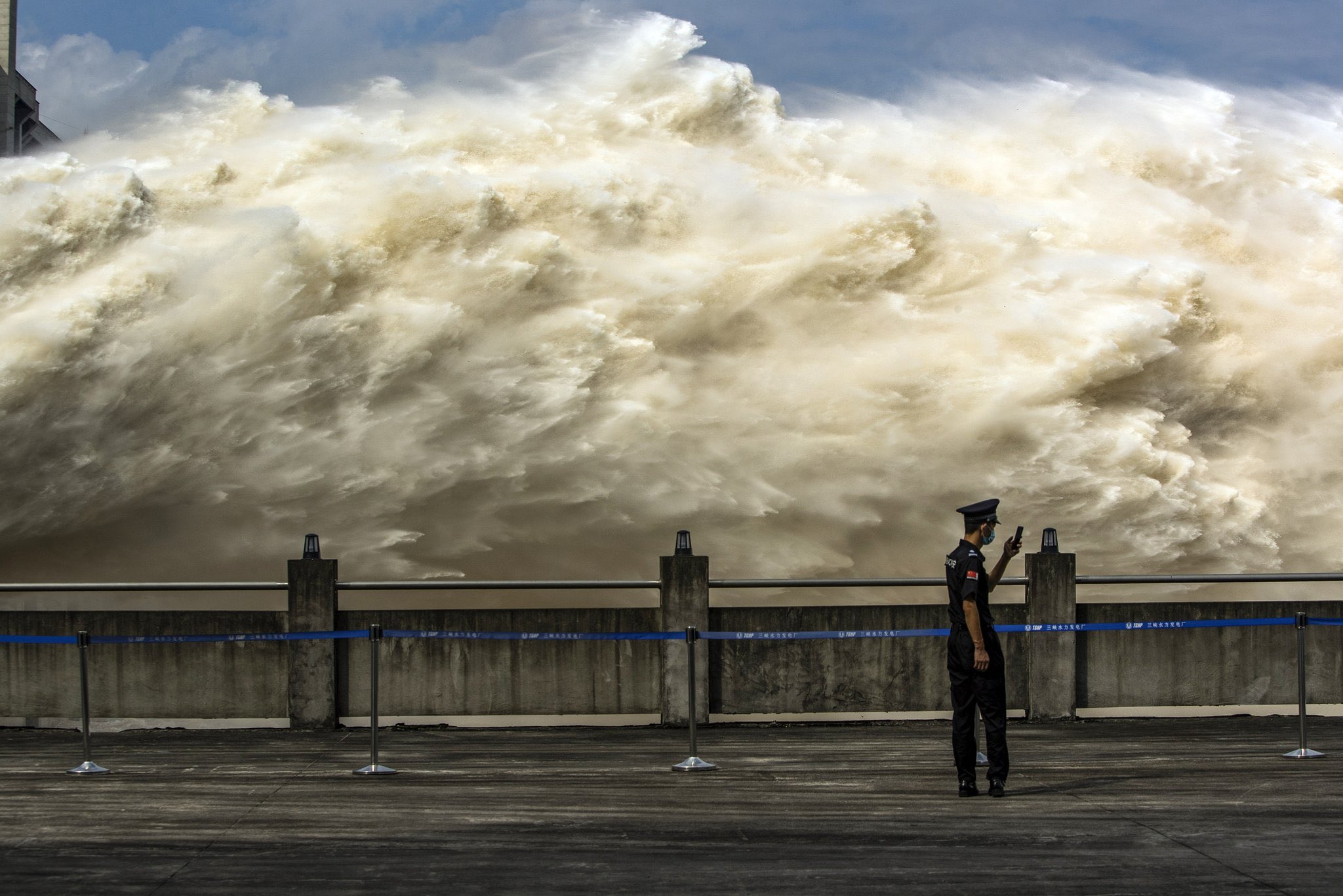
There’s more water coming in than the dam is capable of controlled release. Enormous storms, and not enough early release.
They’re already causing damage downstream by opening the floodgates wide open. Unfortunately for the dam, the floodgates aren’t big enough.
Current image on Apple Maps shows the straight structures (power lines) are straight. Very bad sign.
(Contrast with older pictures, where the power lines were distorted similar to the apparent dam distortion.)
All that hydraulic pressure is gonna turn Wuhan into a mud flat.
400 million people without food, water, or power stumbling around an irradiated swamp. How many plants? Are we talking about meltdowns?
Concrete does not bend well. It is, however, very good at cracking!
They have been releasing water, to slow the rise behind the dam, but they have to balance it against the flood conditions that already exist down river. They get the weather forecast for the upcoming rain, and model the buildup and runoff and such.
Bottom Line: Even though they have been releasing a flood downstream, the water still built up to a record level behind the dam. Once in a hundred year rains.
They reported just this last weekend that the flow rate peaked on Saturday night. Hope the rain lets up.
Releasing excess water at Three Gorges Dam last week:
If you’re thinking “when the levee breaks mama you got to move” you gots to move NOW.
I’ve pointedly told my kids “never live in an area that could possibly be flooded.” Chose my homes that way, based on an offhand comment from my father “if we’re ever flooded, Syracuse would be under 900 feet of water.”
This image is the disturbing one: https://twitter.com/ctdonath/status/1285027190350983169?s=20
As I noted above, the power lines are clear and straight. The dam isn’t.
I’m going to take the other side on this one. I tried putting the side of a piece of paper against the power lines next to the biggest deformity and in fact they don’t seem straight. And since they are at an almost 90 degree angle to the direction of the deformity, I would expect them to be only very slightly deformed by warping the dam perpendicular to its run. I also find it a bit suspicious that the greatest deformity occurs in a place where there’s no power lines.
Also, I think that if structures that large shift even a half inch, which you would never even notice without a laser measure, they would be severely structurally unsound. This photo suggests tens of feet of deformation.
Maybe it’s possible but I’m pretty doubtful.
Well, just blow a big hole in the dam like right next to the floodgate and make a new floodgate that way.
That would let some water out, wouldn’t it?
Disclaimer: Opinions posted on Free Republic are those of the individual posters and do not necessarily represent the opinion of Free Republic or its management. All materials posted herein are protected by copyright law and the exemption for fair use of copyrighted works.