Part 1 is a timeline sequence of who reported what flood events, to whom, and when it was reported. It can be found here:
Part I: Hurricane Katrina Flood Report Sequence
Part 2 is a discussion of the levee system's viability, or lack thereof, prior to Hurricane Katrina. It can be found here:
Part II: Pre-Katrina Levee Assessment
Part 3 is a discussion of the overall storm surge sequence, levee failure modes, and causal limitations relating to the 17th Street Canal and London Canal seawall breaches. It can be found here:
Part III: Downtown New Orleans Levee Failures
Part 4, this part, is an assessment of the current functionality and status of the levee systems in St. Bernards and East Orleans Parish.
The original intention for this section was to also include an analysis of the flood sequence in St. Bernard's Parish and East Orleans Parish, and to arrive at some conclusions regarding whether or not the post storm empirical evidence supports the position that significant subsidence had rendered the levee systems fatally flawed before Hurricane Katrina, but that work will have to wait until section five now, because Hurricane Rita is just causing too much trouble and taking up too much time.
I choose not to wait and include everything together because some people are still located in New Orleans and the surrounding areas, and this assessment has yet to reach the general public in its entirety, therefore, additional delay potentially places those persons at risk.
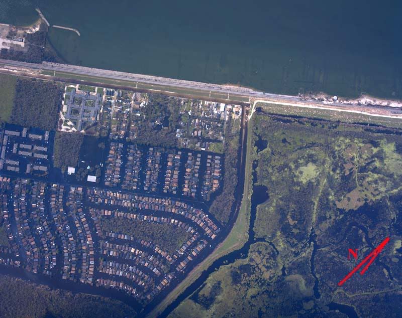
The primary foundation for this assessment rests on an experimental aerial photography/distribution technique developed by the National Oceanographic and Atmospheric Administration (NOAA), and links to this photographic database can be found here:
NOAA Post Katrina Overhead Imagery
The assessment for each of the two areas begins with a status map of that area's levee system, which is followed by a text summary of each notable feature as specified on the map, including a link to the imagery of that feature. The maps are roughly 200kb in size, while each individual sub-image runs between 30 and 160KB.
St. Bernard Parish Levee System Overview Map
St. Bernards Parish Levee System Post Katrina Damage Assessment
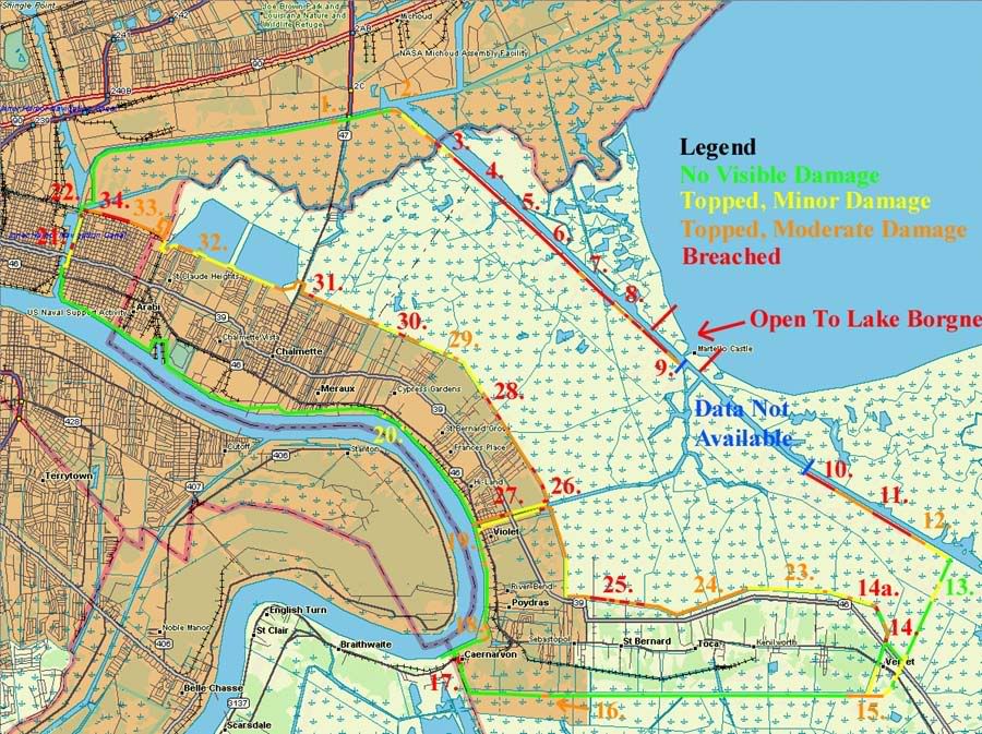
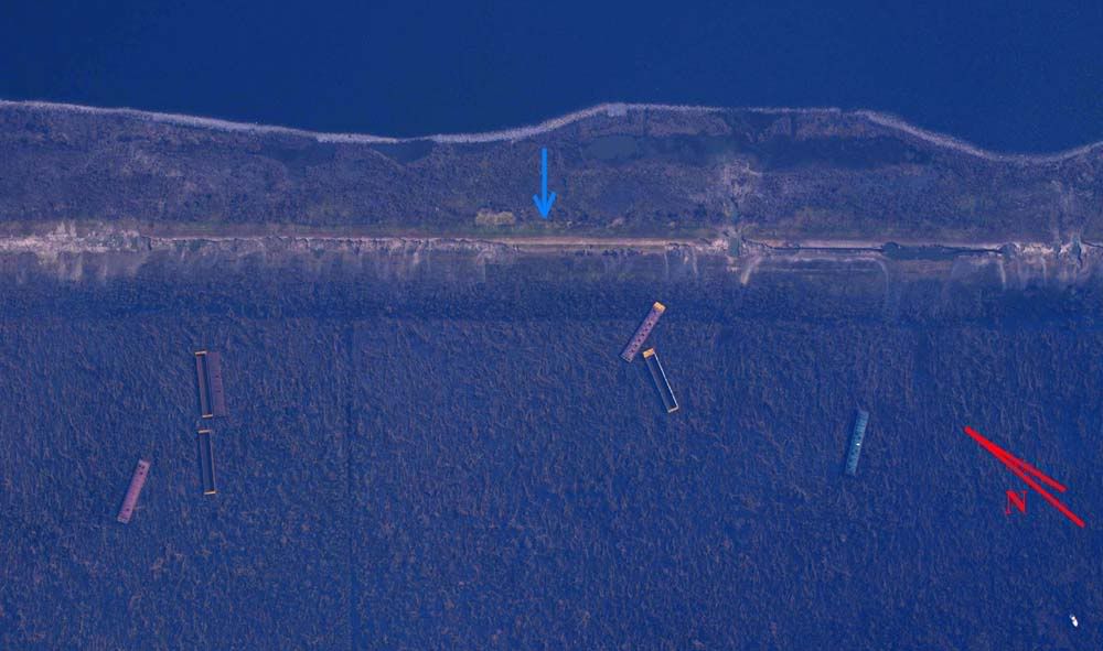
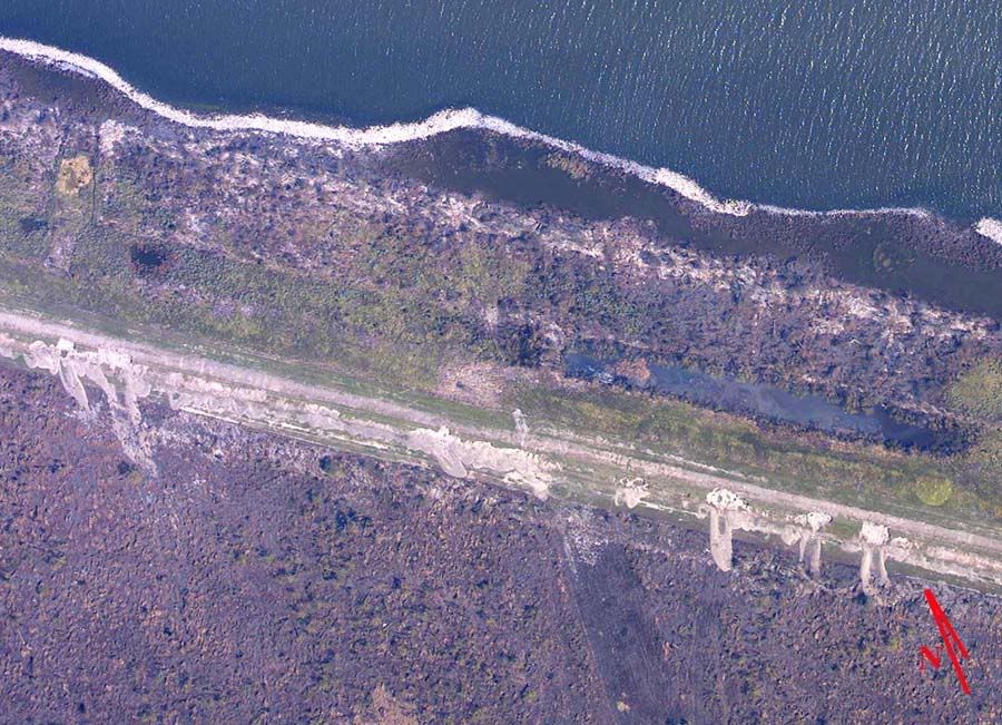
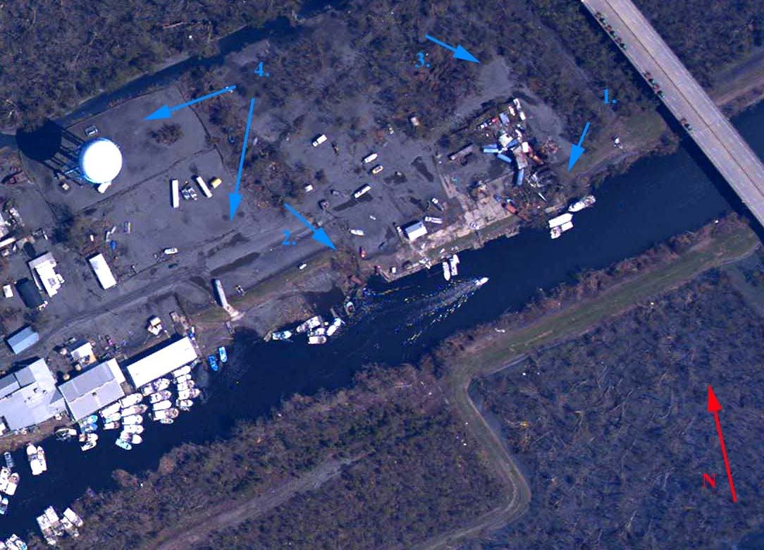
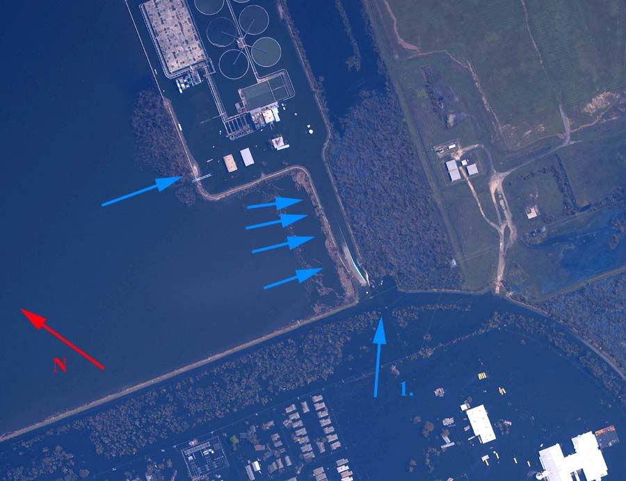
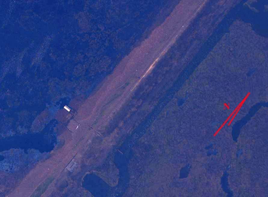
1. Levee/seawall topped by surge at arrow 1, moderate fill displacement, seawall flanked at arrow 2 with moderate fill displacement at arrow 2 and minor fill displacement at arrow 3. The larger of the barges in the image probably unseated the seawall on impact, loosening compacted fill behind the wall. The surge itself, or else disrupted flow over the smaller barges, caused scouring and potholing indicated by the arrows at 4.
Overhead Image
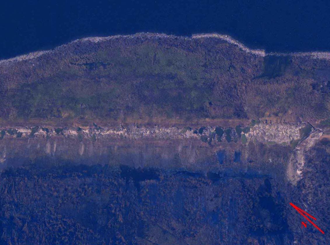
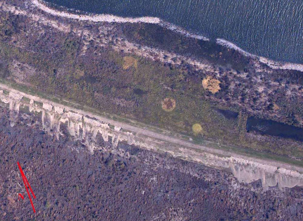
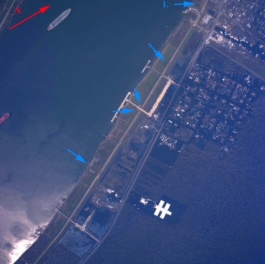
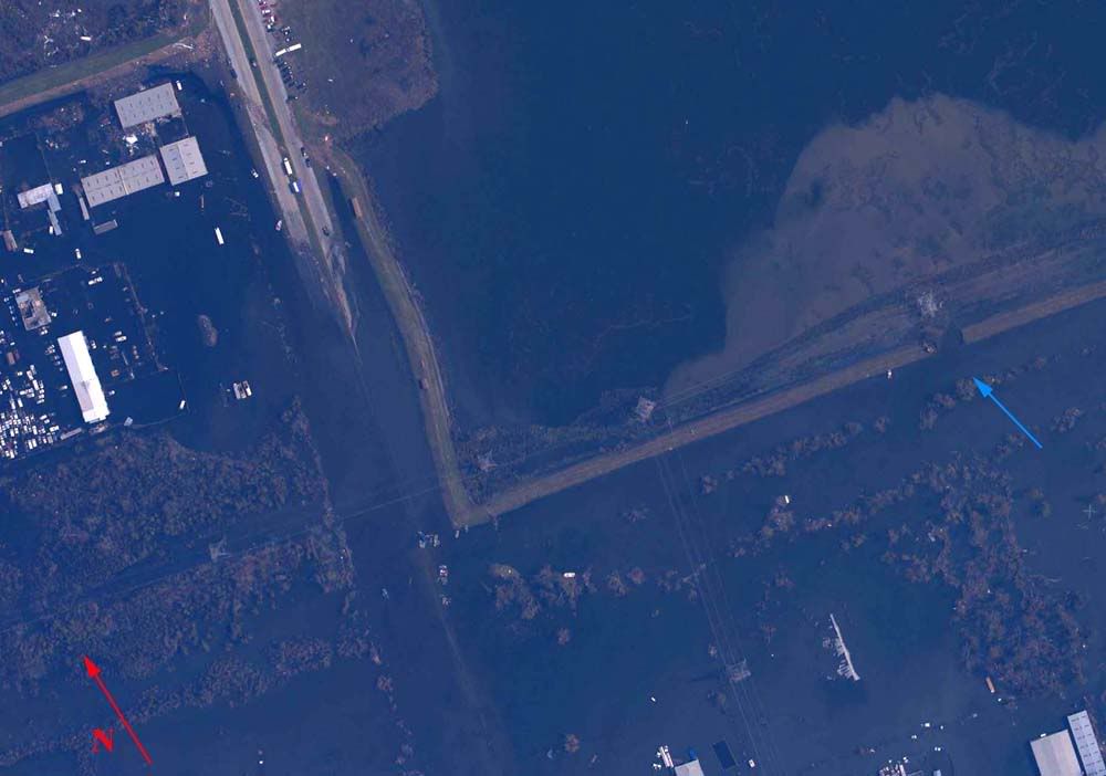
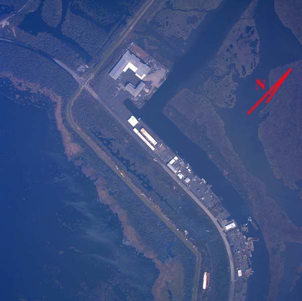
2. Surge topped levee from arrow 1 to 2 along the indicated direction, resulting in minor fill displacement on the inner face, and possible subgrade exposure indicated by arrow 5. A second surge apparantly did not top the levee from the direction of arrows 3 and 4, resulting in minor fill displacement on the levee's outer face. Assuming that the surge directions coincide with tangential winds at the time each event occurred, the surge indicated by arrows 1 and 2 took place shortly after passage of the eye's center, while the event indicated at arrows 3 and 4 occurred later in the storm.
Overhead Image
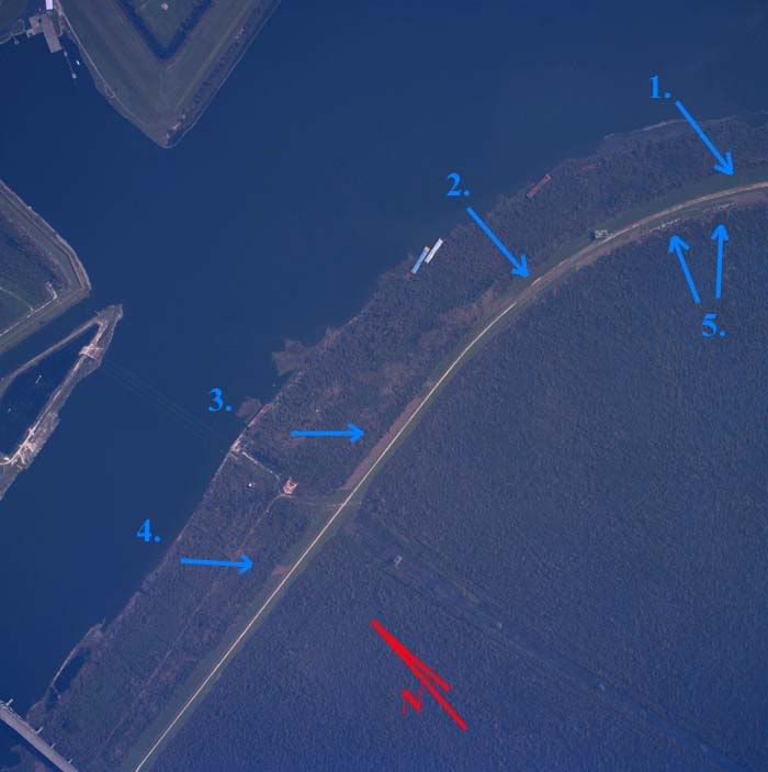
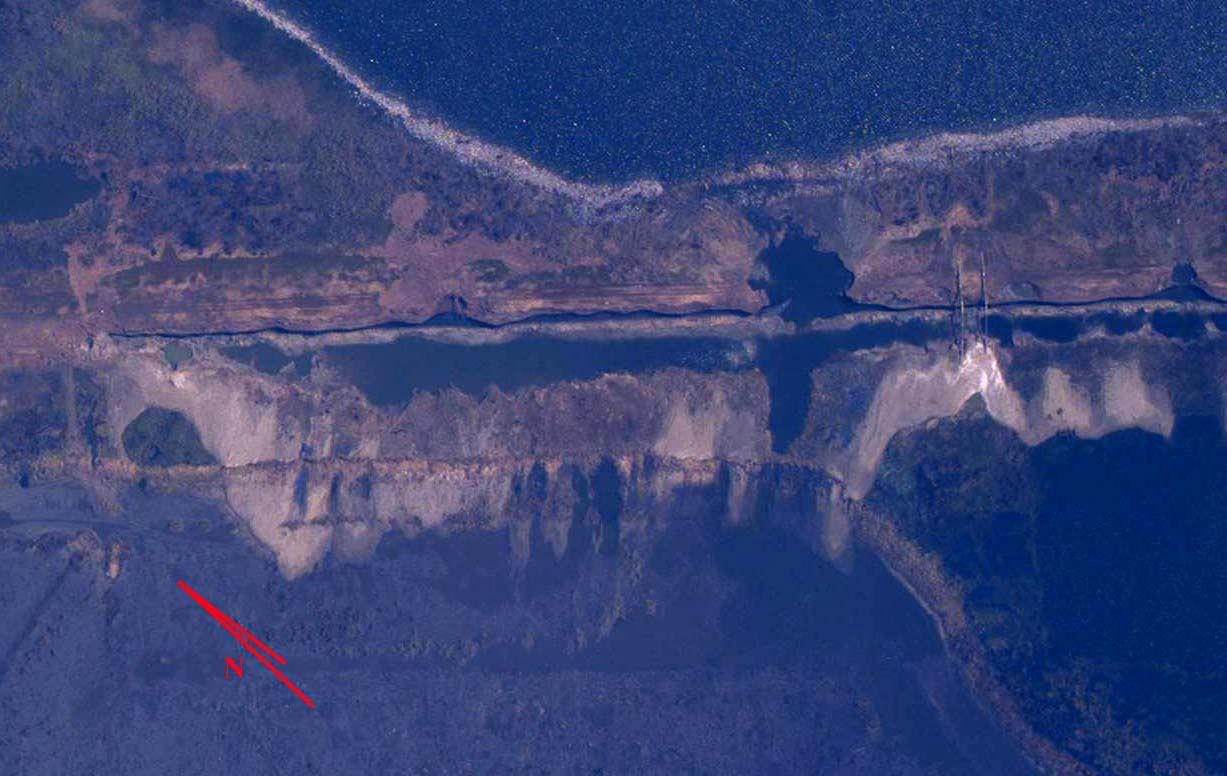
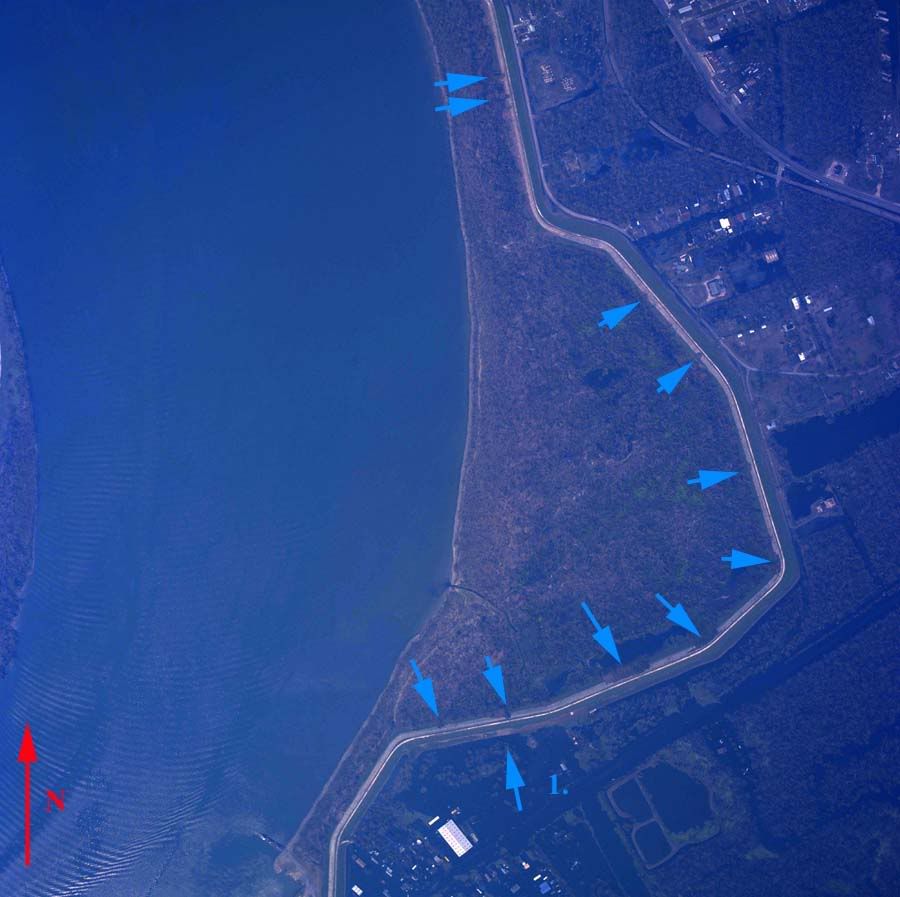
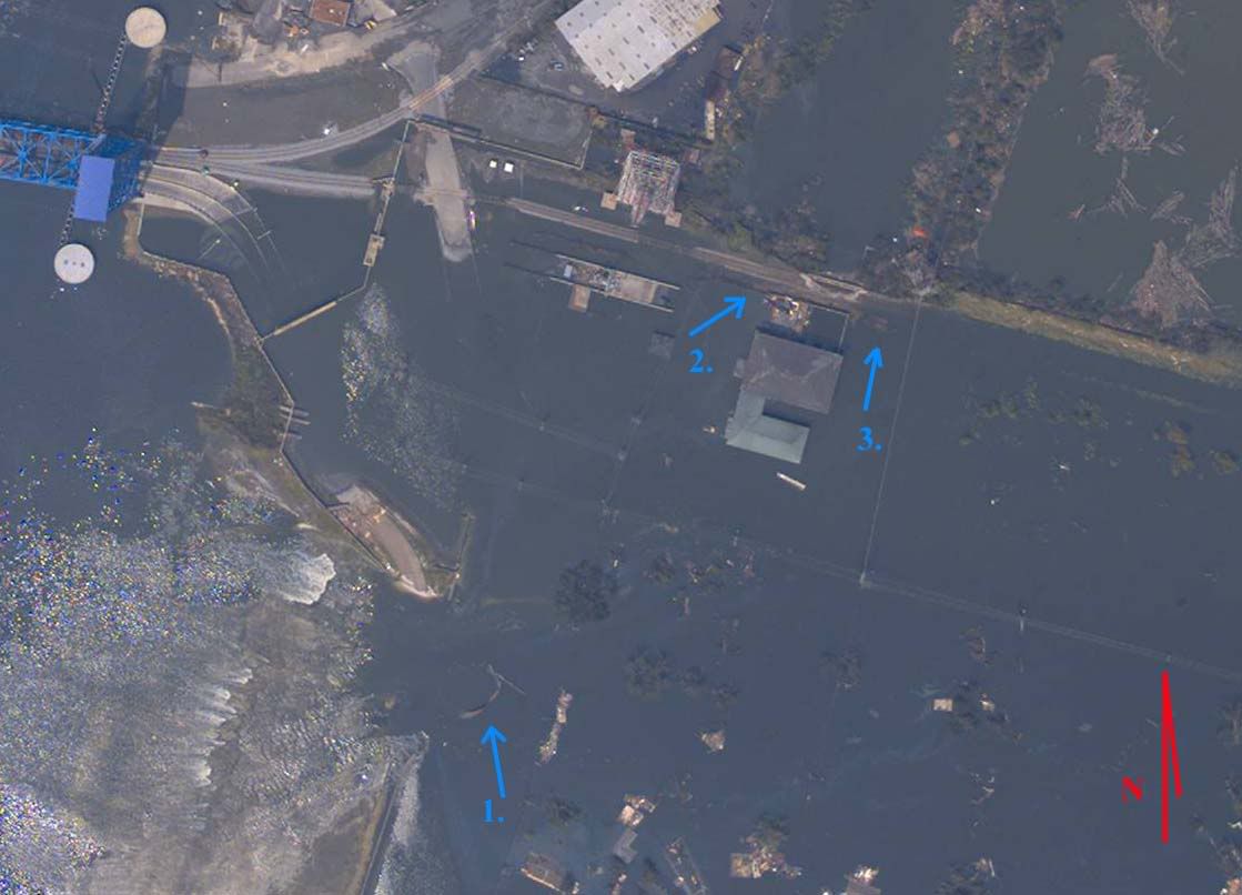
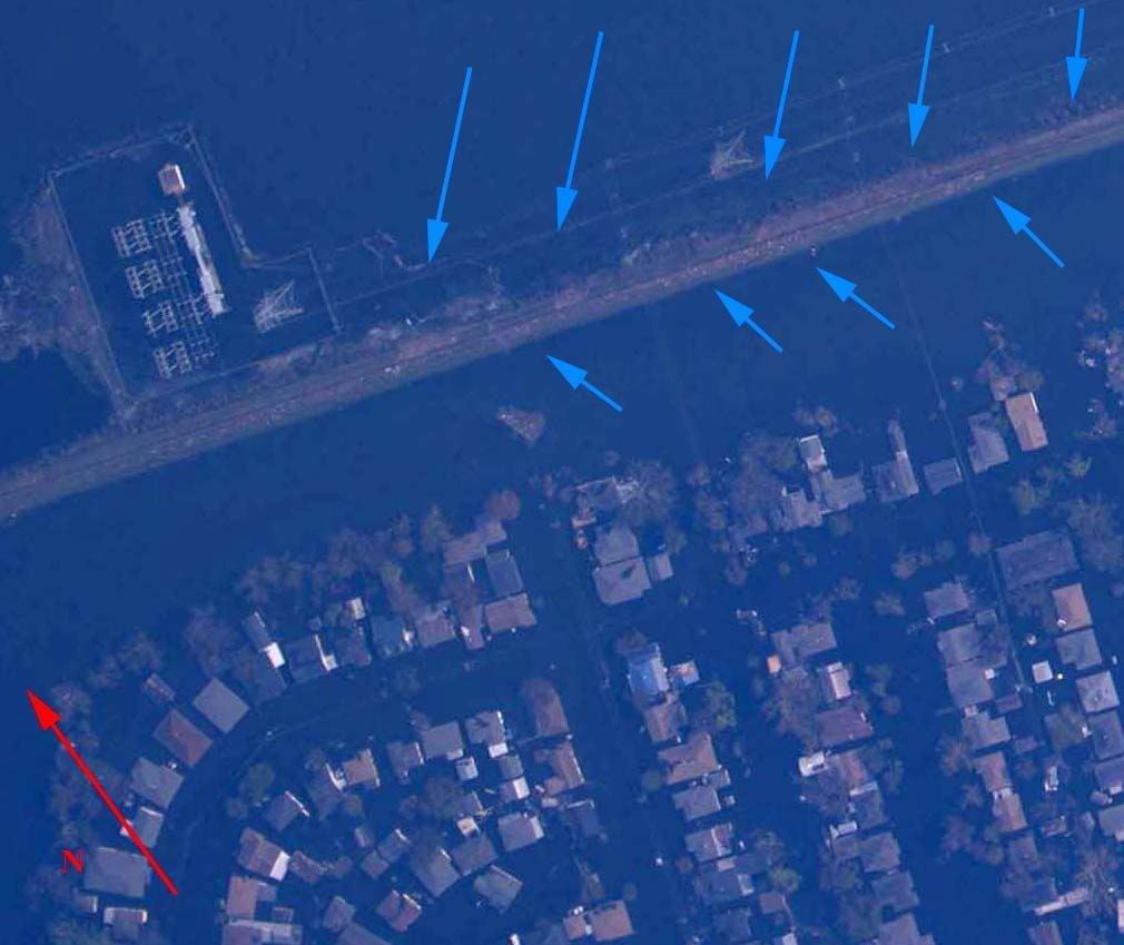
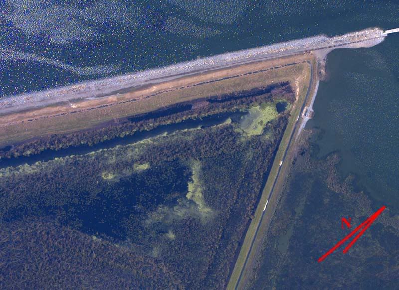
3. Inner face fill displacement indicates direction of surge at arrow 1. Barge atop seawall adjacent to flood control gate indicates surge topped seawall at arrow 2. Surge flanked seawall at arrow three, resulting in significant fill displacement. Easternmost flood control gate most likely inop at time of data capture. Topping at arrow 4 indicates levee cross section mostly intact. Barge at arrow 5 resting nearly at pre-storm levee crest, probably indicating that at least minimal vertical cross section remains intact. Full breaches at the remaining four non-numbered arrows.
Overhead Image
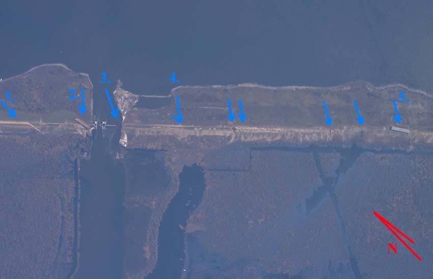
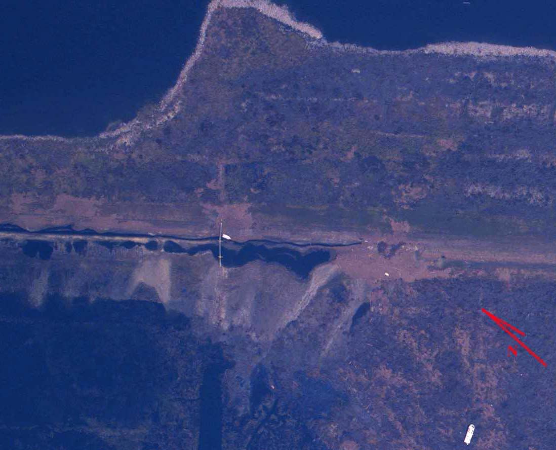
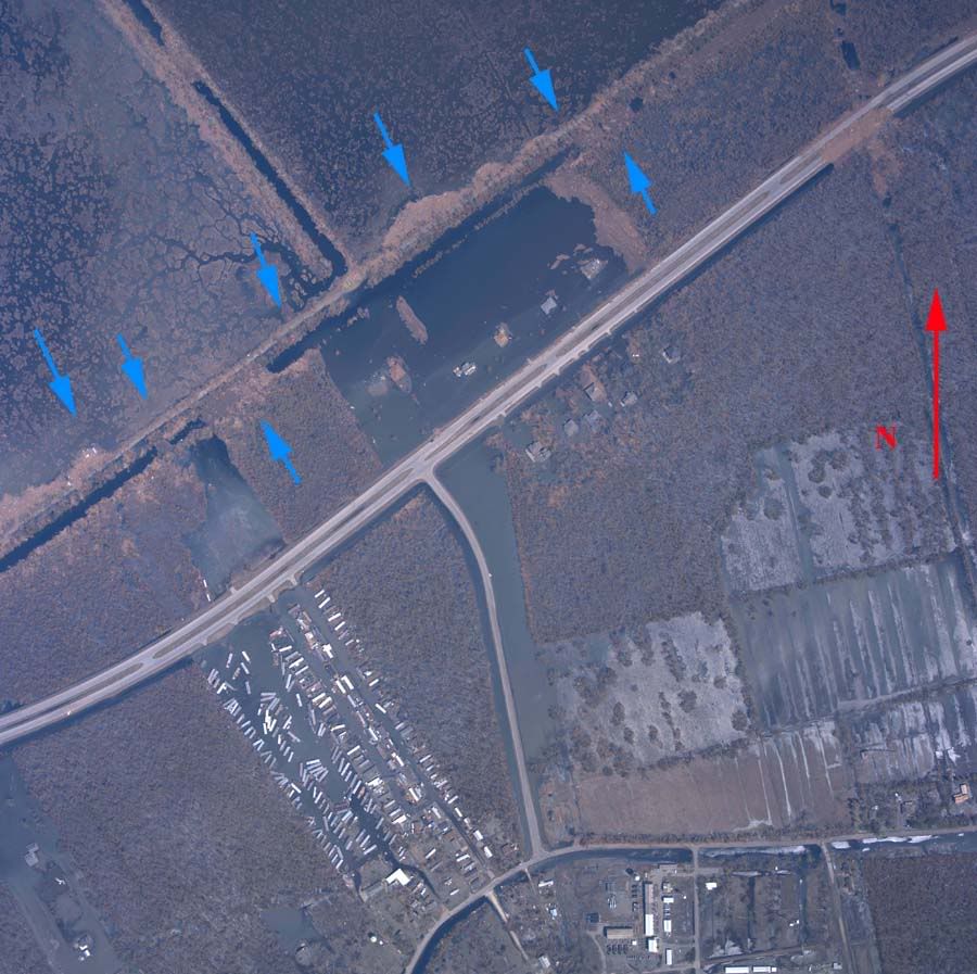
4. Numerous full breaches at arrows. Predominance of northwest trending fill deposition may indicate that these sections failed well prior to passage of the storm's eyewall.
Overhead Image
5. Catastrophic breaching. One section of levee possibly undamaged at arrow. Barge lengths estimated at 100 to 150 feet for reference. Fill deposition indicates wind driven surge trending due west at failure.
Overhead Image
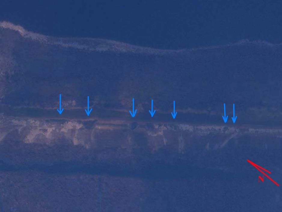
6. Catastrophic breaching. No undamaged sections of levee visible.
Overhead Image
7. Catastrophic breaching. Twin pipelines exposed. Significant fill transport.
Overhead Image
8. Catastrophic breaching. Pipeline exposed. Some visibly undamaged levee sections left standing.
Overhead Image
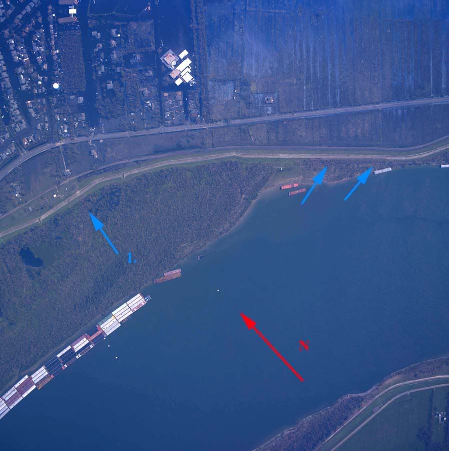
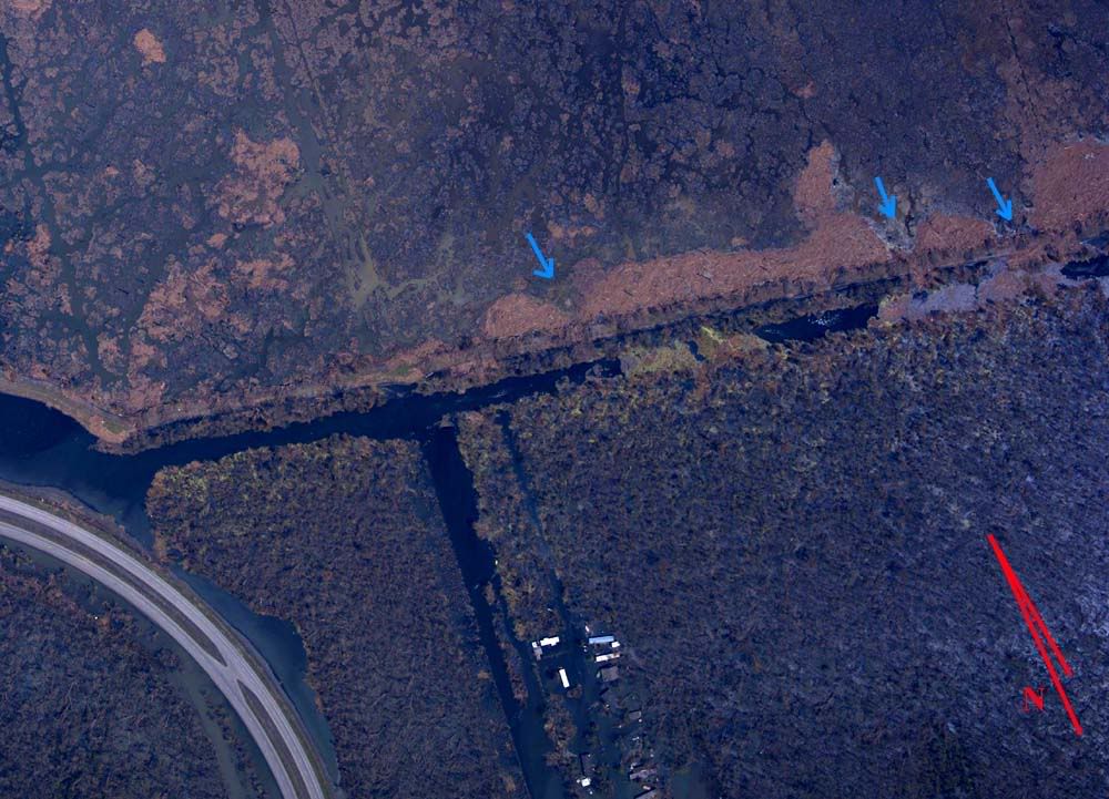
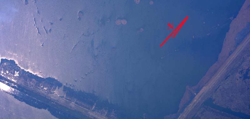
9. Catastrophic breaching, left third of image, balance of levee shows intermittent full breaches. Wetland barrier between Mississippi River Gulf Outlet and Lake Borgne breached for approximately 1 mile, open to the Gulf of Mexico. Island at image's upper right is probably remnants from Martello Castle.
Overhead Image
10. Intermittent breaching/significant scouring and fill transport.
Overhead Image
11. Intermittent breaching/significant scouring and fill transport.
Overhead Image
12. Intermittent breaching/significant scouring and fill transport.
Overhead Image
13. Minor topping and scouring, subfill exposed at arrows.
Overhead Image
14. 200' full breach. Fill transport at arrows 1 and 2 indicates a probable bidirectional flow of water at different times during the flooding. Arrow 3 probably indicates another storm breach.
Overhead Image
14a. Two full breaches, water flowing out of populated area, height differential noted with levee center line at arrows 1, probably sand boils at arrows 2, 3, and 4 indicate probable percolation through levee to downstream face.
Overhead Image
15. Scouring and potholing at arrows. Fill displacement suggests topping occurred from inside to outside.
Overhead Image
16. Topped in direction of arrows. Minor fill transport.
Overhead Image
17. Seawall breach at arrow, may be deliberate opening of flood control structure.
Overhead Image
18. ***RIVER LEVEE*** Concrete or riprap facing displaced, numerous locations at arrows. River levee vulnerable to river wave action where facing no longer exists. Minor fill displacement at arrow 1 on inner face.
Overhead Image
19. ***RIVER LEVEE*** Concrete or riprap facing displaced, locations at arrows. River levee vulnerable to river wave action where facing no longer exists. Moderate fill displacement at arrow 1 on outer face.
Overhead Image
20. ***RIVER LEVEE***Concrete or riprap facing displaced, locations at arrows. River levee vulnerable to river wave action where facing no longer exists. Minor fill displacement at arrow 1 on inner face.
Overhead Image
21. 500' seawall breach, probably caused by loose barge, debris logjams at arrows 1 and 2, and the resting location of the barge at arrow 3, indicate the initial surge flow was in through the breach, though later the flow reversed, as shown in the image.
Overhead Image
22. Seawall breach, seawall remnant at arrow 1 indicates initial failure was inward, debris transport at arrows 2 and 3 indicate that Florida Canal breach (between the arrows) was in opposition to the seawall breach at arrow 1, at some point flow reversed direction at arrow 1 and flows out of the breach at the time the photo was taken.
Overhead Image
23. Minor potholing, fill displacement and scouring at arrows.
Overhead Image
24. All visible sections heavily abused. Fill displacement and transport at arrows probably indicates weakening.
Overhead Image
25. Multiple full breaches at arrows, fill transport away from breaches indicates significant flood velocities away from the populated area.
Overhead Image
26. Multiple breaches at arrows, fill transport and scouring at arrows 1, 2, and 3 indicate initial breachs from Violet Canal into populated areas, while cratering at arrow four may be due to wave action or may be due to populated areas overfilling with water topping the levee back out into the marshy areas later.
Overhead Image
27. Breach at arrow 1, probable breach at arrow 2. Debris in breach at arrow 1 indicates significant flow volume and velocity out of populated area, but wetting and scouring at arrows 3 and 4 indicates a counterflow at some point, into the populated area.
Overhead Image
28. Multiple breaches at arrows, debris deposition indicates flow into populated area.
Overhead Image
29. Numerous small pockmarks and fill displacements at arrows.
Overhead Image
30. Breaches at arrows. Minor flanking at both ends of pump station seawall. Fill removal pattern there indicates that flow direction was into the populated area.
Overhead Image
31. Breach at arrow, fill transport out of populated area, smooth and linear breach perimeter and presence of heavy equipment adjacent to breach indicate this is probably a deliberate breach.
Overhead Image
32. Numerous minor and moderate cave-ins and scoured areas on outer face, subfill exposed along inner face, events probably originated from both inside and outside.
Overhead Image
33. Possible breach or damage to flood control structure at arrow 1. Numerous pockmarks, boils and fill displacements at arrows.
Overhead Image
34. Possible subsistence issue, long stretch of levee under or nearly underwater.
Overhead Image
East Orleans Parish Levee Overview Map
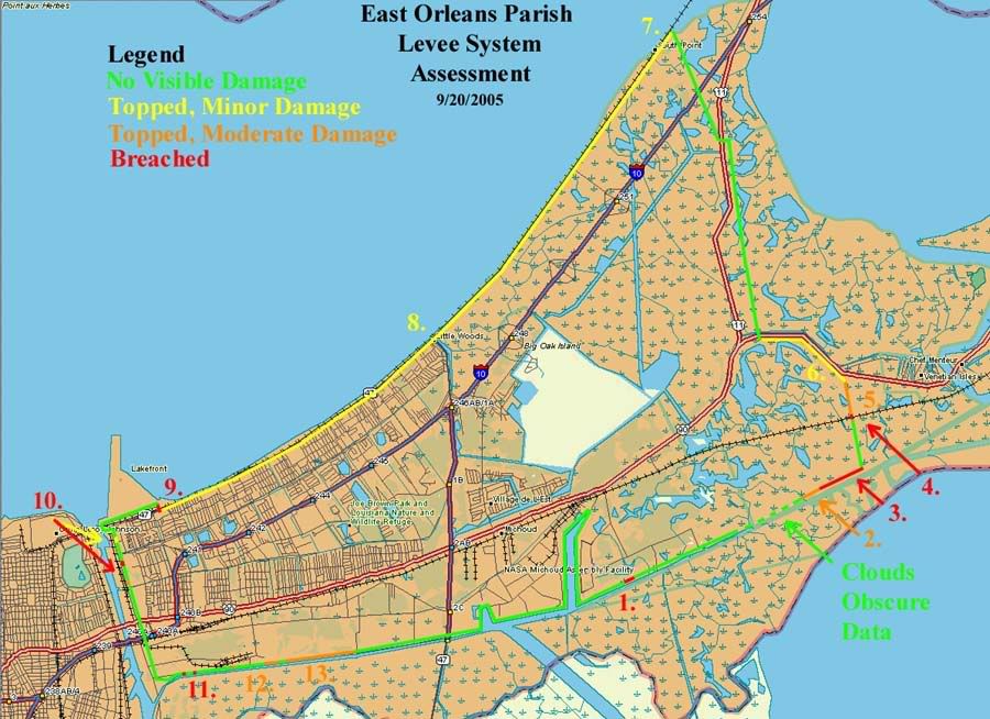
East Orleans Parish Levee System Assessment
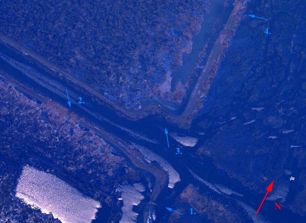
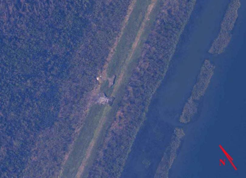
1. Isolated breach and partial collapse, probable cause; topped by rogue wave, secondary source of rural east Orleans flooding.
Overhead Image
2. Major breach, several areas of significant scouring, probable cause; liquefaction by sustained surge. Major contributing factor to rural east Orleans flooding.
Overhead Image
3. Multiple major breaches, topped by sustained surge, numerous full and partial breaches, wide areas of vegetation inside failed section removed by scouring, significant quantities of fill material deposited at considerable distances from point of origin. Major contributing factor to rural east Orleans flooding.
Overhead Image
4. Minor breach, flood control gate flanked by sustained surge, moderate amount of non-structural fill removed.
Overhead Image
5. Topping by sustained surge, moderate fill removal, some pocking and cratering but no full breaches visible.
Overhead Image
6. Minor Topping. Debris fields indicate considerable topping occurred, but little, if any damage or fill transport is visible.
Overhead Image
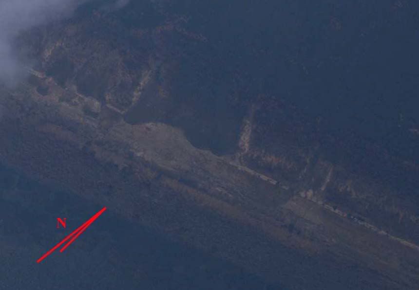
7. Minor topping. Well designed corner withstood peak winds with only minor wave topping on the Lake Pontchartrain section. Negligible fill quantities deposited on inner Lake section face, visible only under magnification. Flooded road atop levee indicates a depression there, not significant damage.
Overhead Image
8. Minor topping. Debris fields indicate frequent wave topping, but no fill appears to have been disturbed, with the possible exception of the inner face, upper left section of image.
Overhead Image
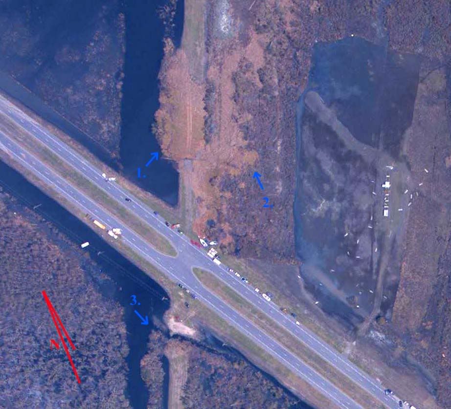
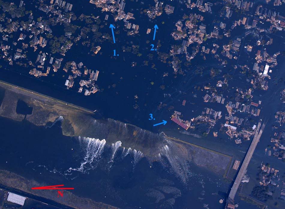
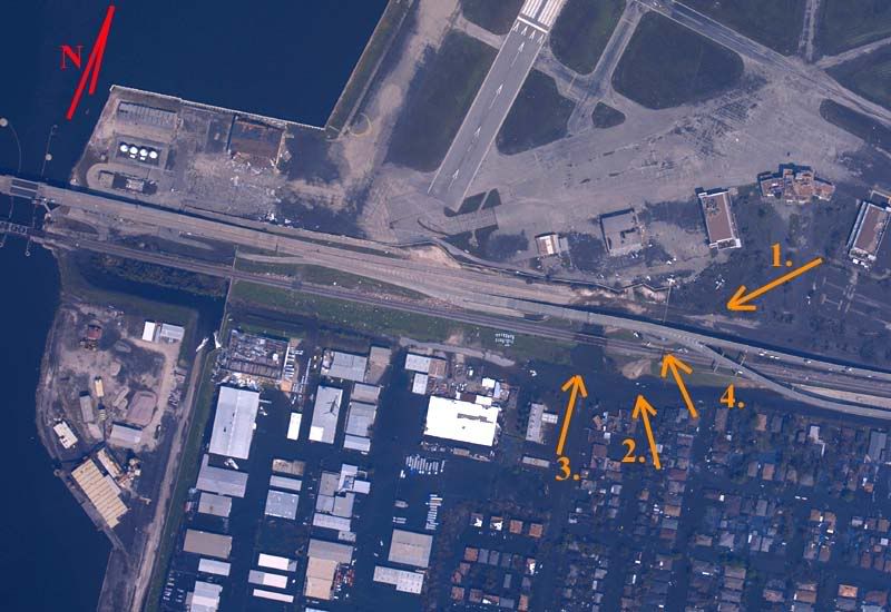
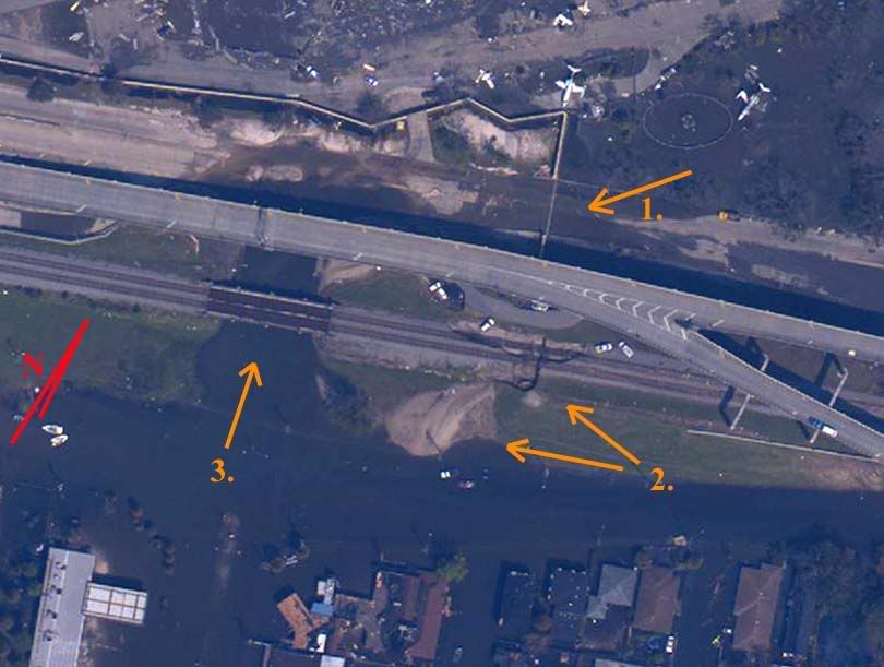
9. Certain small breach, probable major breach, critical components obscured by elevated freeway. If so, this is most likely the primary cause of urbanized east Orleans flooding, with inundation from Lake side wave topping secondary in effect. Sustained Lake surge at arrow 1 probably flanked or topped flood control gates at same location. Some flooding certainly took place as evidenced by displaced fill at arrow 2. Significantly more flooding probably occurred through waterway at arrow 3. Elevated freeway pylons at arrow 4 may have been undermined by scouring.
Overhead Image Zoom Overhead Image
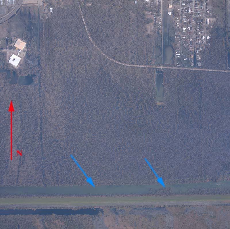
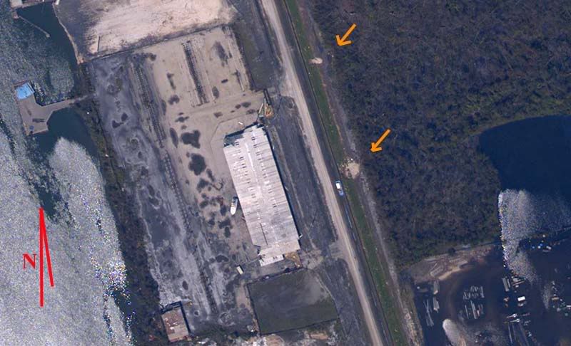
10. Minor breach and moderate scour, probably due to Lake surge channelized between buildings.
Overhead Image
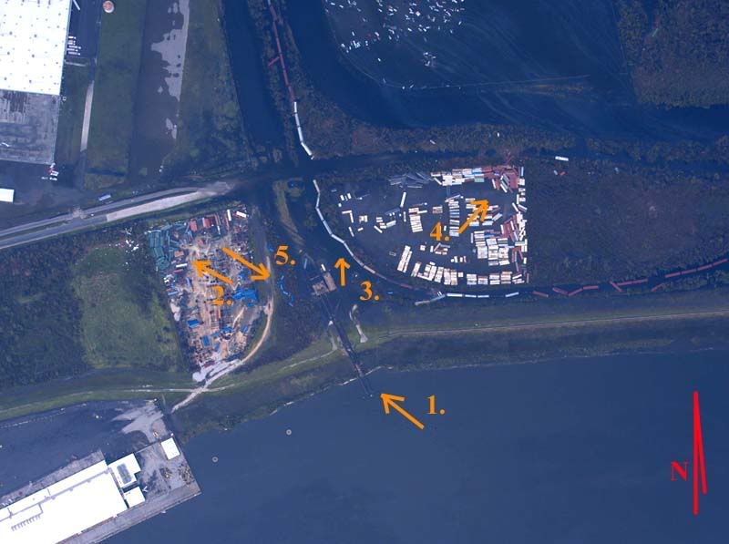
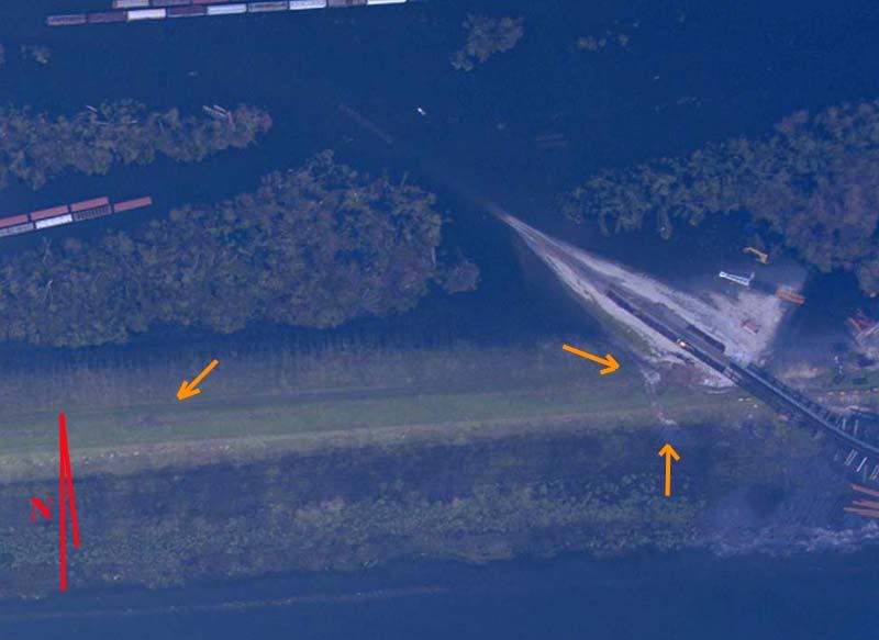
11. Major breach or significant surge/topping. Unclear if arrow 1 denotes a breach but two areas of fill displacement on inner face demonstrate flowing water in this area, as do rail cars pushed from tracks at arrow 3 and displaced shipping containers at arrows 2 and 4. Also interesting is an apparant reversal in surge flow as evidenced by displaced bright blue containers at arrow 5. This later and lesser surge is also evidenced by the oil slicks from parked cars at upper right of the image.
Overhead Image
12. Minor topping/scouring at arrows.
Overhead Image
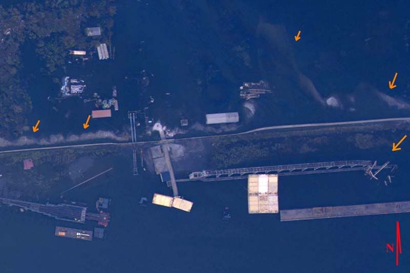
13. Significant fill transport at arrows inside levee indicate a large area of surge topping and direction of travel. Gantry damage at arrow outside wall may indicate either wind direction or a surge reflection from the seawall.
Overhead Image
Even without delving into detailed analysis, certain conclusions are hard to miss.
1. Many or most failed sections were subjected to a storm surge far beyond their original design specifications.
2. Both Parish areas flooded from multiple levee breaches, from different directions, and at different times.
3. Many levee segments failed in multiple directions at different times during the storm's passage.
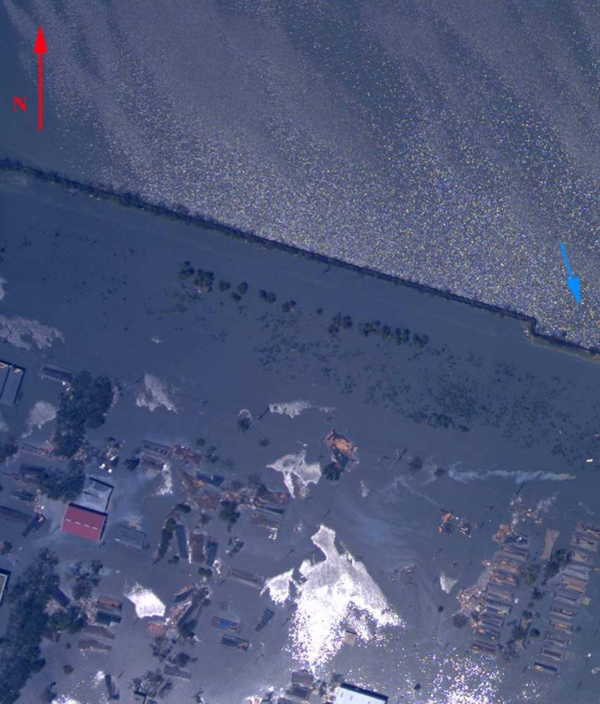
4. Notably absent are significant failures along the Intercoastal Waterway between the two Parish areas. Funneling did not result in levee failures in this area.
I have some thoughts on these issues already and have a good idea how the flooding sequence took place, but this is a good spot to leave off, if for no other reason than it's time to take a look at Rita and see if she's turned towards Houston since 1 am or not. Feel free to ask questions or raise issues not considered so far.