Skip to comments.
It wasn't just redistricting that gave Republicans their House majority
Washington Examiner ^
| February 14, 2013
| Michael Barone
Posted on 02/21/2013 5:24:17 PM PST by JerseyanExile
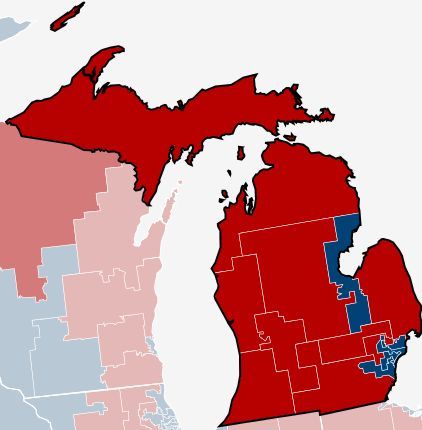
Here’s something to think about for those who say that the only reason Republicans won a majority of House seats last November is favorable redistricting. I agree that Republicans did have a net advantage in redistricting in the 2010 Census cycle, but not an overwhelming one: Republican advantages in Florida, Michigan, North Carolina, Ohio and Pennsylvania were offset to a significant extent by Democratic advantages in Arizona, California and Maryland.
But there’s another factor that gives Republicans an advantage in equal-population districts: clustering. Democratic voters, particularly in the two Obama elections, tend to be clustered in black, Hispanic and gentry liberal neighborhoods in major metropolitan areas and (this makes a difference in state legislative districting but not so much in congressional districting) university towns. Democrats win districts in such areas by huge margins, with upwards of 70% of the vote in many cases. Republican voters are pretty evenly dispersed outside these clusters.
Clustering in big metro areas helps Democrats clinch the electoral votes of several large and medium-sized states: California, Illinois, Massachusetts, New Jersey, New York, with 129 electoral votes. That gives them an advantage in the electoral college, since the only similarly sized states that are safe Republican are Texas and Georgia, with 53 electoral votes. But clustering hurts Democrats in equal population plans.
Proof comes from this “Electoral Reform Map” which divides the United States into 50 equal-population states. The folks who did this want to reduce the power of small states in the Electoral College. They used algorithms in order to draw the states and then smoothed out the boundaries, keeping major metro areas together in one state (or more than one when they have enough population). It’s a pretty neat looking map. And each state would have the same number of electoral votes.
I estimated which of their 50 states had more votes cast for Barack Obama and which had more votes cast for Mitt Romney. My count is Romney 29, Obama 21. So their plan would have produced a Romney presidency. Now obviously the campaign would have been conducted differently if the Electoral College worked that way. But my point remains solid: in an election in which Obvama won the popular vote 51%-47%, a politically neutral division of the nation into 50 equal-population states would have given Romney 58% of the electoral votes and Obama 42%. Equal-population districts work against the Obama Democratic coalition.
This effect was visible as well in elections to the House, which have equal-population districts within each state. Republicans won 234 seats in the House and Democrats 201. Mitt Romney appears to have won (I’m waiting on final counts) 228 House districts and Obama 207.
Interested readers with time on their hands might want to actually calculate the vote in each of these districts, and my estimates may be wrong in a couple of cases. But if I’m anywhere close to right, Romney carried a majority of these equal-population states.
TOPICS: Culture/Society; Government
KEYWORDS: electoralcollege; states
The aforementioned map.

The population of House districts ranges from 528,000 to 924,000. After this reform, every House seat would represent districts of the same size. (Since the current size of the House isn't divisible by 50, the numbers of seats should be increased to 450 or 500.) States could be redistricted after each census - just like House seats are distributed now.
The average population of the new states is 6,174,911. The smallest new state varies from this average by 2,087 (0.03%), the largest by 4,073 (0.07%). This is far less variance than is currently allowed in Congressional districts. More than half of the new states are within 0.01% of the target.
Methodology
The map began with an algorithm that grouped counties based on proximity, urban area, and commuting patterns. The algorithm was seeded with the fifty largest cities. After that, manual changes took into account compact shapes, equal populations, metro areas divided by state lines, and drainage basins. In certain areas, divisions are based on census tract lines.
The District of Columbia is included into the state of Washington, with the Mall, major monuments and Federal buildings set off as the seat of the federal government.
The capitals of the states are existing states capitals where possible, otherwise large or central cities have been chosen. The suggested names of the new states are taken mainly from geographical features:
Mountain ranges or peaks, or caves – Adirondack, Allegheny, Blue Ridge, Chinati, Mammoth, Mesabi, Ozark, Pocono, Rainier, Shasta, Shenandoah and Shiprock
Rivers – Atchafalaya, Menominee, Maumee, Nodaway, Sangamon, Scioto, Susquehanna, Trinity and Willimantic
Historical or ecological regions – Big Thicket, Firelands and Tidewater
Bays, capes, lakes and aquifers – Casco, Tampa Bay, Canaveral, Mendocino, Ogallala, Salt Lake and Throgs Neck
Songs – Gary, Muskogee and Temecula
Cities – Atlanta, Chicago, Columbia, Detroit, Houston, Los Angeles, Miami, New York, Newark, Philadelphia, Phoenix and Washington
Plants – Tule and Yerba Buena
People – King and Orange
Keep in mind that this is an art project, not a serious proposal, so take it easy with the emails about the sacred soil of Texas.
To: JerseyanExile
I want my state's electoral votes given by district so my vote will count again.
2
posted on
02/21/2013 5:29:37 PM PST
by
cripplecreek
(REMEMBER THE RIVER RAISIN!)
To: JerseyanExile
Mr Barone seems to have too much time on his hands left to him by his Washex editors. While he’s too valuable to send him to some place like Syria. He should be given additional responsibilities to occupy his time....I ahhh hope he wasn’t serious this is pretty funny .
3
posted on
02/21/2013 6:06:12 PM PST
by
mosesdapoet
("It's a sin to tell a lie", in telling others that , got me my nickname .Ex Chi" mechanic"ret)
To: JerseyanExile
I am moving to salt lake....
4
posted on
02/21/2013 6:06:24 PM PST
by
GraceG
To: cripplecreek
I want to get rid of that Commie, Levin and his clone Stabenow.
"Edward Spencer Abraham" wuz a leftist RINO and it's good that he's gone.
Mi is worse than MT when it comes to Senators.
5
posted on
02/21/2013 6:10:00 PM PST
by
Paladin2
To: JerseyanExile
Those districts bear no relationship to watersheds and don't comprehend that demographics are not constant. Plus all the 'rat concentrations need to be concentrated.
The flyover peeps need to be politically disconnected to be the rural, Constitutional self sufficient peeps.
6
posted on
02/21/2013 6:13:56 PM PST
by
Paladin2
To: Paladin2
What mechanism would re-district these states after each census?
Eventually the map would look like a gerrymandered NIGHTMARE!!!
7
posted on
02/21/2013 6:25:59 PM PST
by
GraceG
Disclaimer:
Opinions posted on Free Republic are those of the individual
posters and do not necessarily represent the opinion of Free Republic or its
management. All materials posted herein are protected by copyright law and the
exemption for fair use of copyrighted works.
FreeRepublic.com is powered by software copyright 2000-2008 John Robinson
