
Posted on 04/13/2012 3:20:25 AM PDT by dirtboy
Edited on 04/14/2012 10:35:01 AM PDT by Admin Moderator. [history]
The Storm Prediction Center has predicted a slight chance of severe weather for parts of Texas and Oklahoma this entire week, thus it should come as no surprise that the weekend holds the best chance of dangerous severe weather.
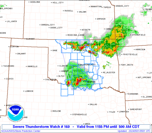
The Storm Prediction Center has issued an upgraded, high chance of severe weather from central Oklahoma through eastern Kansas (see image below). In addition, there is a moderate risk of severe weather from western Texas through southern Iowa, and a slight risk in the greater area from central Texas through southern Wisconsin.
I cannot stress the severity of this situation enough. Residents living in these regions should prepare for severe weather on Saturday.
Should be fine. The biggest problem is she will be onstage 7:30 til 9 pm and DH and I will be in audience. However, the campus monitors weather warnings and there is a large basement in the fine arts building. All should be well
A couple of warnings issued in far NW Oklahoma:
... A Tornado Warning remains in effect for northwestern Edwards...
northeastern Hodgeman... extreme southeastern Ness... northwestern
Pawnee and rush counties until 315 PM CDT...
At 306 PM CDT... trained weather spotters reported a tornado 3 miles
west of Burdett. Doppler radar showed this tornadic storm moving
northeast at 40 mph. Large destructive hail up to baseball size is
also expected with this storm.
Locations impacted include...
Burdett...
Rozel...
mainly rural areas of northeastern Hodgeman... northwestern
Edwards... northwestern Pawnee... rush and southeastern Ness
counties.
The first tornado has dissipated, however another storm just west of
the previous storm appears to be developing another tornado.
Precautionary/preparedness actions...
Take cover now. Move to an interior room on the lowest floor of a
sturdy building. Avoid windows. If in a Mobile home... a vehicle or
outdoors... move to the closest substantial shelter and protect
yourself from flying debris.
Heavy rainfall may obscure this tornado. Do not wait to see or hear
the tornado. Take cover now.
Lat... Lon 3835 9956 3835 9944 3835 9926 3835 9903
3828 9914 3798 9960 3809 9982
time... Mot... loc 2008z 228deg 36kt 3821 9957
hail 2.75in
The National Weather Service in Norman has issued a
* Tornado Warning for...
northeastern Harper County in northwestern Oklahoma...
extreme Northwestern Woods County in northwestern Oklahoma...
* until 345 PM CDT
* at 316 PM CDT... National Weather Service meteorologists detected
a severe thunderstorm capable of producing a tornado. This
dangerous storm was located 7 miles north of Selman... moving
northeast at 40 mph.
* This tornadic thunderstorm will remain over mainly rural areas
of northeastern Harper and extreme Northwestern Woods
counties.
Precautionary/preparedness actions...
Get in... get down and cover up. Take cover now in a storm shelter
or an interior room of a sturdy building. Stay away from doors and
windows.
Lat... Lon 3687 9920 3683 9952 3694 9962 3700 9953
3700 9920
time... Mot... loc 2016z 226deg 36kt 3691 9950
Line of tornadic supercells from central Kansas into far NW Oklahoma, and looks like the line is extending well into the Texas panhandle. The NWS has shifted the 45 percent risk area into this region in their latest forecast.
Tornado warning SW Iowa
The National Weather Service in Des Moines has issued a
* Tornado Warning for...
southeastern Adair County in southwest Iowa...
northeastern Adams County in southwest Iowa...
southwestern Madison County in south central Iowa...
northwestern Union County in south central Iowa...
* until 415 PM CDT
* at 342 PM CDT... National Weather Service Doppler radar indicated a
severe thunderstorm capable of producing a tornado. This dangerous
storm was located 10 miles south of Greenfield... or 11 miles
northwest of Creston... and moving east at 45 mph.
* Locations impacted include...
Orient and Macksburg.
Precautionary/preparedness actions...
This is a dangerous storm. Immediately seek shelter in a basement...
or in an interior room of a reinforced building. Stay away from
windows.
If you are outside... in a Mobile home... or in a vehicle... seek
shelter in a nearby reinforced building. As a last resort... find the
lowest spot available and cover your head.
Lat... Lon 4135 9418 4118 9409 4110 9455 4121 9461
time... Mot... loc 2047z 253deg 40kt 4119 9446
Thanks.
That’s all sliding a bit south of us.
Prayers up for all in the vicinity.
We are getting a little rain now up our way, and pretty steady thunder rumbling off to the south.
Much-needed rain, by the way. It’s been dry as a bone here.
Tornado warning for west-central Nebraska:
The National Weather Service in North Platte has issued a
* Tornado Warning for...
Logan County in west central Nebraska...
eastern McPherson County in west central Nebraska...
* until 500 PM CDT
* at 423 PM CDT... National Weather Service Doppler radar indicated a
severe thunderstorm capable of producing a tornado. This dangerous
storm was located 8 miles southeast of Ringgold... or 9 miles
southwest of Stapleton... and moving northeast at 35 mph.
* This dangerous storm will be near...
Stapleton around 435 PM CDT.
Other locations impacted by this dangerous storm include Highway 83
mile marker 120.
Precautionary/preparedness actions...
This Tornado Warning replaces the Severe Thunderstorm Warning that
was in effect for the same area.
Take cover now. Move to an interior room on the lowest floor of a
sturdy building. Avoid windows. If in a Mobile home... a vehicle or
outdoors... move to the closest substantial shelter and protect
yourself from flying debris.
Lat... Lon 4140 10088 4174 10080 4173 10027 4139 10053
time... Mot... loc 2127z 207deg 32kt 4144 10065
Very dry here in SE PA as well. Might get some rain tonight without the threat of the weather going all Dorothy on us.
In the wake of last year’s tornado disasters in Alabama and Joplin, Missouri, one thing is clear: the “science” of tornado warning is as much about sociology as meteorology. Before hundreds died in those storms, it was widely assumed that we’d never see death tolls on the scale of the 1974 Super Outbreak, or the storm that devastated Flint, Michigan in the early 1950s.
But the experts were wrong; despite 20 minutes of advance warning, more than 150 people died in Joplin. One reason was the power of the storm; when an F-5 tornado plows through a heavily-populated area, people are going to die. However, the death toll might have been lower if people had simply heeded the warnings.
In one case, the Weather Service interviewed a couple who set out for a local restaurant—despite the fact that tornado sirens were blaring. When they discovered the eatery was closed (because of the approaching storm), they headed to another restaurant. They survived because the staff there was also aware of the threat, and moved customers to a place of safety.
Once upon a time, people headed for shelter when a tornado warning was broadcast, or the sirens sounded. Today, folks go about their business, or grab a camera and head outside. That sort of mindset can be deadly.
Storm getting stronger in Kansas:
..A TORNADO WARNING REMAINS IN EFFECT FOR NORTHWESTERN BARBER AND
SOUTH CENTRAL PRATT COUNTIES UNTIL 445 PM CDT...
AT 425 PM CDT...NATIONAL WEATHER SERVICE DOPPLER RADAR INDICATED VERY
STRONG ROTATION ASSOCIATED WITH A POSSIBLE TORNADO 2 MILES NORTH OF
LAKE CITY. THIS DANGEROUS STORM WAS MOVING NORTHEAST AT 45 MPH. LARGE
DESTRUCTIVE HAIL UP TO BASEBALL SIZE IS ALSO EXPECTED WITH THIS
STORM.
LOCATIONS IMPACTED INCLUDE...
LAKE CITY...
SAWYER...
MAINLY RURAL AREAS OF NORTHWESTERN BARBER AND SOUTHERN PRATT
COUNTIES.
THE ROTATION HAS INTENSIFIED SIGNIFICANTLY WITH THIS STORM, AND A
TORNADO IS LIKELY ABOUT 10 MILES SOUTHWEST OF SAWYER.
PRECAUTIONARY/PREPAREDNESS ACTIONS...
TAKE COVER NOW. MOVE TO AN INTERIOR ROOM ON THE LOWEST FLOOR OF A
STURDY BUILDING. AVOID WINDOWS. IF IN A MOBILE HOME...A VEHICLE OR
OUTDOORS...MOVE TO THE CLOSEST SUBSTANTIAL SHELTER AND PROTECT
YOURSELF FROM FLYING DEBRIS.
&&
LAT...LON 3729 9900 3765 9882 3752 9850 3719 9900
TIME...MOT...LOC 2130Z 236DEG 59KT 3742 9873
HAIL 2.75IN
Gotta cook dinner, back in a bit
The sociology part befuddles me. False alarms are annoying, yes, but to hear the sirens and not at least check what was going on...is beyond me. I watched (via computer) the storm that hit Joplin and it was obvious it wasn’t a false alarm.
That said, I have grabbed a camera and headed outdoors after checking where the rotation was located and listening to a trusted local meteorologist. Of course, the kids and pets were already safe in the storm shelter at the time.

A few supercells on the radar, blog chatter in wunderground predicts they will get worse when they hit the juicier air to the east.
Heck, look at Katrina. Just the year before, Ivan was heading towards NOLA and turned to the right at the last minute. Too many people thought that would happen again - and it did to an extent, but Katrina was so massive that it took out NOLA with a backhand blow.
And for all the talk of people being unable to evacuate, over half those found dead in NOLA after Katrina had a car in their driveway. They made the choice to stay and paid with their lives.
In the end, it comes down to the psychology of the fact that, in the name of prudence, forecasters issue a lot of warnings where nothing comes to pass, which lulls people into a sense of apathy. And IMO there is no good answer to that.
incredible storm spotter live vid of tornado
http://www.severestudios.com/cgi-bin/player.pl?username=steve.worthington&uid=390
It really is a double-edged sword for forecasters, but it all comes down to personal responsibility. In the south, finding a meteorologist that I trusted was just part of living, like finding a good doctor or dentist. Just making an arbitrary decision and deciding to ignore a weather warning smacks of sheer stupidity.
Obviously it’s a bit different with hurricanes, but I suppose if people are willing to risk life and limb rather than get off their duffs and save themselves then there’s really nothing the rest of us can do. It really shouldn’t be up to the gov’t/NWS to figure out how to convince people that yes there really is something coming your way that will kill you.
Pronounced hook echo due west of Wichita:
A Tornado Warning remains in effect for northern Kingman and
southeastern Reno counties until 715 PM CDT...
At 644 PM CDT... a severe thunderstorm capable of producing a tornado
was located near Kingman... and moving northeast at 40 mph.
Hazard... developing tornado and ping pong Ball size hail.
Source... radar indicated rotation.
Impact... significant house and building damage possible. Mobile homes
completely destroyed if hit. Some trees uprooted or snapped.
Vehicles will likely be thrown by tornadic winds.
Locations impacted include...
Pretty Prairie... Partridge and Mt Vernon.
Precautionary/preparedness actions...
This storm has a history of producing funnel clouds and strong
rotation. Conditions are favorable for a tornado to form at any time!
Lat... Lon 3805 9808 3782 9770 3748 9820 3757 9837
time... Mot... loc 2347z 224deg 35kt 3771 9808
Tornado... radar indicated
hail... 1.50in
Disclaimer: Opinions posted on Free Republic are those of the individual posters and do not necessarily represent the opinion of Free Republic or its management. All materials posted herein are protected by copyright law and the exemption for fair use of copyrighted works.