
Figure 1. Gypsum Mountain, north-west Wind River Mountains, Wyoming, USA. The strata dip to the west at about 40°, but they have been planed flat.
Article figure and caption.
Posted on 10/10/2017 7:53:26 AM PDT by fishtank
The uniformitarian puzzle of mountaintop planation surfaces
by Michael J. Oard
Planation surfaces are a common feature across the earth.1,2 But secular researchers often find these surfaces perplexing because it is not unusual to find them at the top of rugged mountains (figure 1):
“Extensive tracts of low-gradient topography in steep mountain ranges, either forming rangetop plateaus or terraced pediments on range flanks are widely distributed in mountain belts around the world.”3 Calvet et al.’s survey of these flat-topped mountains establishes their frequency across the globe.3 Calvet et al. also point out that they are even found atop some of the most active and rapidly eroding mountains on the planet.
(Excerpt) Read more at creation.com ...
Figure 1. Gypsum Mountain, north-west Wind River Mountains, Wyoming, USA. The strata dip to the west at about 40°, but they have been planed flat.
Article figure and caption.
Martian landing fields, obviously.
I've been to both the peneplains of the Wind River Range at 12,000 feet and the Gangplank.

Thanks for that. I learnt more reading your post than I have from years of creationist ‘science’ articles.
I had a geophysicist/geologist buddy clue me in to the natural history of the West, Utah and Colorado in particular, and the series of mountain building, erosion, shallow seas, dune deserts etc...I remember he said there have been 5 different cycles of this...Explains the brown, tan, pink layers in the sedimentary rock formations...
I now look at the drive across central Utah (San Rafael Swell, in particular) entirely differently...
Thanks for the post...
Yeah, when I was in the Winds, it was a NOLS course with a geology doctoral candidate as one of the instructors, and we got a field course in geology as part of the curricula. The Winds have been called the ultimate expression of the Laramide Orogeny. Hiking in from the East, you pass through progressively older tilted sedimentary layers until you get to the Precambrian basement rock that forms the highest peaks.
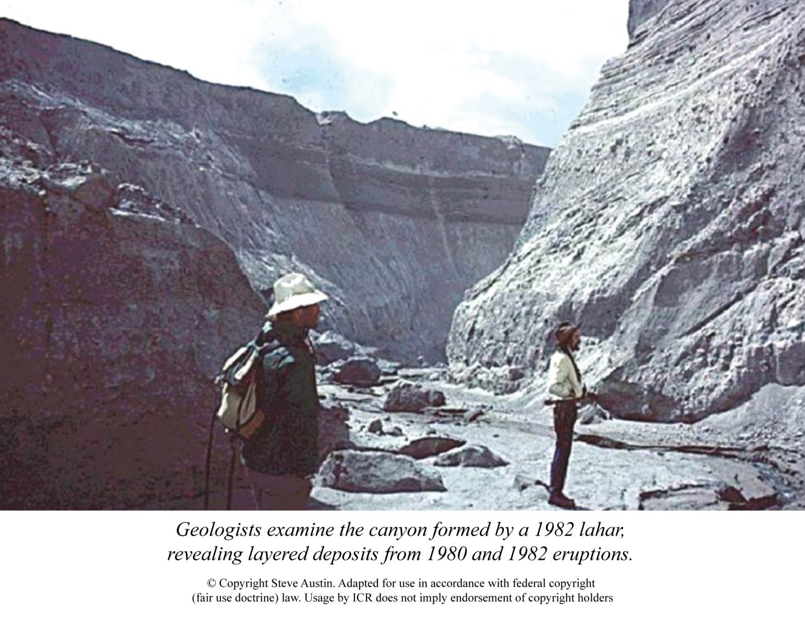
Remembering Mount St. Helens 35 Years Later
by Brian Thomas, M.S. *
Evidence for Creation › Evidence from Science › Evidence from the Earth Sciences › The Global Flood Is the Key to the Past
The volcano’s main 1980 eruption filled in an entire valley with hundreds of feet of sediment. Another smaller eruption event deposited more material on top of that, and then a third deposition occurred in 1982. Later, a catastrophic flood of snowmelt water and muddy debris tore a gash through those fresh deposits, revealing sharp and flat contacts between each earlier deposit. It also showed that fast-flowing currents can lay down multiple layers thinner than a finger width.....
And please tell me again, what the picture you just posted has to do with peneplains in the Wind River Mountains. Once again, I have seen those in person and hiked across them. And hiked all the way across the tilted sedimentary sequences on the east flank of the range. That cannot be explained by a Flood.
Disclaimer: Opinions posted on Free Republic are those of the individual posters and do not necessarily represent the opinion of Free Republic or its management. All materials posted herein are protected by copyright law and the exemption for fair use of copyrighted works.