Well yeah, but in 1918 they were something like this...
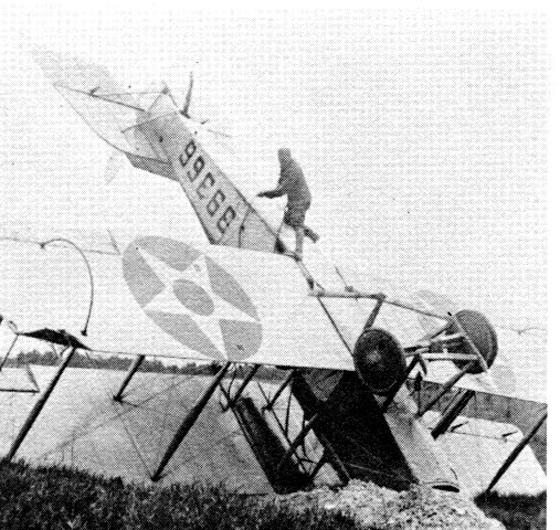
Amazing how many pilots in WWI crashed their kites and walked away looking for some French brandy and a farmgirl. ;>)
Posted on 02/11/2016 8:31:39 PM PST by Utilizer
Five harrowing days after becoming stuck on a remote backcountry road in Death Valley National Park in August 2009, Alicia Sanchez lay down next to her Jeep Cherokee and prepared to die.
Then she heard a voice.
"I called as I approached, asking if she was okay," wrote Ranger Amber Nattrass in a park report. "She was waving frantically and screaming, 'My baby is dead, my baby is dead.' "
In the SUV, Nattrass found Sanchez's lifeless 6-year-old son Carlos on the front seat. "She told me they walked 10 miles but couldn't find any help (and) had run out of water and had been drinking their own urine," Nattrass wrote.
"She turned down a wrong road," Nattrass said in a recent interview. "She said she was following her GPS unit."
Danger has long stalked those who venture into California's desert in the heat of summer. But today, with more people pouring into the region, technology and tragedy are mixing in new and unexpected ways.
"It's what I'm beginning to call death by GPS," said Death Valley wilderness coordinator Charlie Callagan. "People are renting vehicles with GPS and they have no idea how it works and they are willing to trust the GPS to lead them into the middle of nowhere."
The number of people visiting Death Valley in the summer, when temperatures often exceed 120 degrees, has soared from 97,000 in 1985 to 257,500 in 2009. That pattern holds at Joshua Tree as well, which recorded 128,000 visitors in the summer of 1988. Last year: 230,000.
(Excerpt) Read more at sacbee.com ...
I have a gps in both cars but before I go somewhere I’ve never been before I look at a map. I don’t like surprises. lol
i am :)
i’m a NYC WOP who thought the world began on Staten ISland and ended on 86th street in Brooklyn (the popular area in Saturday Night Fever.
i lived a parody and realize it too late!!
well, at least FR has a resident old school Italian on the board.
But I want to see the heartland!!
and change my last name :)
i was gonna knock down the trees and build the street and address myself, but that would have taken years.
YES!! it does NOT care about your safety!!
but i warns of red light and speeding cameras in the United Soviet States of NY!!
Took my son through an orienteering course last weekend. Next time (there's an additional requirement for a five mile long course), we're stopping at a football field to measure his steps more efficiently. He measured how many steps to a foot, and was stubborn about it. smdh
Before GPS, the most dangerous weapon in the Army was a 2nd LT and a map. I know, I was one (but only for a few months...lol).
LOL the 2nd LT, same thing my dad used to say.
I was damned good with a map thank you very much!
Now, property accountability.....
Yes. biggest number of errors I find are changes in the use of roads. Around here when a road was mapped it may of had more traffic due to ranch use etc. Today the traffic patterns have changed to an adjacent road. I do wonder how many people submit problem reports to the mapping company. I do recall when the flurry of name changes to MLK this or that it took the mapping companies years to catch up.
I have seen mapping vehicles in the back country on two occasions. Once what I believe was a Google mapping vehicle was broken down in a very remote area in Northern Nevada. Stopped to help and the guy was not very friendly and said that help was on the way.
For some reason, after reading your post, “A Good Man is Hard to Find” by Flannery O’Connor came to mind.
One of my favorite short stories.
.... my flight instructor told me once if I got lost ..... fly low over an interstate highway and read the signs.... he meant it.....:o)
I honestly carry a ruck in my vehicle even around here that gives me 16 days of comfortable living if I should be marooned , lost, injured, need to hole up or broke down vehicle in a remote area .
The ration packs I make with a food saver can be stretched to 45+ days if augmented with small game , fish and forage ....
Primary item I wear is a brietling emergency II watch that has a built in PLB aka personal locator beacon. It was a gift as I couldn’t afford nor would I pay as much if I could afford it.... well maybe...:o)
http://www.breitling.com/en/emergency/
If you hunt, fish, hike, fly, work or wheel in remote regions its the cats ass of cool tools.
ACR makes some very good PLB’s as well. Bottom line is “”skill sets”” and practice using them versus relying on items / gadgets you may or may not have with you or aren’t working properly.
Ya’ll stay safe !
I have been to the Saline Valley a few times myself.
Just following the early airmail SOP when transcontinental US Airmail Service began and there were little if any airports or FBO's.
Instructions: Follow rivers, railways, and highways.
Farmers painted big honking arrows on barn roofs, which could be the origin of the term barnstorming. There are still some giant concrete arrows set in the ground to guide flights.
Oh yeah, forgot to mention no radios or air traffic controllers.
There are a few interesting videos on youtube, search " early airmail "
Those early pilots were like Lewis and Clark without the grizzlies.
+1 on that.
“my flight instructor told me once if I got lost ..... fly low over an interstate highway and read the signs.... he meant it.....:o)”
Ever see the movie Fandango? There’s that exact scene in there. It’s hilarious.
Lots of folks have BOBs in their vehicles. I call ours “Oh S*** Kits”. Don’t have 16 days but there is (are?) 48 hours of relative comfort and security as well as the means to dress properly for a 2 day walk home.
We love our Foodsaver. You can make a sweet little airtight and waterproof Trauma Kit with one. We don’t have James Bond watches but we do have laminated paper maps of the 5 county area, lensatic compasses, hand help GPS units from our geocaching hobby, 2-3 days of food and water, Katydyn filters, etc.
Then there is a brace of C&R pistols we have previously discussed and one each Ruger 10-22 Takedowns with 4 25 round mags each. That ought to get us home in the wilds of west suburban Chicago.
Best,
L
Gravity is a pilots grizzly .....:o)
Friend of mine has a carbon super cub that he can pretty much land in a mcdonalds parking lot at taxi thru to the drive up window if he wanted. I’ve done some off airfield landings in my aero clubs 172 and 180 but he’s the only modern era barnstormer I know....LOL !
Too stupid to know what’s 10 feet past her nose.
A couple years ago in the Volvo Ocean race a 65 high performance sailing yacht helmed by expert sailors plowed a reef at high speed in the dead of night. They all got lucky and lived. But the REASON it happened is they were using an electronic map and when you zoom it out just one notch too far the smaller details... like a reef... are oh so helpfully removed. With a paper map showing all the detail all the time they would have been fine.
I added google earth satellite pictures to my map kit. Printed out my intended route / area that if studied and marked prior to laminating can show structures, old roads,ponds etc to augment your navigation kits maps. Yeah I used to wear a rolex submariner for decades as barter for a ride home from anywhere on the globe as plan x when all had went to shit in a hand basket etc. My little sister, she saw me gawking at the “james bond” watch in a store and bought it for my birthday.....as stated its cool factor is high at when BBQ gun match is a tie....:o)
BTW how is that 10-22TD holding up ? Still on my todo list...
Well yeah, but in 1918 they were something like this...
Amazing how many pilots in WWI crashed their kites and walked away looking for some French brandy and a farmgirl. ;>)
Our battalion had batteries at Hahn, Spangdahlem, and Bitburg AB's. My first two years were with C Battery at Hahn, my last two were at Battalion HQ at Spangdahlem. I was in the S-4 section for much of that.
I knew most of our area of operations like the back of my hand by the end of my third year, to include the "alternate supply points", i.e. gasthauses and backereis. I was sought after during evaluations...by the evaluators looking for the best places to visit.
Disclaimer: Opinions posted on Free Republic are those of the individual posters and do not necessarily represent the opinion of Free Republic or its management. All materials posted herein are protected by copyright law and the exemption for fair use of copyrighted works.