
Dozens of tornadoes reported so far. Schools closed. Damage reports coming in.
More...
Posted on 01/10/2008 3:27:51 PM PST by Milwaukee_Guy
Dangerous thunderstorms and tornadoes will continue into tonight across the South. The same system will spark an outbreak of strong storms along the mid-Atlantic coast Friday.
The South Regional News reports increasingly strong storms are erupting from southeastern Louisiana to central Kentucky and will shift eastward later tonight, reaching from the Virginia Panhandle to the Florida Panhandle.
(Excerpt) Read more at accuweather.com ...
Dozens of tornadoes reported so far. Schools closed. Damage reports coming in.
More...
Tornado Reports (in CSV format)
Time Location County State Lat Lon Comments
1600 JACKSON EAST FELICIANA LA 3083 9121 POSSIBLE TORNADO DAMAGED BALLFIELDS IN JACKSON. DAMAGE TO DUGOUTS REPORTED. (LIX)
1708 1 W MAGNOLIA PIKE MS 3115 9048 SIGHTING REPORTED NEAR HAMP LEA ROAD JUST WEST OF TOWN. (LIX)
1752 3 SW GOODMAN HOLMES MS 3294 8995 *** 1 INJ *** SUBSTANTIAL DAMAGE IN SE HOLMES CO, BETWEEN I-55 AND GOODMAN. NUMEROUS HOMES DAMAGED/DESTROYED WITH HUNDREDS OF TREES SNAPPED/UPROOTED. TORNADO CONTINUED (JAN)
1800 GOODMAN HOLMES MS 3297 8991 TORNADO REPORTED ON THE GROUND IN WESTERN ATTALA COUNTY. DAMAGE OCCURED IN GOODMAN. MORE DETAILS TO COME. (JAN)
1805 GOODMAN HOLMES MS 3297 8991 ONE HOUSE HAS MAJOR DAMAGE, ANOTHER HOUSE HAS ROOF DAMAGE, NUMEROUS TREES AND POWERLINES DOWN. RELAYED VIA ATTALA COUNTY EMA. (JAN)
1813 SALLIS ATTALA MS 3302 8976 ONE BARN AND 3 OTHER STRUCTURES HEAVILY DAMAGED. (JAN)
1843 MCCOOL ATTALA MS 3320 8934 ONE OLD STORE DESTROYED AND ROOF DAMAGE TO ANOTHER STRUCTURE. (JAN)
1915 2 W NEW ROADS POINTE COUPEE LA 3069 9149 POSSBILE TORNADO DAMAGED SEVERAL BUILDINGS NEAR THE INTERSECTION OF LA HIGHWAY 3131 AND LA HIGHWAY 1. (LIX)
1928 1 N NEW HARMONY UNION MS 3441 8892 REPORTED BY 911 DISPATCH (MEG)
2005 5 S IUKA TISHOMINGO MS 3474 8820 REPORTED BY TISHOMINGO COUNTY EMA AND LAW ENFORCEMENT. TORNADO TOUCHDOWN AT THE LANDFILL (MEG)
2015 CALEDONIA LOWNDES MS 3368 8833 SIGNIFICANT DAMAGE IN CALEDONIA. MORE DETAILS TO COME. (JAN)
2024 VANCOUVER LAKE CLARK WA 4568 12273 TOUCHDOWN REPORTED FROM NEAR 78TH (PQR)
2030 VERNON LAMAR AL 3376 8811 TORNADO CONFIRMED ON THE GROUND NEAR INTERSECTION OF HWY 18 AND HWY 17. (BMX)
2035 VERNON LAMAR AL 3376 8811 *** 1 INJ *** NUMEROUS TREES DOWN AND SEVERAL CARS DAMAGED. (BMX)
2035 HAZEL DELL CLARK WA 4568 12265 TREE DAMAGE. POWER LINES DOWN AND TRANSFORMER BLOWN IN HAZEL DELL. POWER FOR ABOUT 2500 CUSTOMERS IN THE AREA IS OUT. (PQR)
2044 7 W VERNON LAMAR AL 3376 8824 TWO HOMES DESTROYED ON COUNTY LAKE ROAD. TWO MORE STRUCTURES DESTROYED ON WILLIE GREER ROAD NORTH OF HWY 18. (BMX)
2044 SULLIGENT LAMAR AL 3389 8813 TWO HOMES DESTROYED ON COUNTY LAKE ROAD. (BMX)
2045 HOCKINSON CLARK WA 4573 12248 TORNADO SPOTTED SOUTH OF HOCKINSON HIGH SCHOOL AND JUST WEST OF 172ND AVENUE (PQR)
2221 10 E SAMANTHA TUSCALOOSA AL 3341 8740 TORNADO REPORTED ON THE GROUND IN THE WILEY COMMUNITY. DAMAGE TO CHURCH IN WILEY. (BMX)
Just lots of heavy rain all afternoon here in SE TN
They had tornadoes in WS a couple of days ago....
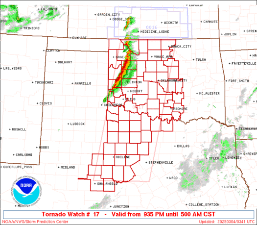 Particularly Dangerous Situation (PDS) Tornado Watch 17
Anyone know where the Virginia Panhandle is?
Hope you folks get the rain you need without any tornadoes.
record flooding in parts of Indiana, too
This is an ongoing life threatening situation.
No longer appears in Breaking News or any of the sidebars!?
Global Warming, no doubt...
It’s all because of Global Warming. If we’d just listen to Al Gore, none of this would happen.
/s
This is an ongoing life threatening situation.
Does not appear in any sidebars, Breaking News or Front page news.
Why does on have to do a search to find a Breaking News story?
BTTT
Yes we did have a rare tornado in Washington/Oregon but your right nothing like the SE
God is proving Al Gore and his minions are wrong.
Never 2nd guess the Almighty...meaning God not Gore.
...and we sadly all know it’s Bush’s Fault.
Praise the Lord for the rain on Alabamastan, we need it.
Prayers that no one gets hurt.
Not worthy of Breaking News,
URGENT - IMMEDIATE BROADCAST REQUESTED
TORNADO WATCH NUMBER 17
NWS STORM PREDICTION CENTER NORMAN OK
1135 AM CST THU JAN 10 2008
THE NWS STORM PREDICTION CENTER HAS ISSUED A
TORNADO WATCH FOR PORTIONS OF
MUCH OF WESTERN AND NORTHERN ALABAMA
PARTS OF SOUTHEAST LOUISIANA
PARTS OF EASTERN MISSISSIPPI
MUCH OF MIDDLE TENNESSEE
COASTAL WATERS
EFFECTIVE THIS THURSDAY MORNING AND EVENING FROM 1135 AM UNTIL
700 PM CST.
...THIS IS A PARTICULARLY DANGEROUS SITUATION...
DESTRUCTIVE TORNADOES...LARGE HAIL TO 2 INCHES IN DIAMETER...
THUNDERSTORM WIND GUSTS TO 80 MPH...AND DANGEROUS LIGHTNING ARE
POSSIBLE IN THESE AREAS.
THE TORNADO WATCH AREA IS APPROXIMATELY ALONG AND 75 STATUTE
MILES EAST AND WEST OF A LINE FROM 40 MILES WEST SOUTHWEST OF
BOOTHVILLE LOUISIANA TO 50 MILES NORTHEAST OF NASHVILLE
TENNESSEE. FOR A COMPLETE DEPICTION OF THE WATCH SEE THE
ASSOCIATED WATCH OUTLINE UPDATE (WOUS64 KWNS WOU7).
REMEMBER...A TORNADO WATCH MEANS CONDITIONS ARE FAVORABLE FOR
TORNADOES AND SEVERE THUNDERSTORMS IN AND CLOSE TO THE WATCH
AREA. PERSONS IN THESE AREAS SHOULD BE ON THE LOOKOUT FOR
THREATENING WEATHER CONDITIONS AND LISTEN FOR LATER STATEMENTS
AND POSSIBLE WARNINGS.
OTHER WATCH INFORMATION...CONTINUE...WW 16...
DISCUSSION...WARM SECTOR HAS CONTINUED TO DESTABILIZE AS SHEAR
PROFILES CONTINUE TO INTENSIFY ACROSS MUCH OF WATCH AREA. DISCRETE
SUPERCELLS ARE DEVELOPING AHEAD OF THE MAIN AREA OF SEVERE OVER WRN
MS/TN. AS 500MB TROUGH AND 100KT WIND MAX ROTATE TOWARD AREA THIS
AFTERNOON...TORNADIC SUPERCELLS ARE EXPECTED TO INCREASE IN NUMBER
AND DEVELOP EWD ACROSS AL AND NWD INTO MID TN. THERE IS A THREAT OF
LONG LIVED SUPERCELLS INCLUDING STRONG TORNADOES.
AVIATION...TORNADOES AND A FEW SEVERE THUNDERSTORMS WITH HAIL
SURFACE AND ALOFT TO 2 INCHES. EXTREME TURBULENCE AND SURFACE
WIND GUSTS TO 70 KNOTS. A FEW CUMULONIMBI WITH MAXIMUM TOPS TO
500. MEAN STORM MOTION VECTOR 24040.
...HALES
“...THIS IS A PARTICULARLY DANGEROUS SITUATION...”
Anything happening on the Georgia drought situation?
Disclaimer: Opinions posted on Free Republic are those of the individual posters and do not necessarily represent the opinion of Free Republic or its management. All materials posted herein are protected by copyright law and the exemption for fair use of copyrighted works.