Posted on 08/22/2009 9:58:14 AM PDT by ETL
http://www.weather.com/maps/maptype/satelliteworld/tropicalatlanticsatellite_large_animated.html
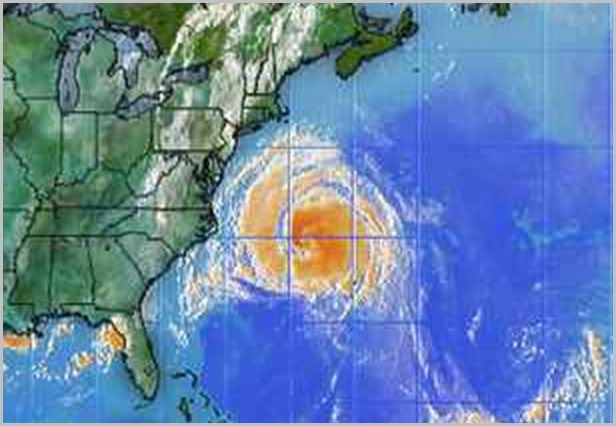
Doesn’t look like it is turning out to sea, does it?
If you follow the eye of the storm in relation to the square grid (in the animation), you'll see it is turning sharply to the north. But it does seem like it may land somewhere in Canada, unless it very quickly moves northeast.
I’m in PA at the NY border, we are so sopped here it will take years to dry out! I see where it is going sharply north and west....We’ll keep an eye out LOL!
All that rain you’ve been getting has little if anything to do with the hurricane, unless the hurricane is acting as a steering or ‘blocking’ mechanism for the stalled front currently along the eastcoast?
In any case, here are some Doppler animation links I put together that you might find useful:
National Doppler:
http://www.weather.com/maps/maptype/dopplerradarusnational/index_large_animated.html
1800-mile:
http://www.weather.com/weather/map/10024?showanimation=yes&mapregion=us_ne_9regradar_plus_usen
600-mile:
http://www.weather.com/weather/map/10024?showanimation=yes&mapregion=us_nyc_closeradar_plus_usen
300-mile:
http://www.weather.com/weather/map/10024?showanimation=yes&mapregion=us_nyc_ultraradar_plus_usen
I’m in NYC, btw.
Disclaimer: Opinions posted on Free Republic are those of the individual posters and do not necessarily represent the opinion of Free Republic or its management. All materials posted herein are protected by copyright law and the exemption for fair use of copyrighted works.