From the Bering Sea land bridge:

To most of the US being submerged:
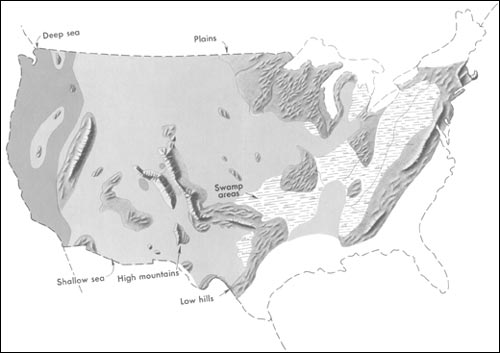
Generalized geographic map of the United States in Late Cretaceous time.
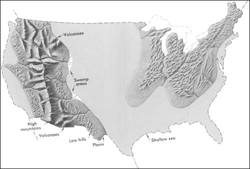
Generalized geographic map of the United States in Middle Pennsylvanian time.
From the Bering Sea land bridge:
To most of the US being submerged:
Generalized geographic map of the United States in Late Cretaceous time.
Generalized geographic map of the United States in Middle Pennsylvanian time.
Studied those maps in school! What many don’t realize is the earth is a closed loop system and has changed many times. Water gets stuck on land masses in the form of ice and the ocean levels decrease, free it from those land masses and the levels increase. Through out that process it takes sediment with it and deposits it on the ocean floors. If you look a Wikipedia you’ll see no mention of this.
http://en.wikipedia.org/wiki/Current_sea_level_rise
Maybe if I just showed them how my stock tanks on the ranch fill with sediment and have to be dredged out every now and then they’d understand.