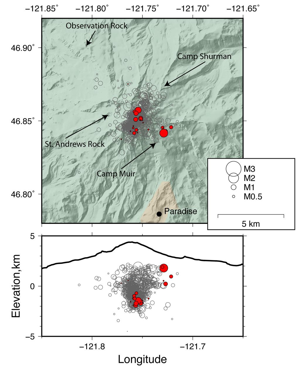
The top map shows the location of historical earthquakes at Mount Rainier, with the recent quakes in red. Seismic stations are marked by arrows. The cross-section below shows the depth of the quakes. (Source: USGS)
=========================================================================
Didn't Mt. ST. HELENS show the same right before it blew?...................
To: Red Badger
“seismologists say there’s no cause for worry.”
In light of events over the past few weeks, if I lived near there, I’d worry.
2 posted on
09/21/2017 6:52:46 AM PDT by
Rennes Templar
(Morning in America Again, again.)
To: Red Badger
Pardon me for not believing scientific consensus. What year were the Himalayas supposed to melt again?
Thanks for posting the pic.. I miss real mountains.
4 posted on
09/21/2017 7:15:23 AM PDT by
momincombatboots
(White Stetsons up.. let's save our country!)
To: Red Badger
“there’s no cause for worry. In the past, these swarms last a couple of days to a week or so and then die out.”
Could this also be the statement of a Pompeiian scientist, just before Vesuvius erupted in 79 AD?
A of of swarms, and a lot of Ring of Fire activity.
8 posted on
09/21/2017 7:24:14 AM PDT by
Yulee
(Village of Albion)
To: Red Badger
No, mt St. Helens had a more significant seismic prelude.
13 posted on
09/21/2017 8:02:31 AM PDT by
Godzilla
( I just love the smell of COVFEFE in the morning . . . . .)
To: Red Badger
St. Helens had a lot more activity before erupting including deformation of the ground and much more earthquake activity. When you get a bulge on the flank of Rainer you should get out of the way.
16 posted on
09/21/2017 8:29:48 AM PDT by
JimSEA
To: Red Badger
Mount Rainier is so beautiful.
19 posted on
09/21/2017 8:39:13 AM PDT by
trisham
(Zen is not easy. It takes effort to attain nothingness. And then what do you have? Bupkis.)
FreeRepublic.com is powered by software copyright 2000-2008 John Robinson