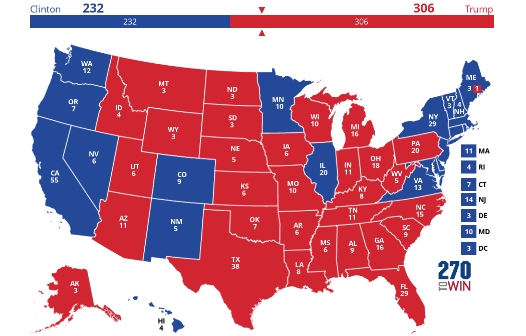
Use the 2016 electoral map. A lot of red states are being left out.
Excellent idea.
Just split it up county by county, city by city according to majority vote.
Remember - West Berlin survived over forty years as an isolated city on the bad side of the Iron Curtain.
Let the libs grow their own food on their own land.
And let them and dump their own garbage and sewage on their own land instead of shipping it to Alabama and other red states.
In less than 40 years they will over-govern themselves into obscurity.

Use the county map and big chunks of blue states are actually red. The blue staters are actually city dwellers. Carve out Chicago and Illinois becomes red, carve out downstate New York and New York becomes red... don’t give them anything just the ground they are standing on.