So why is Russia across the border from Ukraine also blacked out on your map?
Are Russians as bad at photoshop as they are at war?
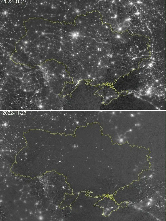
Interesting thing is there’s also a corresponding drop in lighted areas in Russia between January and November.
So either the November image is being manipulated to reduce evidence of lighting overall or else the Russians are also feeling the sting of the war.
I’m going with manipulation.
In this CNN report of the same topic you can toggle between the two images and see decreased lighting in the areas of Europe that are unaffected by the war.
But that are affected by image (and public opinion) manipulation.
https://www.cnn.com/interactive/2022/03/world/ukraine-satellite-images/