Free Republic
Browse · Search
News/Activism
Topics · Post Article

This thread has been locked, it will not receive new replies.
Locked on 08/28/2012 10:11:43 AM PDT by Sidebar Moderator, reason:

New thread here: http://www.freerepublic.com/focus/f-news/2923793/posts


Skip to comments.

Tropical Storm Isaac
NOAA/NHC ^ | 22 August 2012 | NOAA/NHC

Posted on 08/22/2012 1:47:19 PM PDT by NautiNurse

Tropical Storm Isaac threatens to dampen the Republican National Convention Monday in Tampa, Florida. National media outlets are having a grand time anticipating a Grand Old Party washout. Tampa mayor Bob Buckhorn (D) announced Wednesday that he is absolutely prepared to call off the convention next week, with anticipated attendance of 70,000 delegates, party officials, journalists, protesters and others. Buckhorn has not indicated that he would attempt to mitigate liberal protests or a hastily planned Joe "Plugs" Biden visit to Tampa during the convention.

Time will tell. Stay tuned...
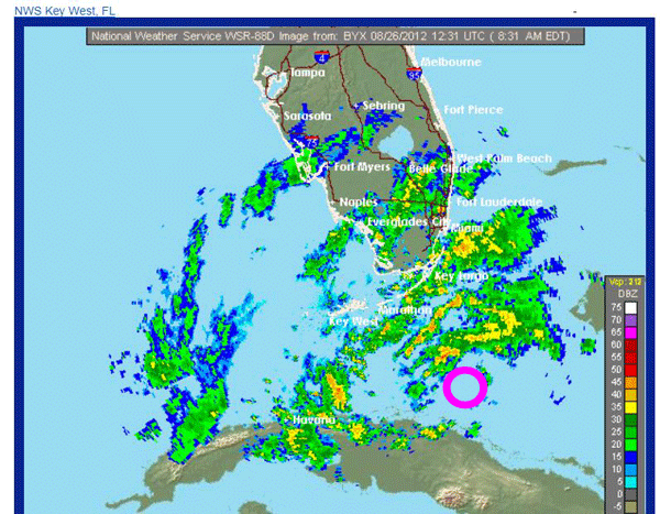

Sea Surface Temps


Public Advisories

NHC Tropical Discussions

Satellite Images

Buoy Data:
Caribbean W. Carib and Florida

Radar:
Puerto Rico Gitmo, Cuba, Key West & Tampa Bay


TOPICS: Extended News; US: Florida
KEYWORDS: 2012rncconvention; isaac; rnc; storm; tropical; tropicalstorm
Navigation: use the links below to view more comments.
first previous 1-20 ... 221-240241-260261-280 ... 541-544 next last
To: NautiNurse; rodguy911
I've never seen two eyes ... I wonder if it's possible .... the storm is vast and it seemed to break up over Hispanola

It's going to be a long night in the Bahamas

a few breezes here but otherwise calm

.

241 posted on 08/25/2012 7:42:35 PM PDT by Elle Bee
[ Post Reply | Private Reply | To 229 | View Replies]

To: abb; abbi_normal_2; aberaussie; abner; AbsoluteGrace; alancarp; Alas Babylon!; Alia; ...
The tropical storm watch along the West Coast of Florida from Bonita
Beach to Tarpon Springs has been replaced with a Tropical Storm
Warning.

The tropical storm watch along the West Coast of Florida and the
Florida Panhandle has been extended northward and westward to
Indian Pass.

340 miles ESE of Key West
Moving NW at 17mph
Max sustained winds 60mph, 997mb
Tropical storm force winds extend outward up to 205 miles
from the center.


On/Off Hurricane List Mash Here-->

242 posted on 08/25/2012 8:01:00 PM PDT by NautiNurse (Rumors of my demise have been greatly exaggerated)
[ Post Reply | Private Reply | To 1 | View Replies]

To: Elle Bee
I've never seen two eyes ... I wonder if it's possible ....

All the better to see you, my dear.

243 posted on 08/25/2012 8:10:55 PM PDT by NautiNurse (Rumors of my demise have been greatly exaggerated)
[ Post Reply | Private Reply | To 241 | View Replies]

To: NautiNurse
ha .... still looks like two storms ... looks like it's expected here at 8:00 pm tomorrow and High tide on this side of the island is about 6:45 pm ... at least it's not a new or full moon

still very calm here with just the occasional sprinkle

.

244 posted on 08/25/2012 10:26:56 PM PDT by Elle Bee
[ Post Reply | Private Reply | To 243 | View Replies]

To: abb; abbi_normal_2; aberaussie; abner; AbsoluteGrace; alancarp; Alas Babylon!; Alia; ...
Hurricane Watch has been issued from the mouth of the Mississippi
River eastward to Indian Pass Florida...not including metropolitan
New Orleans.

The Tropical Storm Warning has been extended northward and westward
along the Florida West Coast and the Florida Panhandle to Indian Pass.

Tropical Storm Isaac located ~205 miles ESE Key West, FL
Moving NW at 18mph
Max sustained winds 65mph, 995mb
Tropical-storm-force winds extend outward up to 205 miles
from the center.
and Isaac is expected to be at or near hurricane strength when it reaches
the Florida Keys.


On/Off Hurricane List Mash Here-->

245 posted on 08/26/2012 2:39:45 AM PDT by NautiNurse (Rumors of my demise have been greatly exaggerated)
[ Post Reply | Private Reply | To 1 | View Replies]

To: Elle Bee

Up this way I think we dodged any flooding problems earlier at high tide—5:06am.Don’t really understand it we have sustained at 31 with gusts to 36 out fo the ENE with a falling baro of 29.68 at Mollasses Reef off Key Largo about 15 miles north of here.Feels a bit stronger than that here.Winds are now beginning to crank up a little bit.
I just took a walk down to the dock and its still a foot from over flowing which surprises me as close to high tide as we are.
The real test will be tonight at 6:01pm on the next high tide,but looking at what I see now I don’t really expect much.


246 posted on 08/26/2012 3:37:19 AM PDT by rodguy911 (FreeRepublic:Land of the Free because of the Brave--Sarah Palin 2012)
[ Post Reply | Private Reply | To 222 | View Replies]

To: Bushbacker1

Thanks I don’t see any huge problems although it all happens over the next 24 hours.Pretty dry storm so far.Mostly rattling the shutters.


247 posted on 08/26/2012 3:39:50 AM PDT by rodguy911 (FreeRepublic:Land of the Free because of the Brave--Sarah Palin 2012)
[ Post Reply | Private Reply | To 230 | View Replies]

To: NautiNurse
A decision will be made this morning based on surge predictions if Ft. Myers Beach, Captiva, Sanibel and other low laying areas will be evacuated. All toll bridges in Lee County have suspended tolls. The bridges will not be closed, the public is urged to cross with caution.
248 posted on 08/26/2012 4:17:20 AM PDT by NicNacPattyWac
[ Post Reply | Private Reply | To 1 | View Replies]

To: rodguy911; NautiNurse
still no rain to speak of .... the ground is dry ... the wind has only just begun to kick up

I'm going to take the dogs out on the white street pier and watch it roll in

Lost power about half an hour ago but it's back

still looks like two storms on the visual loop

.

249 posted on 08/26/2012 4:36:43 AM PDT by Elle Bee
[ Post Reply | Private Reply | To 246 | View Replies]

To: Elle Bee
Isaac appears tattered this morning with lots of dry air.

IIRC, historically Isaac has had morning bed head, with increasing convection later in the day. As long as the core is intact, there isn't much to keep it from strengthening at this point. Should be an interesting day.

250 posted on 08/26/2012 4:54:35 AM PDT by NautiNurse (Rumors of my demise have been greatly exaggerated)
[ Post Reply | Private Reply | To 249 | View Replies]

To: NautiNurse

thanks again for your weather updates...I’ve got friends that aren’t even Freepers across the country following your reports....time to get your own TV weather show!


251 posted on 08/26/2012 5:02:16 AM PDT by Recovering Ex-hippie
[ Post Reply | Private Reply | To 250 | View Replies]

To: Elle Bee; rodguy911
8:00AM Update:

About 135 miles ESE Key West
Moving NW at 20mph
Max sustained winds 65mph, 995mb

Storm Surge:
* Crystal River through The Big Bend of Florida...4 to 7 ft
* Southwest Florida coast within Hurricane Warning area...4 to 6 ft
* Florida West Coast from Bonita Beach to south of Crystal River
including Tampa Bay...3 to 5 ft
* Southeast Florida coast and the Florida Keys...1 to 3 ft

252 posted on 08/26/2012 5:03:20 AM PDT by NautiNurse (Rumors of my demise have been greatly exaggerated)
[ Post Reply | Private Reply | To 249 | View Replies]

To: All
Correction for movement: WNW at 20mph.
253 posted on 08/26/2012 5:05:24 AM PDT by NautiNurse (Rumors of my demise have been greatly exaggerated)
[ Post Reply | Private Reply | To 252 | View Replies]

To: Recovering Ex-hippie

Geez...I thought this thread was our own little secret.


254 posted on 08/26/2012 5:07:14 AM PDT by NautiNurse (Rumors of my demise have been greatly exaggerated)
[ Post Reply | Private Reply | To 251 | View Replies]

To: NautiNurse

Good morning...lovely morning here in the Orlando area...but TWC told me yesterday that by now I would be under a tornado warning with already a ton of rain..


255 posted on 08/26/2012 5:13:12 AM PDT by SE Mom (Proud mom of an Iraq war combat vet)
[ Post Reply | Private Reply | To 254 | View Replies]

To: gov_bean_ counter
Yesterday TWC was practically cheering for a Tampa hit and a Republican National Convention cancellation.

Off topic: Why do we bother with conventions? In my lifetime, they've moved from decision-making bodies with many important committee and floor votes to absurdly expensive commercials.

Go Isaac!

256 posted on 08/26/2012 5:18:29 AM PDT by Jim Noble (Diseases desperate grown are by desperate appliance relieved or not at all.)
[ Post Reply | Private Reply | To 223 | View Replies]

To: NautiNurse

Thanks as ever, NN, for the best hurricane watcher service in the country.


257 posted on 08/26/2012 5:23:52 AM PDT by Jim Noble (Diseases desperate grown are by desperate appliance relieved or not at all.)
[ Post Reply | Private Reply | To 252 | View Replies]

To: SE Mom
Pink ring=center of circulation:


258 posted on 08/26/2012 5:47:54 AM PDT by NautiNurse (Rumors of my demise have been greatly exaggerated)
[ Post Reply | Private Reply | To 255 | View Replies]

To: NautiNurse
WFTV at 8am said the Hurricane Center is behind in updating the track and the next update will have the storm on an even more westerly track. It will be a CAT 1 as it moves north and then they show it as a CAT 2 and believe it will hit New Orleans.
259 posted on 08/26/2012 5:55:40 AM PDT by sheikdetailfeather (Yuri Bezmenov (KGB Defector) - "Kick The Communists Out of Your Govt. & Don't Accept Their Goodies.")
[ Post Reply | Private Reply | To 258 | View Replies]

To: NautiNurse

I predict that the idiots in NOLA will wait for The One to shower them with gifts and attention after the storm.


260 posted on 08/26/2012 5:57:18 AM PDT by NCjim (Do not argue with an idiot. He will drag you down to his level and beat you with experience.)
[ Post Reply | Private Reply | To 245 | View Replies]


Navigation: use the links below to view more comments.
first previous 1-20 ... 221-240241-260261-280 ... 541-544 next last

Disclaimer: Opinions posted on Free Republic are those of the individual posters and do not necessarily represent the opinion of Free Republic or its management. All materials posted herein are protected by copyright law and the exemption for fair use of copyrighted works.

Free Republic
Browse · Search
News/Activism
Topics · Post Article

FreeRepublic, LLC, PO BOX 9771, FRESNO, CA 93794
FreeRepublic.com is powered by software copyright 2000-2008 John Robinson