Navigation: use the links below to view more comments.
first 1-20, 21-24 next last
To: J. Worthington
Keep me posted.
I’m getting into the shower.
2 posted on
08/31/2011 11:44:55 AM PDT by
BenLurkin
(This is not a statement of fact. It is either opinion or satire; or both)
To: J. Worthington
Maybe looking for damage by the hurricane??
To: J. Worthington
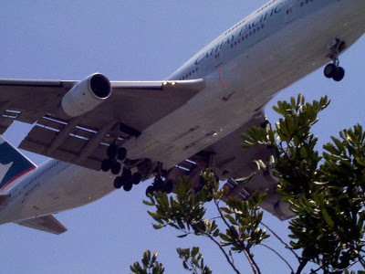
There have been reports of abnormally high flying planes in the same area, flying so high as to be actually out of sight.
Unable to confirm at this time.
6 posted on
08/31/2011 11:47:14 AM PDT by
shibumi
("A Republic - if you can keep it.")
To: J. Worthington
To: J. Worthington
Just north of Lake Okeechobee the Kissimmee River has been dredged and a berm is on either side about 50 feet high.
I love to fly below the tops of the berms right off the water and watch for Gators. Just a few bridges and power lines to avoid from Sebring to the big lake.
Lots of times a commercial will go low to avoid the top of a hammerhead thunderstorm or Ridge pushing along a front.
10 posted on
08/31/2011 11:48:39 AM PDT by
Joe Boucher
((FUBO) an affirmative action mistake)
To: J. Worthington
things so bad for the airlines under this administration that they are moonlighting as crop dusters?
To: J. Worthington
....another Dumbo photo op
12 posted on
08/31/2011 11:49:49 AM PDT by
Doogle
((USAF.68-73..8th TFW Ubon Thailand..never store a threat you should have eliminated))
To: J. Worthington
14 posted on
08/31/2011 11:52:11 AM PDT by
RushIsMyTeddyBear
(Mr. Weiner...Don' t Tweet your meat. It's too late to delete!)
To: J. Worthington
I’m gonna add to it! I just have to. I went to lunch about an hour ago, and there were two planes in a very low pattern (Southwest 737 and another company) in a very different location from normal. Albuquerque metro area. I’ve worked in this area for six and a half years and have never seen this flight path or altitude here. We’re about 10 miles north of the airport, just off I-25, but we’re not on the normal approach (normal approach directions and altitudes are way different from what I saw today). I was wondering if it was an emergency go-around. They were way low considering our distance from the airport - much lower than 1,000 feet, closer to 500 or so.
15 posted on
08/31/2011 11:52:15 AM PDT by
IYAS9YAS
(Rose, there's a Messerschmitt in the kitchen. Clean it up, will ya?)
To: J. Worthington
To: J. Worthington
Airforce One looking for a golf course?
To: J. Worthington
To: J. Worthington
24 posted on
08/31/2011 11:57:37 AM PDT by
svcw
To: J. Worthington
To: J. Worthington
To: J. Worthington
Maybe he was lost and looking for road signs.
Either that or there was property for sale and he wanted a quick look.
36 posted on
08/31/2011 12:10:02 PM PDT by
OldMissileer
(Atlas, Titan, Minuteman, PK. Winners of the Cold War)
To: J. Worthington
I believe that Frontier has taken on contracting for sky-planting winter wheat over the soy beans.
37 posted on
08/31/2011 12:10:55 PM PDT by
Cletus.D.Yokel
(Islam is a violent and tyrannical political ideology and has nothing to do with "religion".)
To: J. Worthington
Cue Ed McMahon” “How low WAS it?
38 posted on
08/31/2011 12:12:55 PM PDT by
don-o
(He will not share His glory and He will NOT be mocked! Blessed be the name of the Lord forever.)
To: J. Worthington
Here is the most recent flight data from
FlightAware.com for a Frontier aircraft landing at Dane County Regional. Is that the correct airport? (I would assume so as there's a listing for Frontier Airlines at that Madison area airport)
Also, here is the TRACK LOG for the flight which has an odd altitude anomaly near the end of the flight. Weird.
42 posted on
08/31/2011 12:21:11 PM PDT by
GreenAccord
(Bacon Akbar)
To: J. Worthington
The pilot saw his house being robbed?
43 posted on
08/31/2011 12:21:35 PM PDT by
GeronL
(The Right to Life came before the Right to Happiness)
Navigation: use the links below to view more comments.
first 1-20, 21-24 next last
FreeRepublic.com is powered by software copyright 2000-2008 John Robinson