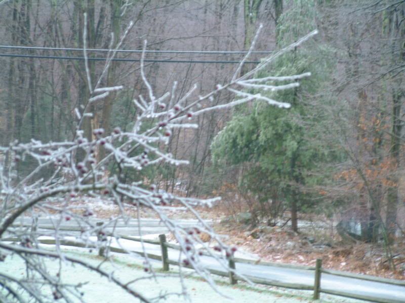
This shot was taken last Monday morning.
Posted on 12/09/2007 4:34:54 AM PST by listenhillary
Three areas of wintry weather are expected today: from the Plains to the Great Lakes, portions of the Northeast, and mountainous areas in the Southwest. The most significant area of wintry precipitation will be from the Plains to the Great Lakes, where significant ice accumulations are expected through Monday evening.
Ice storm warnings run from near Oklahoma City to Toledo, Ohio, due to the potential for significant icing today. Ice is expected to last longer in southwestern Missouri and southeastern Kansas, where rain and temperatures near or below freezing is expected to last until Tuesday. Rainfall amounts across much of the Midwest are expected to be in the one-quarter to one-half of an inch range, with locally heavier amounts possible, and much of this freezing on contact causing dangerous driving conditions and downing tree limbs and power lines. Farther to the north, snow is expected over the Upper Mississippi Valley and much of Michigan; snow amounts are not expected to be that great, with up to three inches expected over parts of central Lower Michigan.
In the Northeast, ice is possible from Pennsylvania into Southern New England, with winter weather advisories posted for much of this area, and an ice storm warning over part of north central Pennsylvania. Ice is possible in some of the northern suburbs of Boston tomorrow. While ice accumulation is not expected to be as great as in the Midwest, ice will still accumulate enough to cause dangerous driving conditions, and weigh down objects like power lines and tree limbs today. Farther north where upper level conditions are favorable for snow, generally light snows are expected, with the heaviest snows expected in the Adirondacks (about one to three inches through Monday evening).
The system in the Southwest will bring a chance of rain and mountain snows to Southern California and Arizona today, and eventually be a player in the chance of wintry weather for the eastern two-thirds of the country later this week. Snow levels are around 2000 feet in the mountains of Southern California, with a few hail-producing thunderstorms possible over the lowest elevations of Southern California as well. The upper level low will move into the Four Corners tomorrow, bringing the chance of snow with it, and helping re-develop freezing rain over parts of Missouri, Kansas, and Oklahoma through Tuesday.
Columbus, KS NUMEROUS LARGE TREES AND POWER LINES DOWNED. IN EXCESS OF ONE INCH OF ICE ACCUMULATION REPORTED.
Pittsburg, KS AROUND ONE INCH OF FREEZING RAIN AND SLEET ACCUMULATION. ROADS ARE TREACHEROUS COUNTY WIDE.
Nevada, MO AROUND ONE INCH OF FREEZING RAIN AND SLEET ACCUMULATION. ROADS ARE TREACHEROUS. SPORADIC POWER OUTAGES REPORTED COUNTY WIDE.
Lamar, MO BETWEEN ONE QUARTER AND ONE HALF INCH OF FREEZING RAIN ACCUMULATION. SPORADIC POWER OUTAGES COUNTY WIDE.
Jasper county, MO NUMEROUS TREES AND POWER LINES DOWNED. WIDESPREAD POWER OUTAGES IN ASBURY...JASPER...AND PURCELL. MUCH OF THE NORTHERN PORTION OF JASPER COUNTY EXPERIENCING THE POWER OUTAGES.
Thanks for the post.... stay warm....
...DAMAGING ICE ACCUMULATION LIKELY THIS MORNING ACROSS CENTRAL AND EAST CENTRAL MISSOURI INTO WEST CENTRAL ILLINOIS...
AT 530 AM...WEATHER SERVICE DOPPLER RADAR INDICATED A NEARLY
CONTINUOUS BAND OF FREEZING RAIN...ALONG WITH SCATTERED
THUNDERSTORMS AND SLEET...EXTENDING FROM SOUTHWEST MISSOURI TO CENTRAL AND EAST CENTRAL MISSOURI TO WEST CENTRAL ILLINOIS. THIS INCLUDES THE NORTHERN HALF OF THE ST. LOUIS METROPOLITAN AREA.
THIS AREA OF PRECIPITATION IS MOVING NORTHEAST...WHICH MEANS NEARLY CONTINUOUS FREEZING RAIN THROUGH THE MORNING HOURS. WITH TEMPERATURES WELL BELOW FREEZING...AND SINCE THE FREEZING RAIN WILL BE FAIRLY HEAVY...DAMAGING ICE ACCUMULATION WILL CONTINUE TO OCCUR. LOSS OF POWER AND TELEPHONE SERVICE IS A VERY REAL POSSIBILITY...ALONG WITH DAMAGE TO TREES.
AT 5 AM...ONE-HALF TO THREE-QUARTERS OF AN INCH OF ICE WAS
COVERING TREES IN COLUMBIA...WITH AROUND TWO INCHES OF SLEET AND ICE ACCUMULATION ON ROADS.
TRAVEL WILL BE EXTREMELY DIFFICULT IN SOME AREAS DUE TO THE THICK COATING OF ICE AND SLEET. EVEN HIGHWAYS THAT HAVE BEEN SALTED MAY BECOME QUITE SLICK IF THE PRECIPITATION IS HEAVY ENOUGH. IF YOU MUST DRIVE...BE VERY ALERT FOR RAPID CHANGES IN ROAD CONDITIONS.
I WANT MY GLOBAL WARMING!!!!!
BTTT Apparently I am on the northern edge of this and have only gotten frozen pellets thus far.
Huh, what happened to Global Warming???
Just what I was thinking a couple of hours ago. Sad part of this mess is a good number of these people just went through an ice storm about a year ago. And it looks like it is going to be another big mess, lots of rural areas going to be iced in.
I remember that.
damn that global warming thingy
Boy, It started early and it’s going to be a long one here in Gnu Yak. Uggh. Looks like the FD will be doing some runs today! Get the skivvies out!
I sure hope that people were paying attention and got themselves prepared. Also looks like once this system moves on a northeast track there is another one to follow come Tuesday. And 'old' man winter is not yet arrived.
Getting some ice here in Columbia county PA.
I had 6 trees taken out this summer so I’m feeling pretty confident this time out.
This shot was taken last Monday morning.
My husband just left St. Louis for Lake Ozark for a business trip. Watching the news, I am very worried about the driving conditions. I wish he would have canceled...
Take Care!
MOgirl
We also had a glorious sunrise; a deep orange.
Beautiful. The landscape looks much like here.
Disclaimer: Opinions posted on Free Republic are those of the individual posters and do not necessarily represent the opinion of Free Republic or its management. All materials posted herein are protected by copyright law and the exemption for fair use of copyrighted works.