
Posted on 09/07/2011 4:11:05 PM PDT by Palladin
Susquehanna River to Flood:
Susquehanna River now forecast to crest at 26.2 feet.
Breaking News
Susquehanna River now forecast to crest at 26.2 feet in Harrisburg Published: Wednesday, September 07, 2011, 5:06 PM Updated: Wednesday, September 07, 2011, 5:12 PM By The Patriot-News
Forecasts for where the Susquehanna River will crest in Harrisburg have steadily increased in the last two days, and the National Weather Service is now calling for the river to crest at 26.2 feet early Friday morning.
Flood stage for the river is 17 feet. At 20 feet, flooding is considered moderate, and at 23 feet, it's major.
When the river reaches 23 feet, evacuations are necessary in the Shipoke area of Harrisburg, according to the NWS. At 24 feet, the residential section of Front and Second streets floods. And at 26 feet, Green and Vaughn streets flood.
Harrisburg Mayor Linda Thompson has declared a stage of emergency for the city, meaning the city’s emergency operations center is now open and the mayor’s office will continue to monitor the situation and notify residents of flood developments.
Thompson said city employees and volunteers will use bullhorns and knock on doors tomorrow to tell residents to move household items to higher levels and evacuate certain sections of Harrisburg.
(Excerpt) Read more at pennlive.com ...
I worked at the airport in Mountoursville as an intermediate job when I relocated to Williamsport area. I know exactly where Broad Street is. Drove it everyday to work.
Mountoursville sits right next to the river. Just so sad to hear about.
I’m familiar with your area as lived over in the Bloomsburg Berwick area for about seven years. My job took me to several communites throughout that whole region. So I know where you speak of pretty well. Then later moved to Willamsport area so that too am familiar with.
Thanks for the prayers. Our lowlying neighbors sure need all the prayers they can get.
You are right...it is a gorgeous area. Since photography is my hobby, I enjoy getting in the car and driv9ing ten or fifteen miles in any direction to get spectacular landscapes, wildlife pics, and just pretty rural photos.
Won’t be doing that for the next few weeks. :(
I've been a southcentral Pennsylvanian all of my 51 year life, so I do remember Agnes ('72) and Eloise ('75).
I also remember all of the farmland that has been paved over in the intervening 29 years.
It won't take as much rain this time to produce the same effect.
Speaking of thoughts, here's one for ya:
Just saw a thread title re snakes being found in a school somewhere.
Given the water levels here, folks along the river and creeks are liable to find some fauna surprises when they start cleanin' up the mess !
(instantaneously grateful for being 2mi from the river ;-)
Stretched to the max in York County. Fortunately, three years ago we got a new 911 radio system that has full Police/Fire/EMS/EMA interoperability and more than enough talk groups (channels).
It was put to the test today but passed.
I’m still gettin my head around this as going thru the web and photos show things are really very bad there. Do you think Mountoursville bridge will hold? They’ll be stranded out there but as i recall should be able to endure for a time.
I do miss the area as I made it my home for a couple years. Use to go out with an Officer who headed up D.A.R.E. The police had a really great place right on the river and we’d go there for a day trip...ride the pontoon boat up and down the river over te 4th of July. Huge bob-fires up and down the river and they competed to see whose would be the greatest. I miss the river.
Williamsport is a great small city....big enough to get lost in and small enough to find your way around in. Did they ever get a handle on the influx from Philadelphia....you know the deal made between the mayors?
That was destroying the city for a time until they got a new mayor who put his foot down on it. I had an interview with him on one occassion for a city job. Can’t remember his name though.
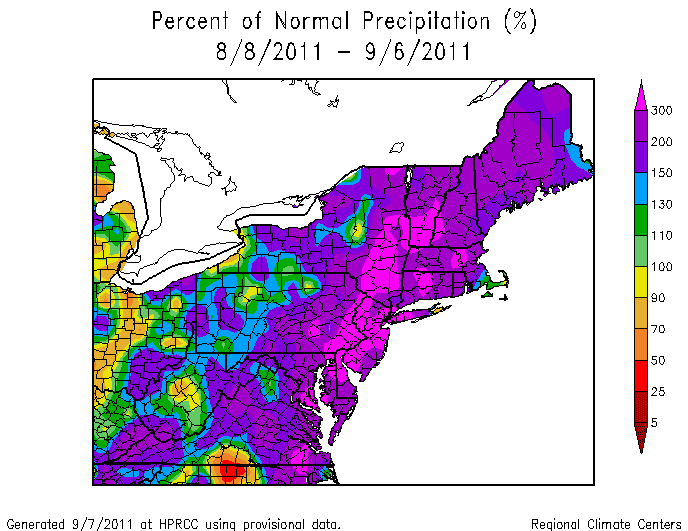
Great maps.
We’ll have 2 more inches overnight before it stops.
Woshing good luck to all. They should close the schools instead of just having a 2-hr delay.
Hope all the kiddos will be safe and sound.
Goodnight, everyone!
Lancaster area getting it too? Map appears to reveal that.
Night Palladin....sleep well even though....
(hope it washes off)
I stopped here, but more is on the way. We live high (for that very reason) up on a ridge. Got 8.96” since August 8th. Thinking about you folks out east.
Issued by The National Weather Service
State College, PA
Wed, Sep 7, 2011, 10:29 PM EDT
For Montoursville:
THE FLOOD WARNING CONTINUES FOR THE LOYALSOCK CREEK AT LOYALSOCKVILLE. * AT 10 PM WEDNESDAY THE STAGE WAS 18.7 FEET AND RISING. * FLOOD STAGE IS 12.0 FEET. * RECORD FLOODING IS FORECAST. * THE CREEK WILL CREST BETWEEN 21 AND 22 FEET EARLY THURSDAY MORNING. THE CREEK WILL FALL BELOW FLOOD STAGE FRIDAY MORNING. A CREST OF 21.5 FEET WOULD BE ABOUT 3.5 FEET ABOVE THE PREVIOUS RECORD FLOOD OF JANUARY 1996.
Issued by The National Weather Service
State College, PA
Thu, Sep 8, 2011, 12:59 AM EDT:
THE NATIONAL WEATHER SERVICE IN STATE COLLEGE PA HAS ISSUED A
* FLOOD WARNING FOR URBAN AREAS AND SMALL STREAMS IN... DAUPHIN COUNTY... LANCASTER COUNTY... LEBANON COUNTY... YORK COUNTY...
* UNTIL 845 AM EDT...
* AT 1252 AM EDT FLOODING WAS ONGOING ACROSS MOST OF THE WARNING AREA. HEAVY RAINFALL WILL CONTINUE OVER THE WARNING AREA FOR THE NEXT SEVERAL HOURS... WITH ANOTHER ONE TO THREE INCHES OF RAINFALL POSSIBLE BY DAYBREAK THURSDAY. THIS IS A POTENTIALLY DEADLY SITUATION... AS ADDITIONAL RAINFALL WILL PUSH STREAMS AND CREEKS TO ALMOST RECORD LEVELS IN SOME CASES.
* SOME LOCATIONS THAT WILL CONTINUE TO EXPERIENCE MODERATE TO SEVERE FLOODING INCLUDE BUT ARE NOT LIMITED TO HARRISBURG... LANCASTER... ELIZABETHTOWN... RED LION... YORK... FREDERICKSBURG AND LEBANON.
PRECAUTIONARY/PREPAREDNESS ACTIONS...
MOST FLOOD DEATHS OCCUR IN AUTOMOBILES. NEVER DRIVE YOUR VEHICLE INTO AREAS WHERE THE WATER COVERS THE ROADWAY. FLOOD WATERS ARE USUALLY DEEPER THAN THEY APPEAR. JUST ONE FOOT OF FLOWING WATER IS POWERFUL ENOUGH TO SWEEP VEHICLES OFF THE ROAD. WHEN ENCOUNTERING FLOODED ROADS MAKE THE SMART CHOICE... TURN AROUND... DONT DROWN.
The river at Wilkes-Barre is expected to crest at 38.5', something like 15' above flood stage.
Here's the latest data on my weather page from the NWS:
Statement as of 8:26 AM EDT on September 08, 2011
826 am EDT Thu Sep 8 2011
The Flood Warning continues for
the Susquehanna River near Sunbury.
* At 8 am Thursday the stage was 28.6 feet and rising.
* Flood stage is 24.0 feet.
* Major flooding is forecast.
* The river will crest near 34.0 feet by tomorrow evening then begin
falling.
* At 34.0 feet... most areas adjacent to the river... which are not
protected by the flood wall and levee system... are affected by high
water. Catasrophic flooding occurs in some of these areas.
826 am EDT Thu Sep 8 2011
The Flood Warning continues for
the Susquehanna River at Danville.
* At 8 am Thursday the stage was 25.5 feet and rising.
* Flood stage is 20.0 feet.
* Major flooding is forecast.
* The river will crest near 31.6 feet by tomorrow morning then begin
falling.
* At 32.0 feet... areas outside of the levee system experiences
widespread flooding. The levee system protects most of Danville to
a height of 34 feet.
826 am EDT Thu Sep 8 2011
The Flood Warning continues for
the West Branch Susquehanna at Lewisburg.
* At 8 am Thursday the stage was 24.6 feet and rising.
* Flood stage is 18.0 feet.
* Major flooding is forecast.
* The river will crest near 29.5 feet by this evening. The river will
fall below flood stage Saturday evening.
* At 30.0 feet... water level reaches the intersection of Saint George
and 3rd streets in Lewisburg.
826 am EDT Thu Sep 8 2011
The Flood Warning continues for
the West Branch Susquehanna at Milton.
* At 8 am Thursday the stage was 25.8 feet and rising.
* Flood stage is 19.0 feet.
* Major flooding is forecast.
* The river will crest near 29.5 feet by this evening then begin
falling.
* At 30.0 feet... many homes on both banks are affected by high water.
826 am EDT Thu Sep 8 2011
The Flood Warning continues for
the West Branch Susquehanna at Watsontown.
* Flood stage is 23.0 feet.
* Major flooding is forecast.
* The river will crest near 32.0 feet this evening.
* At 31.0 feet... many homes in Watsontown are affected by high water
levels. A number of streets and roads are closed.
826 am EDT Thu Sep 8 2011
The Flood Warning continues for
the West Branch Susquehanna at Montgomery.
* At 8 am Thursday the stage was 26.4 feet and rising.
* Flood stage is 20.0 feet.
* Major flooding is forecast.
* The river will crest near 32.0 feet by this evening then begin
falling.
* At 30.0 feet... numerous homes and businesses are affected by
widespread flooding.
401 am EDT Thu Sep 8 2011
The National Weather Service in State College PA has issued a
* Flood Warning for urban areas and small streams in...
Columbia County...
northern Dauphin County...
Montour County...
Schuylkill County...
Snyder County...
Sullivan County...
Tioga County...
Union County...
Northumberland County...
Lycoming County...
* until 200 PM EDT Thursday...
* at 353 am EDT flooding was widespread across much of the warning
area... as heavy rainfall continued to fall throughout the
overnight hours. Many roads are closed and travel is strongly
discouraged throughout the warning area. Rainfall will become more
showery and intermittent early this morning... but excessive runoff
from overnight rains will last throughout the morning and into
this afternoon... with widespread flooding continuing throughout
the warning area.
* Locations experiencing moderate to severe flooding include
but are not limited to Tioga... Mansfield... Dushore... LaPorte...
Williamsport... Bloomsburg... Sunbury and Shamokin.
Precautionary/preparedness actions...
Most flood deaths occur in automobiles. Never drive your vehicle into
areas where the water covers the roadway. Flood waters are usually
deeper than they appear. Just one foot of flowing water is powerful
enough to sweep vehicles off the Road. When encountering flooded
roads make the smart choice... turn around... dont drown.
Forecaster: devoir

Watching this story all night, due to another situation I also have to watch :(
Many areas will go ten feet above flood stage. Sunbury can probably handle a little more before the river goes over the wall. Most major roads and backroads too are closed, schools closed, county govt closed in Northumberland, cell phone service is reported out in places, and some oil tanks have collapsed at a heating oil facility on or near Route 61 (per newsitem.com).
That is all coal country — most famously, the underground fire of Centralia is in the region affected. Erosion will threaten many homes.
Seven to ten inches of rain in the past 3 days, and 10 feet over flood stage is reported in many areas.
Disclaimer: Opinions posted on Free Republic are those of the individual posters and do not necessarily represent the opinion of Free Republic or its management. All materials posted herein are protected by copyright law and the exemption for fair use of copyrighted works.