
Posted on 08/26/2011 9:40:24 AM PDT by NautiNurse
Approximately 65 million people are likely to be directly impacted by Hurricane Irene as the storm takes aim at the densely populated Eastern Seaboard. Evacuations are underway for high flood risk areas.
Mass transit cancellations, schedule changes and road/bridge closures are occurring throughout the storm warning areas. Please check with local news and Emergency Management Operations to determine the recommendations for your immediate area.

Mash image to enlarge

Mash image to enlarge
Radar Images & Loops (interactive maps short/long range) Southeast
Northeast (Cape Hatteras to NE)
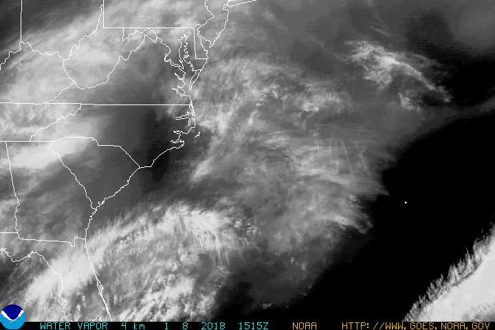
Satellite Images Still Images/Loops (both Flash & Java)
Buoy Data: Florida
Southeast US
Northeast US
Local News Coverage: WWAY 3 Wilmington NC
WRAL Raleigh NC
WETC Wilmington NC
WAVY Portsmouth VA w/Live Stream coverage link
WTVR Richmond VA
WUSA Washington DC
WBAL Baltimore MD
CBS Local Baltimore
WPVI Philadelphia
WTXF My Fox Philly
WABC NYC
WTNH New Haven CT
WHDH Boston
If you eat enough beans you may be able to push Irene back out to sea.
Fight back!
The good news about this storm is that it looks like most of the east coast will be getting hit with winds from the western side of the storm. With the current northward trajectory, this means that the actual wind speeds will be somewhat less that the circulating speeds (105 predicted - forward storm speed). Still a very dangerous storm and no one should take it lightly. Any storm surge predictions? That is one massive storm!
Pretty scary presser being held by Philly mayor Michael Nutter on TWC.
View from the International Space Station
One good reason to live in California.
Pick up paper plates and plastic forks and spoons. You’ll thank me...
I’d recommend a big jar of instant coffee. Add water, sugar, dried milk maybe, you have iced coffee with just a pour into your cold bottled water. And jumbo jars of peanut butter and chocolate graham cookies.
Prayers for all the good Freepers.
bttt
Thanks, that’s cool.
Hope it’s weakening as that site shows the eye going right over my house!!
Prayers sent .. stay alert and in a strong, safe location. Lord, protect those millions in harm’s way. It is not a small system.
http://www.goes.noaa.gov/GIFS/ECSTWV.JPG
http://i.flhurricane.com/images/2011/IreneAug26AM.jpg
http://www.goes.noaa.gov/HURRLOOPS/huvsloop.html
Thanks, NN, for your excellent and reliable resource, as always.
Pick up a hand operated water purification unit from a camping store and coffee filters for prefiltration and some sterno to boil water.
Clean your cache. It figures that someone from MN would need basic guidance for simple browser maintenance on a hurricane thread.
webcam on Indian Beach, NC... should be within 10-20 miles of landfall.
Specific/Relevant NOAA Weather Buoys that will be closest to the path up to the point of initial landfall:
41004 (41 NM Southeast of Charleston, SC)
41037 (27 miles SE of Wrightsville Beach)
41036 (Onslow Bay Outer)
BFTN7 (Beaufort, NC)
CLKN7 (Cape Lookout)
Buoy 41010 was passed by Irene this morning. Wave heights went from a low of around 9 feet to a peak of 31.5. Maximum wind gusts: 64.1 kts... minimal hurricane force. I *think* the closest approach was about 72 miles.
Time for my morning look at the track... albeit a little later than I’d planned. First off, here are the last several reported eye positions:
1700 THR 27.0N 77.3W
2000 THR 27.7N 77.4W
2300 THR 28.3N 77.3W
0200 FRI 28.7N 77.3W
0500 FRI 29.3N 77.2W
0800 FRI 30.0N 77.3W
1100 FRI 30.7N 77.3W
Okay, I think we can be pretty well assured that the beast is moving NORTH. A couple of days ago (post #416), I opined that if there was any chance of missing the Carolinas, it had better be moving a little right (east) of due north by the time it passed Daytona Beach (29.2°).
Well, technically it was (77.2W then)... but as we see since, that was just a ‘wobble’, and Irene has steamed straight north since then and is now parallel to Brunswick, GA on that same straight north tack... well over 100 miles further north.
My guesses from this:
1. It’s still not turning as I type this, though probably will start to do so soon.
2. It’s going a little west of the official track - currently Cape Lookout.
3. I’m thinking Atlanta Beach, NC is in trouble.
4. Irene is about 250 miles to Morehead City... landfall at current speed is roughly 17 hours away - before dawn Saturday morning.
Beyond the NC landfall, I have no ideas — the interaction with that much land might be a Godsend for the NE Corridor due to substantial weakening.
Aww rats, the Hurricane visible loop link seems to show a slight veer to the west. Definitely going to be a rough day for those people.
“Wow—this beats the record for people rushing to criticize the info provided for this thread.”
It was not a criticism. Just an observation.
Your initial posting contained an out of date map.
You then corrected your thread and put in the correct map - which I acknowledged in a separate post.
Don’t kill the messenger for simply pointing out that you used an out of date map.
Wise words P144...
Please be aware of the horrific dangers of the flooding that will accompany Irene. Flash floods are deadly.
Last week, Friday afternoon to be exact, a series of quick heavy thunderstorms (nothing like Irene will bring) hit the Pittsburgh area. My youngest son and I took advantage of the “last day of summer vacay” to do a trip to the Pgh Zoo. We left about 2:30ish. The first of the series of t-storms was rolling thru—leaving our route, Washington Boulevard, with heavy run off and ponding of water. I have a sm Jeep..and I felt the “push” of the puddles. Washington Boulevard is a major thorofare (with aging infrastructure) in a big city. About an hour later, and after another sudden two inch down pour, Washington Blvd was suddenly under nine feet of water...nine feet! In a matter of minutes. Four people (a mother and her two little girls in a minivan; and a woman swept out of her car perished).
Please...flooding kills. Like P144 noted if you think youi need to get away...get away now while you can!
Prayers up!
Here’s Joe Bastardi’s new web site:
http://www.weatherbell.com/
Disclaimer: Opinions posted on Free Republic are those of the individual posters and do not necessarily represent the opinion of Free Republic or its management. All materials posted herein are protected by copyright law and the exemption for fair use of copyrighted works.