To: Granof8
Please, let us know where the non containment areas are, if you hear.
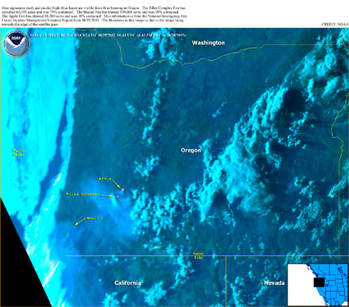
To: All
This is the latest NOAA picture of the Oregon Fires.
This is interesting to how the smoke from the Tiller and Apple fires going a little south and mainly east. While the smoke from the Biscuit fire is head a little west and south. We had smoke in the Kali upper/North wine country yesterday afternoon. It never got here until later at night with the coastal winds and after dark you could smell smoke.
To: Grampa Dave
Looks like it is the upper Pistol River close to the Gardner Ranch, and the Mislatnah Creek area down toward the Chetco.
13 posted on
08/30/2002 10:18:45 AM PDT by
Granof8
FreeRepublic.com is powered by software copyright 2000-2008 John Robinson