Just in time for Hitlery to hop on her broom and make one last whirlwind tour.
Posted on 02/04/2008 12:48:45 PM PST by HAL9000
Excerpt -
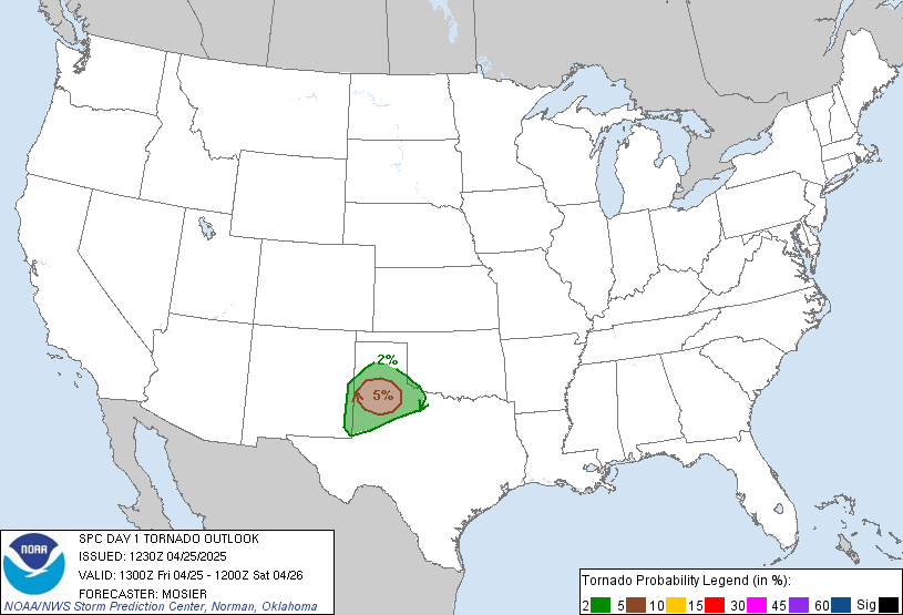
A severe weather outbreak is likely tonight through tomorrow from the eastern Southern Plains east to the Mississippi River Valley (Southern IL southward). The models have been trending slower and slower with this system with each consecutive run, with the WRF now forecasting the dryline to cross the I-35 corridor late tomorrow (Tuesday) morning. Therefore, the severe weather threat for today will hold off until after dark when the upper-level support arrives. Beginning early tomorrow afternoon, or even late tonight, the threat for tornadoes will increase dramatically over Northeast TX, East OK, and AR as supercells become surface-based. Given 0-1 km helicity values of 200+ m2/s2 over the entire warm sector, these tornadoes could be strong and long-track (especially with the fast storm motions). Selected WRF forecast panels for 00z tomorrow are displayed below.~ snip ~
(Excerpt) Read more at tornadovideos.net ...

Just in time for Hitlery to hop on her broom and make one last whirlwind tour.
Divine Intervention?
Not suprised. It’s 80 degrees right now in Central Texas and couldn’t get any muggier if it tried.
I am in North Mississippi and we are scheduled to have this tomorrow between the morning and late tomorrow night. It is 75 degrees here and muggy hot....and a cold front approaching. I have been lucky the past couple of years thank God...the tornadoes have missed me three times by a couple of hundred yards. Good Luck...and this is from someone that lived in Wichita County, Texas, and used to the blows.
I used to live in Wichita County too! Loved it there (I know, I know I must be crazy).
Small world. I have relatives in Iowa Park, Wichita Falls and Henrietta.
I’ve had the AC on today in Mobile, 80 degrees and high humidity streaming north.
Allison in Galveston, Sweet Eileen in Abiline....
Me too!
I need then rain on my wheat in Stephens County.
Too funny, you lived there too? Would you believe I was born in Pennsylvania? I arrived in Texas when I was two.
Hmmm........going to ask around about you.
PUBLIC SEVERE WEATHER OUTLOOK NWS STORM PREDICTION CENTER NORMAN OK 0651 AM CST TUE FEB 05 2008 ...A HIGH RISK OF SEVERE THUNDERSTORMS...INCLUDING TORNADOES... EXPECTED OVER PARTS OF THE MID SOUTH LATER TODAY AND TONIGHT...
THE NWS STORM PREDICTION CENTER IN NORMAN OK IS FORECASTING THE DEVELOPMENT OF A FEW STRONG...LONG-TRACK TORNADOES OVER PARTS OF THE MID SOUTH LATER TODAY AND TONIGHT.
THE AREAS MOST LIKELY TO EXPERIENCE THIS ACTIVITY INCLUDE
A LARGE PORTION OF ARKANSAS
NORTHWESTERN MISSISSIPPI
FAR SOUTHWEST TENNESSEE
SURROUNDING THE HIGH RISK AREA...THERE IS A MODERATE RISK OF SEVERE THUNDERSTORMS FROM PORTIONS OF EASTERN OK/SOUTHERN MO EAST-NORTHEASTWARD INTO THE OHIO RIVER VALLEY AND ACROSS THE LOWER MISSISSIPPI RIVER VALLEY.
A STRONG LATE WINTER MID AND UPPER LEVEL WEATHER SYSTEM NOW MOVING RAPIDLY EASTWARD OUT OF THE SOUTHERN ROCKIES WILL SUPPORT AN OUTBREAK OF TORNADOES AND OTHER SEVERE THUNDERSTORMS AS IT EJECTS ACROSS THE SOUTH CENTRAL UNITED STATES THROUGH TONIGHT. THE AIRMASS AHEAD OF THIS SYSTEM IS ALREADY UNSEASONABLY WARM AND MOIST EARLY THIS MORNING...AND WILL UNDERGO FURTHER HEATING AND MOISTENING THROUGH THE DAY. THIS WILL SUPPORT VIGOROUS STORMS BEGINNING EARLY THIS MORNING OVER PORTIONS OF OKLAHOMA AND NORTHERN TEXAS...WITH THE THREAT SPREADING STEADILY EAST-NORTHEASTWARD ALONG TRACK OF A SURFACE LOW AND ASSOCIATED SURFACE COLD FRONT MOVING ACROSS THE MID SOUTH TODAY. VIGOROUS STORMS SHOULD DEVELOP AHEAD OF THE FRONT THIS AFTERNOON...WHICH WILL QUICKLY PRODUCE TORNADOES GIVEN COMBINATION OF EXTREME WINDS ALOFT AND VERY WARM AND MOIST AIRMASS. STORMS MAY FORM INTO A LINE AND CONTINUE THE THREAT OF SEVERE THUNDERSTORMS EASTWARD INTO THE LOWER MS RIVER AND TN RIVER VALLEYS OVERNIGHT...WITH NORTHERN END SPREADING UP THE OHIO RIVER VALLEY.
EXTREMELY STRONG WINDS THROUGHOUT THE ATMOSPHERE WILL SUPPORT THE THREAT OF LONGER-LIVED STORMS...INCLUDING SUPERCELLS AND FAST MOVING LINES. THIS WILL ENHANCE THE POTENTIAL FOR STRONG TORNADOES AND WIDESPREAD DAMAGING WINDS ACROSS MUCH OF THIS REGION...WITH ADDED THREAT OF A FEW SIGNIFICANT EVENTS.
THIS IS POTENTIALLY A VERY DANGEROUS SITUATION. THOSE IN THE THREATENED AREA ARE URGED TO REVIEW SEVERE WEATHER SAFETY RULES AND TO LISTEN TO RADIO...TELEVISION...AND NOAA WEATHER RADIO FOR POSSIBLE WATCHES...WARNINGS...AND STATEMENTS LATER TODAY.
Bush’s fault! And he’s doing it without Rove’s Weather Machine!
___________-
GW licensed its use through the end of his term, as I understand it. With an option on Hillary’s inauguration day.


I’ve been watching the coverage today of the aftermath. Can’t say I’ve heard a single mention that the NWS nailed this one.
Now only if the mass media made more people aware of this situation rather than the latest polling data yesterday....
Disclaimer: Opinions posted on Free Republic are those of the individual posters and do not necessarily represent the opinion of Free Republic or its management. All materials posted herein are protected by copyright law and the exemption for fair use of copyrighted works.