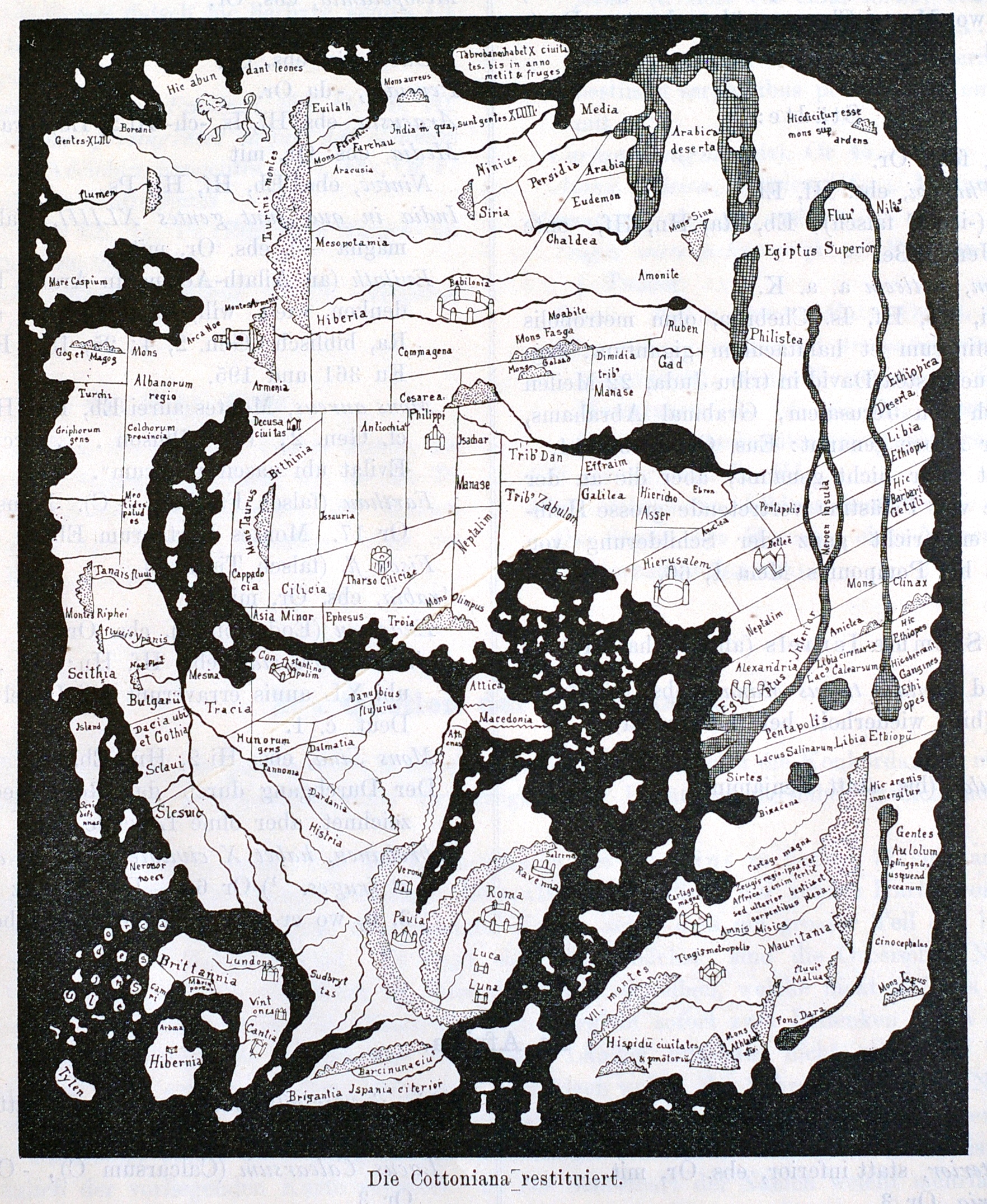
sorry “typo” -= “Hybernia”
That is really interesting, thanks for the post! East is at the top.
found this
from Latin Hibernia, the Roman name for Ireland, also in forms Iverna, Juverna, Ierne, etc., all ultimately from Old Celtic *Iveriu “Ireland” (see Irish (n.)). This particular form of the name was altered in Latin as though it meant “land of winter” (see hibernation).
http://www.etymonline.com/index.php?term=Hibernia
It’s Hibernia.
Interesting map. It has Ravenna on the wrong side of the Apennines.
Yet, even with the distortion, modern geographers can say, Mount Sinai should be about here." -- and,there it is...
That is an amazing amount of data! And, it makes surprisingly good sense...
Thanks for posting it!
Not sure how they managed to disconnect the upper Nile from the Nile, proper, though...
All in all, still amazing -- for a "flat world" map -- drawn over a milennium ago...
Where did you find it?
Hiberia is near Mesopotamia and Babilonia. On the other hand Hibernia, and Brittannia with Lundona are in the lower left hand corner. There are many places correctly near one another but other seriously out of place. Europe is seriously undersized out of position relative to Turkey The map would make more sense to modern eyes if it were rotated 90 degrees to put Ireland and Briton in the upper left hand corner. Is this a complete work, or someone’s attempt to reassemble fragments? Who created this?