Skip to comments.
NASA unveils 'stunning' close-ups of massive crater on Mars - Victoria crater
AFP on Yahoo ^
| 10/6/06
| Veronica Smith
Posted on 10/06/2006 9:53:49 PM PDT by NormsRevenge
WASHINGTON (AFP) - NASA scientists unveiled unprecedented close-up images of a massive crater on Mars they said could open the book on the Red Planet, from its formation to its history with water, the basis of life on Earth.
The images were taken three days ago by the Mars Reconnaissance Orbiter (MRO), which arrived in its permanent Martian orbit this week after an August 2005 launch and just turned its cameras on, and by a robotic rover on the planet's surface.
The MRO is providing support for the rover Opportunity, which began its first week at the enormous crater, exploring the layered rocks in cliffs ringing it.
The Victoria crater is the biggest crater the National Aeronautics and Space Administration will probably get to with its two rovers on the Martian surface, Doug McCuistion, director of NASA's Mars Exploration Program in Washington, said at a news conference.
"It gives us a window on the past on the planet," McCuistion said.
The level of detail in the photo from the MRO high-resolution camera will help guide Opportunity's exploration of Victoria, named for the sole surviving ship of the Portuguese explorer Magellan's global odyssey.
Steve Squyres of Cornell University in New York, the principal investigator for Opportunity and its twin rover, Spirit, located on the opposite side of the planet, underscored the potent synergies of the MRO and the rover working in tandem.
"We can see down to the subsurface of Mars," Squyres said, calling the combination "a remarkable opportunity."
Exposed geological layers in the cliff-like portions of Victoria's inner wall appear to record a longer span of Mars' environmental history than the rover has studied in smaller craters. Victoria is five times larger than any crater Opportunity has visited during its Martian trek.
The MRO's aerial images showed the rover perched on the outer rim of the Victoria crater, and provided significantly greater detail than previous images, the scientists said.
The images show the Victoria crater, about half a mile wide (0.8 kilometers wide), has scalloped edges of alternating cliff-like promontories, which appear to record a longer span of Mars' history than the rover has studied in smaller craters. Those craters are about a fifth the size of Victoria.
High-resolution color images taken by Opportunity's panoramic camera since September 28 reveal previously unseen layers that indicate environmental conditions on the planet had varied.
The cliffs are up to several hundred feet (meters) high, and the boulders are six to nine feet (1.8 to 2.7 meters) in diameter.
"We're extremely excited to see these" layers and rocks, said Jim Bell, lead scientist for the rover's panoramic camera, also of Cornell.
Bell said he was "running out of superlatives" to describe the "stunning" images of Mars. "We've just sort of opened the book."
Squyres said the rocks were probably extremely old and show "pervasive evidence" of having once been soaked in water.
The MRO mission is to search for evidence that water existed on the surface of Mars for a long period of time. While other Mars missions have shown that water flowed across the surface in the planet's history, it remains a mystery whether water was ever around long enough to provide a habitat for life.
Within two months after landing on Mars in early 2004, Opportunity found geological evidence for a long-ago environment that was wet. Scientists hope the layers in Victoria will provide new clues about whether that wet environment was persistent, fleeting or cyclical.
NASA plans to drive Opportunity from crater ridge to ridge, studying nearby cliffs across the intervening alcoves and looking for safe ways to drive the rover down into the bowl.
"It's like going to the Grand Canyon and seeing what you can from several different overlooks before you walk down," Bell said in a statement.
TOPICS: Government; News/Current Events
KEYWORDS: hirise; mro; nasa; opportunity
Navigation: use the links below to view more comments.
first 1-20, 21-29 next last

This NASA handout panoramic camera image released shows layers of "Cape Verde" in "Victoria Crater (False Color) taken fron the Mars Exploration Rover on Mars. NASA scientists unveiled unprecedented close-up images of a massive crater on Mars they said could open the book on the Red Planet, from its formation to its history with water, the basis of life on Earth.(AFP/NASA-HO)
To: NormsRevenge

In this photo released by NASA on Oct. 6, 2006, a view of Victoria crater is seen looking north from 'Duck Bay' towards the dramatic promontory called 'Cape Verde' on Mars. The dramatic cliff of layered rocks is about 50 meters (about 165 feet) away from the rover and is about 6 meters (about 20 feet) tall. The taller promontory beyond that is about 100 meters (about 325 feet) away, and the vista beyond that extends away for more than 400 meters (about 1300 feet) into the distance. This is a false color rendering (enhanced to bring out details from within the shadowed regions of the scene) of images taken by the panoramic camera (Pancam) on NASA's Mars Exploration Rover Opportunity during the rover's 952nd sol, or Martian day, (Sept. 28, 2006) using the camera's 750-nanometer, 530-nanometer and 430-nanometer filters. (AP Photo/NASA, JPL, Cornell)
2
posted on
10/06/2006 9:54:20 PM PDT
by
NormsRevenge
(Semper Fi ......Help the "Pendleton 8' and families -- http://www.freerepublic.com/~normsrevenge/)
To: NormsRevenge

Rocky cliffs in the foreground named 'Cape Verde' on the left, are seen in this image taken by Mars Exploration rover released on October 5, 2006. NASA's Mars rover Opportunity edged 3.7 meters (12 feet) closer to the top of the 'Duck Bay' alcove along the rim of 'Victoria Crater' during the rover's 952nd Martian day, or sol (overnight September 27 to September 28), and gained this vista of the crater. The rover's navigation camera took the seven exposures combined into this mosaic view of the crater's interior. This crater has been the mission's long-term destination for the past 21 Earth months. The far side of the crater is about 800 meters (one-half mile) away. The rim of the crater is composed of alternating promontories, rocky points towering approximately 70 meters (230 feet) above the crater floor, and recessed alcoves, such as Duck Bay. The bottom of the crater is covered by sand that has been shaped into ripples by the Martian wind. FOR EDITORIAL USE ONLY REUTERS/NASA-JPL/Handout (UNITED STATES)
3
posted on
10/06/2006 9:55:19 PM PDT
by
NormsRevenge
(Semper Fi ......Help the "Pendleton 8' and families -- http://www.freerepublic.com/~normsrevenge/)
To: NormsRevenge

This handout photo made by the Mars rover Opportunity and released Friday, Oct. 6, 2006, by NASA shows a view of the 'Victoria crater' looking southeast from 'Duck Bay' towards the dramatic promontory called 'Cabo Frio.' The small crater in the right foreground, informally known as 'Sputnik', is about 65 feet away from the rover. This is an approximately true color rendering of images taken by the panoramic camera on Opportunity taken Thursday, Sept. 28, 2006. (AP Photo/NASA, JPL, CORNELL)

This handout image from NASA taken Tuesday, Oct. 3, 2006 and released Friday, Oct. 6, 2006, from the High Resolution Imaging Science Experiment on NASA's Mars Reconnaissance Orbiter shows 'Victoria crater,' an impact crater at Meridiani Planum, near the equator of Mars. The crater is approximately 800 meters (half-a-mile) in diameter. It has a distinctive scalloped shape to its rim, caused by erosion and downhill movement of crater wall material. The floor of the crater is occupied by a striking field of sand dunes. (AP Photo/NASA, JPL, Cornell)
4
posted on
10/06/2006 9:56:55 PM PDT
by
NormsRevenge
(Semper Fi ......Help the "Pendleton 8' and families -- http://www.freerepublic.com/~normsrevenge/)
To: NormsRevenge

Alfred McEwen, Principal Investigator of Mars Reconnaissance Orbiter High Resolution Camera, University of Arizona, shows an image of Victoria crater on Mars with a football stadium superimposed to help show it's relative size, during a news conference at NASA Headquarters in Washington, DC October 6, 2006. EDITORIAL USE ONLY REUTERS/NASA/Bill Ingalls/Handout (UNITED STATES)
5
posted on
10/06/2006 9:57:59 PM PDT
by
NormsRevenge
(Semper Fi ......Help the "Pendleton 8' and families -- http://www.freerepublic.com/~normsrevenge/)
To: NormsRevenge
Great! Now the politicians in Los Angeles will want to use tax payer money to build a stadium on mars too....
To: NormsRevenge
This crater was discovered by Bill Clinton in 1995.

7
posted on
10/06/2006 10:02:42 PM PDT
by
blake6900
(THIS SPACE FOR RENT)
To: Walkingfeather
Great! Now the politicians in Los Angeles will want to use tax payer money to build a stadium on mars too....
--
lol.. Don't let Al Davis know.. ;-)
for more info on the mars Rovers
http://mars.jpl.nasa.gov/
8
posted on
10/06/2006 10:03:06 PM PDT
by
NormsRevenge
(Semper Fi ......Help the "Pendleton 8' and families -- http://www.freerepublic.com/~normsrevenge/)
To: NormsRevenge
Amazing pics! Look at this one, you can see fuzzy plant like aliens.

9
posted on
10/06/2006 10:06:07 PM PDT
by
Screamname
(LET`S GO METS!!! LET`S GO METS! LET`S GO METS! LET`S GO METS!!! LET`S GO METS! LET`S GO METS!)
To: NormsRevenge
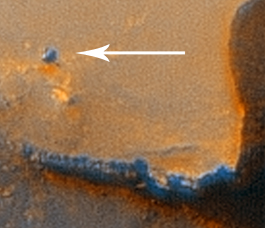
Btw, you can see the rover in the pic.

To: NormsRevenge
To: MrNationalist
12
posted on
10/06/2006 10:19:25 PM PDT
by
NormsRevenge
(Semper Fi ......Help the "Pendleton 8' and families -- http://www.freerepublic.com/~normsrevenge/)
To: MrNationalist
That must be somebody's thumb print in the center. Yep, gotta be.
13
posted on
10/06/2006 10:22:34 PM PDT
by
Chuck54
( "Your right to privacy is not as important as my right to live".)
To: NormsRevenge
Next they will post a photo of the EU "Beagle" lander that crashed. The EU's "Mars Express" has been searching without success.
To: NormsRevenge
15
posted on
10/06/2006 10:43:20 PM PDT
by
dr_lew
To: free_at_jsl.com
"Next they will post a photo of the EU "Beagle" lander that crashed. The EU's "Mars Express" has been searching without success." Yeah...and designed on the same computer as was used for the Airbust 380
16
posted on
10/06/2006 11:08:32 PM PDT
by
spokeshave
(The Democrat Party stands for open treason in a time of war.)
To: NormsRevenge
Hmmm ....
In that picture of the eroded outcropping there appear to be sedimentary layers...
can fossilized remains (diatoms, etc.) be next?
17
posted on
10/06/2006 11:28:18 PM PDT
by
compuguru
(De Oppresso Liber)
To: NormsRevenge
Isn't that photo totally amazing?
To: NormsRevenge
So that's the Mars Dome. Or is it an "open air" stadium? Talk about home field advantage.
19
posted on
10/07/2006 12:14:44 AM PDT
by
eggman
(Democrat party - The black hole of liberalism from which no rational thought can escape.)
To: All
Navigation: use the links below to view more comments.
first 1-20, 21-29 next last
Disclaimer:
Opinions posted on Free Republic are those of the individual
posters and do not necessarily represent the opinion of Free Republic or its
management. All materials posted herein are protected by copyright law and the
exemption for fair use of copyrighted works.
FreeRepublic.com is powered by software copyright 2000-2008 John Robinson