I’m sure this is somehow related to GLOBAL WARMING.
No doubt this is caused by global warming. I wonder how many carbon offsets do we need to purchase to prevent them from erupting?
I always love these type of articles.......a general question............I’ll comment way deep in the thread
....Why are the Oceans salty ?........
Warms the water, pollutes the air and probably has sunk some ships and caused some planes to go down over water.
Bush’s fault!
It's not new volcanoes -- its newly found volcanoes. I was astonished for a moment...
Pretty interesting - I wish they'd elaborated on this phenomenon though. Wouldn't the gravity caused by the mountain mass itself pull the water down causing a dish, rather than dome, on the oceans surface?
My personal theory is that these underwater volcanoes and other steam vents, when very active, cause El Nino. I don’t have any proof, but it makes sense to me. It would take a tremendous amount of volcanic activity just to heat the Pacific Ocean to the point that an El Nino occurs. If this is true, it would be enough to heat the Pacific enough.
Gads! Volcanoes spewing all those greenhouse gases and polluting the sea. Congress has just got to pass a law to prevent this travesty.
OK so the oceans surface is randomly pimpled and pocked with "water domes" which measure in metres, an equatorial bulge of about half a metre (between Maine and Miami) due to rotation and never ending wave action of indeterminate height due to winds. So how do you define the "average sea level"? Let alone measure it with millimetre precision? Establishing that baseline number is necessary to be able to document any increase as predicted by global warming alarmists.
I know, we'll use a satellite based radar system! Except that's measuring a point value not an average. It is almost like measuring the average height of an American male. By the time you finish measuring all the required points, they have all changed in value.
Regards,
GtG
Notice when the news is being reported...during Bush’s term...and it’s taken this long for someone to say the obvious “Bush’s Fault”!!!??

WE'RE DOOMED!
self-ping.
 |
||
| · join · view topics · view or post blog · bookmark · post new topic · | ||
In 1971, petroleum geologists in the southern Gulf of Mexico took a bizarre photograph near the Campeche Knolls oilfield, a region where the evaporite deposits below the seafloor have warped up into domes. The photo seemingly showed a small patch of asphalt covering the seafloor. Such an exposure, however, would mean that hot tar was erupting in the deep, cold Gulf, far from any spreading center or ridge — a scenario unheard of at the time.
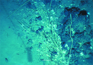
At the edges of the flow field at Chapopote in the southern Gulf of Mexico, small clusters of tubeworms grow under eroded asphalt deposits, along with living bivalve shells and galatheid crabs. Photos by Ian MacDonald, Texas A&M University, Corpus Christi.