Posted on 10/12/2013 9:21:37 AM PDT by lbryce
Who doesn’t love Mars? Amid the bad news of a U.S. government shutdown now stretching towards Day 12, there are still several spacecraft from NASA and the European Space Agency taking pictures of that red dot in the sky. Here are some recent stunners from the Red Planet.
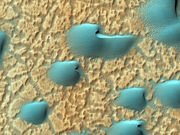
Above is an infrared view of Noachis Terra as seen through the eyes of the Mars Reconnaissance Orbiter. The High Resolution Imaging Science Experiment (HiRISE) camera website (from the University of Arizona) released the picture on its website Oct. 2, with this description (in part):
“When there are perfect conditions for producing sand dunes — steady wind in one direction and just enough sand — barchan sand dunes form. The word ‘barchan’ is a Russian term because this type of dune was first described in the desert regions of Turkistan.”
MRO is run under a contract from NASA and is still operating, although its Twitter feed warns funds are running low.
![]()
Mars Express is a European Space Agency spacecraft and is thus not affected by the shutdown. This mosaic of eight images released Oct. 8 (above) shows Hebes Chasma, which is about 186 miles (300 kilometers) north of Valles Marineris. The trench is about five miles (eight kilometers) deep at its utmost, and hundreds of miles long. “A flat-topped mesa is located in the center of Hebes Chasma, which was likely shaped by the action of wind and water,” ESA wrote.
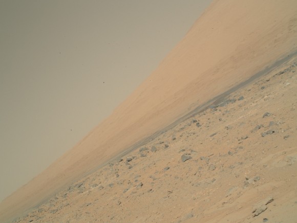
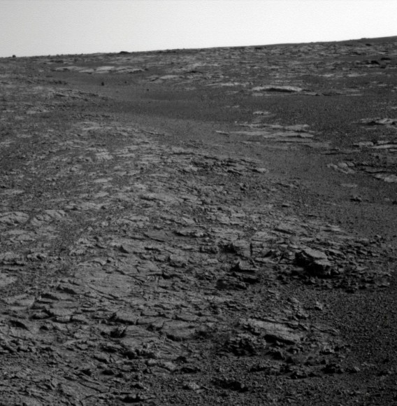
Meanwhile, the Curiosity and Opportunity rovers are still trundling away on Mars. NASA’s Jet Propulsion Laboratory is a contract operation and is still running its missions for the time being. These pictures were downloaded from the raw image sites for the rovers (here and here) as all press updates are suspended amid the shutdown.
Mars ain’t the kind of place to raise your kids, in fact, it’s cold as Hell.
Over to you, professor...
/8^)

Wow, five miles deep!
How did it form?
Awesome.
"Hebes Chasma....The trench is about five miles deep at its utmost, and hundreds of miles long."
The origin of this feature defies explanation. On Earth, such features have been gouged out by running water, but I see no evidence of where water would have come from, or gone to, in this photo.
Where are the river channels leading to, and away from this structure? Perhaps it was once a lake?
Mining operation !?
That's what I'm asking.
The only thing that makes sense to me, is that the planet ripped open at that location. I can't see any other way for that feature to form.
Something along the lines of a rift valley. It would be evidence of ancient tectonic activity on Mars if that's correct.
There doesn’t appear to be any outlet, so erosion
would seem to be out. Would love to see some oblique
close ups. Mars, temporarily shut down due to close
of government offices...
Naw.....no tire tracks. There'd definitely be tire tracks.
Sink hole.
That's why I'm thinking tectonic rift. It's the correct shape for that, too.
Does it say how big the dunes are?
That’s one, big crocodile fossil !
YouTube:William Shatner "Sings" 'Rocket Man'-The Museum of Classic Chicago Television
That would have been one humongous cave.
Maybe Mars used to have 3 little moons and one of them crashed there??
And there’s no one there to help you raise them ...
Rover and it's little shovel have been busy.
|
Disclaimer: Opinions posted on Free Republic are those of the individual posters and do not necessarily represent the opinion of Free Republic or its management. All materials posted herein are protected by copyright law and the exemption for fair use of copyrighted works.
