
Posted on 09/14/2005 7:51:52 AM PDT by cogitator
Inspiration: the "close approach" of the Japanese satellite Hayabusa to the asteroid Itokawa. Hayabusa is actually going to attempt to gather material from Itokawa using an impactor, and it will deploy a micro-robot that hops around the asteroid. Cool mission -- the samples are supposed to land in the Australian outback in 2007.
Hayabusa Hovers Near Asteroid Itokawa
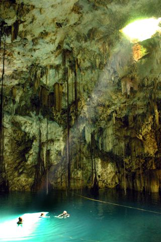
So why the images? Well, the cenote was caused by the K/T impactor, and that's what I thought of today. According to a long-remembered National Geographic article, the Chichen Itza cenote was supposedly the site of human sacrifices; after the sacrifice was tossed in, the onlookers tossed in gold and gems.
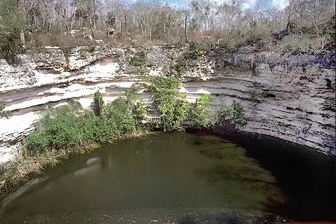

Yucatan has a lot of cenotes (it's karst, after all), but the ring of cenotes around Merida was one of the first surface indications of the K/T impact structure rim.
** ping **
Thanks! Again, great pics & interesting topic.
Please FREEPMAIL me if you want on or off the
"Gods, Graves, Glyphs" PING list or GGG weekly digest
-- Archaeology/Anthropology/Ancient Cultures/Artifacts/Antiquities, etc.
Gods, Graves, Glyphs (alpha order)
cogitator's link may be of interest (or, it may have appeared as a separate topic already, in which case please disregard).
Hayabusa Hovers Near Asteroid Itokawa
http://www.spaceref.com/news/viewsr.html?pid=18064"
Just FYI, Hayabusa used to be known as MUSES-C. I was wondering why I hadn't heard about it before, but I did hear references to MUSES-C as it was being prepared and launched.
I wonder if the semicircle around Merida is a consequence of the Chixlub(sp) meteorite impact 65 million years ago?
Yes it was (I mentioned this in my "prologue"). The curious cenote pattern was what alerted the researchers to the presence of the structure -- later they found drilling records that confirmed the 3-D structure and the offshore circular extension of it.

This image is from the Shuttle Imaging Radar, which viewed the "rim" of the crater -- even though it's a only a couple of meters different from the rest of the surface.
Here's the 3-D structure of the impact feature, based on gravity mapping. The white line is the Yucatan coast:

Is this impact area considred the source of *the* K/T impact and resulting climate change?
Cool!! Cenotes, caves and karst! Now, you're talking my language.
Yes. The meteor came in at an angle of about 35 degrees from the south southeast.
"The meteor came in at an angle of about 35 degrees from the south southeast."
Ah...so any debris field would now be covered by the Gulf of Mexico. I take it back then the Gulf wasn't even there?
Disclaimer: Opinions posted on Free Republic are those of the individual posters and do not necessarily represent the opinion of Free Republic or its management. All materials posted herein are protected by copyright law and the exemption for fair use of copyrighted works.