Let us know when they find Davy Jones' Locker.
Posted on 10/02/2014 9:25:53 PM PDT by Utilizer
Oceanographers have a saying: Scientists know more about the surface of Mars than they do about the landscape at the bottom of our oceans. But that may soon change. Using data from satellites that measure variations in Earth’s gravitational field, researchers have found a new and more accurate way to map the sea floor. The improved resolution has already allowed them to identify previously hidden features—including thousands of extinct volcanoes more than 1000 meters tall—as well as piece together some lingering uncertainties in Earth’s ancient history.
Roughly 90% of the deep-ocean sea floor remains unmapped, a fact that’s been thrown into sharp relief by searchers’ inability to locate Malaysia Airlines Flight 370, which is thought to have crashed somewhere in the southern Indian Ocean in March. What maps do exist have been largely generated by instruments such as ship-based multibeam sonar systems, which take soundings of the depth to the sea floor as they crisscross select areas of ocean. That leaves “big holes hundreds of kilometers across with no data,” says David Sandwell, a geophysicist at the Scripps Institution of Oceanography in San Diego, California.
(Excerpt) Read more at news.sciencemag.org ...
Also makes note of the fact that the ChiComs are very interested in this information as well.
It ain’t there - it’s in Syria.....
No mention if they have managed to discover Atlantis, though. Of course, they could have been told to remain silent about it. :)
Let us know when they find Davy Jones' Locker.
No, I am quite certain that the ChiComs originate from Mainland China, you know that evil socialist “Worker’s Paradise” which everyone is struggling to emigrate to since it is such a benevolent country.
OK, the part about the origins of the ChiComs is true, but the rest of the comment is satire, just in case some NoKs decide to take it seriously and print it in the NK national paper to convince its peasantry and KimJon Ill how evil all other countries are.
Atlantis. Mu. Lemuria. And a large Happy Face.
or the entrance to inner earth
Malay air 700.
Pakistan or Inian Ocean.
I think you posted on the wrong thread, mate. This article is about the new resolution available from the latest satellites now in orbit, not a re-tread of yet another Malaysian Airlines story.
There have been far too many of those already.
Yes, I had forgotten about Mu and Lemuria. Not sure about the Happy Face, though. *grin*
Yes, another interesting thing to look for indeed.
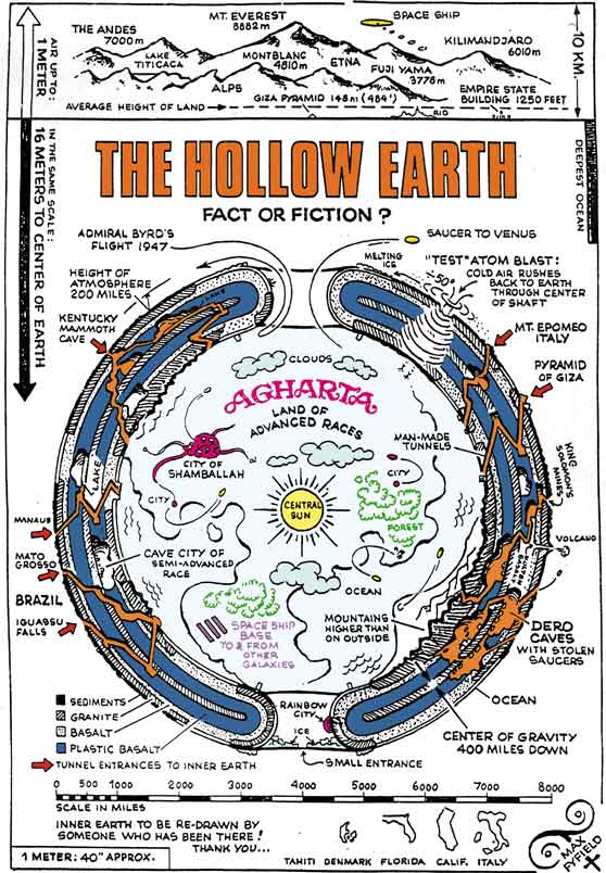
I searched on “inner earth” then chose the “images” link. There’s a ton of them. They’re pretty hilarious.
“I searched on “inner earth” then chose the “images” link. There’s a ton of them. They’re pretty hilarious.”
You mean people believe that nonsense? That is scary.
And here all the time I was looking at the ocean floor on Google earth I was being deceived????
Figures.
Mu
***************
Brought to mind the old comic strip of ‘Alley Oop’, who was a stone age guy in the land of Moo with a pet dino named Dinny and a girlfriend named Ooola.
I read the comics every day when a young kid in the ‘40s.
I suppose the name Moo was chosen based on the stories that there had once been a land of Mu.
The improved resolution has already allowed them to identify previously hidden features—including thousands of extinct volcanoes more than 1000 meters tall—as well as piece together some lingering uncertainties in Earth’s ancient history.
Thanks Utilizer.
|
I want new craters, big big craters with dates!
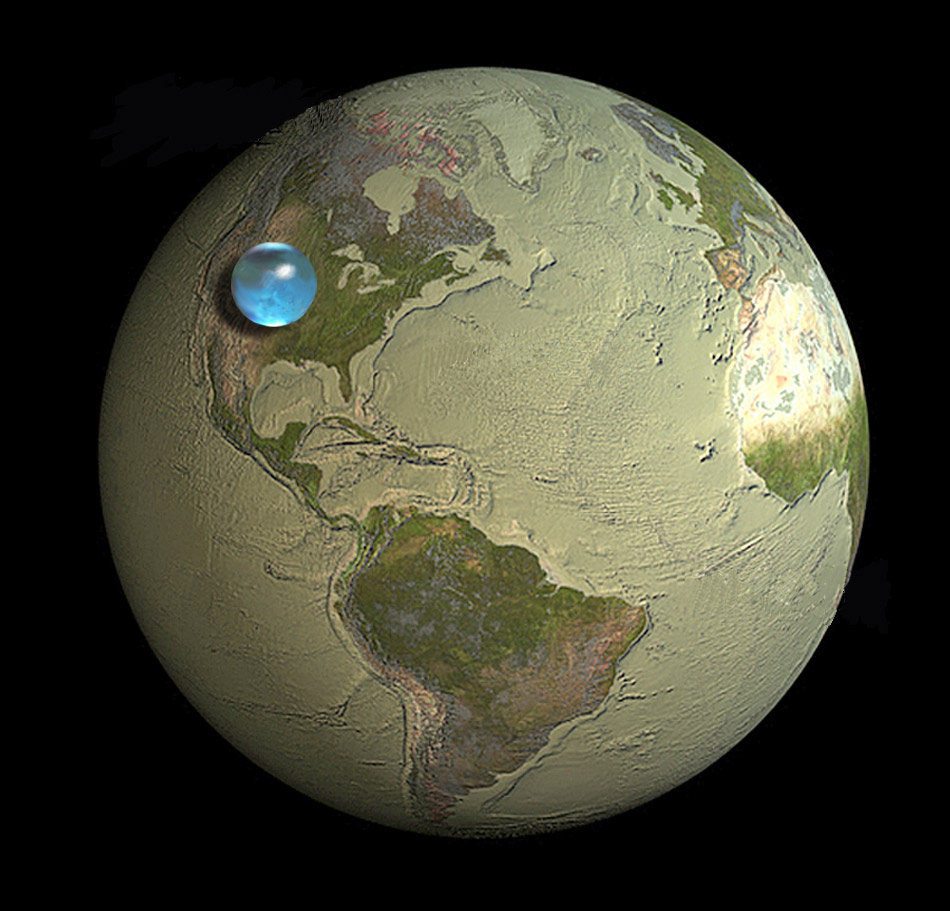
Amazingly, the earths water is really a miniscule amount | 5/15/2012 | thanks central_va.The Louis Frank keyword:
Disclaimer: Opinions posted on Free Republic are those of the individual posters and do not necessarily represent the opinion of Free Republic or its management. All materials posted herein are protected by copyright law and the exemption for fair use of copyrighted works.