Skip to comments.
Firefighters battle winds (Black Hills SD FIRE PHOTOS)
Rapid City Journal ^
| 7-3-02
| By Tim Paluch and Tim Velder, Journal Staff Writers
Posted on 07/04/2002 12:33:33 AM PDT by petuniasevan
Firefighters battle winds
By Tim Paluch and Tim Velder, Journal Staff Writers
DEADWOOD -- Fire officials said that Wednesday was a critical day for firefighters battling Grizzly Gulch Fire south and east of Deadwood.
High winds from the southeast ripped through the area throughout the day and weren't expected to stop until today.
The fire was on the move in some areas Wednesday. By midafternoon, Pillar Peak, near Dome Mountain and Bear Den Mountain, was burning about four miles east of Deadwood.
Scores of residents in homes from the Shonley Addition to Deadwood on the north side of Highway 14A were placed under mandatory evacuation Wednesday evening. If the fire were to cross the highway, residents there would have no escape route.
Crews hoped to hold a fire line today from Highway 14A to Bear Den Mountain. If the line resists flare-ups today, the crews will breathe much easier, incident commander Paul Hefner said.
"Today was a big day for us," Hefner said. "If we can get through tomorrow, I can relax a little bit more."
Winds were expected to pick up even more throughout the evening.
By Wednesday evening, the fire had burned 9,800 acres, up from an estimated 9,000 the day before. But officials said they had the blaze 50 percent contained by Wednesday.
Fire-behavior specialist Ivan Erskine said the gusty winds Wednesday made the fire patterns erratic. "It made a run at Pillar Peak and was burning extremely hot," Erskine said during the evening briefing. He told the night crews that winds circulate around canyons and could cause spot fires as far as three-fourths of a mile ahead of the main body of the fire.
Helicopters with 2,000-gallon water buckets pounded active fire areas in the Pillar Peak and Galena areas throughout the afternoon and evening Wednesday.
Officials have not yet determined the cause of the fire that started Saturday in Grizzly Gulch south of Deadwood and Lead. Hefner said Wednesday night that the cause of the fire has been narrowed down to an area, but local investigators have called in a specialist to help.
Grizzly Gulch Fire is now the No. 1 priority fire in the nation, U.S. Forest Service deputy incident commander Mike Dondero said. He said a big reason for that is the number of private homes and property throughout the national forest.
"Homes are not just on the edges of cities and towns, they're scattered everywhere," he said. "That makes it strategically difficult."
Wednesday evening, fire officials played host to about 250 people at a public-information meeting in Deadwood. Many in the audience applauded the efforts of local, state and federal authorities in saving Lead and Deadwood as well as most of the homes threatened by the fire.
People also asked about the most dangerous areas of the fire.
One critical area was near Gilt Edge Mine, where fire threatened structures. "Fire was backing (into the wind) and kept making runs at the structures," operations supervisor Beth Lund said.
Winds pushed the fire into bulldozer lines in that area, but they appeared to hold, fire officials said.
By late Wednesday, Lead Mayor Tom Nelson anticipated that Lead residents would be able to return to their homes at 6 a.m. today, barring a major flare-up overnight. He said people should call Lead City Hall at 584-1401 this morning to find out whether the evacuation order had been lifted.
Lead resident Deb Chase welcomed that news. She and hundreds of other Lead residents have been out of their homes for more than four days. "I'm not impatient about getting back home," Chase said. "It's Mother Nature, and you can't do anything about it."
She expressed frustration that Deadwood - only three miles away - could reopen and welcome residents and tourists while Lead remained closed. "I understand that gaming must go on and how much money they are losing," Chase said. "But look at the people that can't go home, let alone work."
Dozens of other evacuees from rural subdivisions likely will have to wait until the weekend before they can go home. Fire crews said they would like to secure fire lines and make sure they hold before letting people back into some of the rural areas south of Lead and Deadwood. Weakened trees and unstable power lines remain obstacles to many people returning home, Lead Fire Chief Ray Bubb said.
Sen. Tom Daschle told those at the meeting that public assistance for fire victims would be based on quantified losses. He said that after a loss assessment is completed, federal funding programs could be directed to specific areas.
Before firefighters began their shifts Wednesday morning, Bob Nester of the National Weather Service told crews they were under a red-flag warning, meaning that weather conditions that potentially could make the fire behave dangerously were imminent.
Firefighters were told to be extra vigilant Wednesday and to make sure escape routes were clear in case erratic winds began moving the fire into their areas.
Operations Sections Chief Jim Reinhardt told crews at a morning briefing that advances were made during the night Tuesday in some parts of the fire but that expected weather posed a risk.
"The high winds whipping through gulches present a severe risk, especially as directions of the wind coming out becomes unpredictable," he said.
Southeast winds blew through the fire area Wednesday, and gusts regularly reached more than 30 mph.
Nester also said there was a possibility of isolated thunderstorms late Wednesday that could bring dry lightning but not much moisture.
The fire had flared up late Tuesday evening and early Wednesday morning, forcing the evacuation of about 10 homes on the south side of the Radio Tower Road area in Boulder Canyon. At the same time, residents along the south side of Highway 14A in the canyon were asked to voluntarily evacuate their homes.
Highway 14A was also closed early Wednesday, from Shonley's to Deadwood.
Two areas were of great concern to firefighters Wednesday.
Officials feared that if high winds channeled into gullies in the northeast sections of the blaze from Two Bit Road east to Dome Mountain and Bear Den Mountain, they would become erratic and unpredictable.
"If that fire comes, and if that fire gets up in the trees and starts moving, you cannot put people out in front of it," Dondero said.
And in the southwest corner of the fire, officials feared spot fires across the fire lines at Yellow Creek Road south of Lead would be pushed by the high southeast winds back toward Lead.
Fire crews made significant gains on the southern end of the fire as winds blew back flames onto areas previously burned.
On Tuesday, the South Dakota Black Hats firefighters from Rapid City built a fire line from Gilt Edge Mine to Galena. They started backfires Wednesday, which, pushed by southeastern winds, burned toward areas already scorched by the Grizzly Gulch Fire (see photo on Page A9).
Hand crews had been on the lines since Tuesday, and a ridge of the mine served as a lookout point for Black Hats to communicate with those on the hand crews.
Dulcie Running Hawk, a Black Hat from Rapid City, took weather measurements from the lookout point Wednesday to be relayed to those on the line.
As Running Hawk measured weather patterns early Wednesday afternoon, flames roared on the ridges below, often crowning in the treetops and racing rapidly up the ridges when high winds gusted.
That, Running Hawk said, was exactly what they wanted it to do as the blaze burned away from the fire lines and toward burned areas.
The lookouts were in constant communication with the hand crews, ready to warn them when the fire direction or behavior changed.
At 12:15 p.m., Running Hawk recorded the temperature at 82 degrees. The relative humidity was 28 percent, and winds were out of the southeast at 10 mph, gusting to 28 mph.
Running Hawk arrived Tuesday at the Grizzly Gulch Fire. She had been working with the Black Hats on the Lost Cabin Fire in Black Elk Wilderness area, which burned about 24 acres last week.
The Grizzly Gulch Fire is the largest Running Hawk has ever worked on in her three years of firefighting. "It's real scary," she said.
Safety Officer LaVerne Hermanson of the South Dakota Wildland Fire Suppression Division also was working in areas on the south end of the fire.
Hermanson said that, before Tuesday and Wednesday, that area presented a problem for crews there.
"It was just Mother Nature being nice to us (Tuesday and Wednesday)," he said. "Sometimes, she isn't so nice."
Dondero said that although the potential for spot fires being pushed in the direction of Lead leaves the town's residents still under evacuation order, Deadwood likely won't encounter any more problems.
Spots throughout the city continue to be watered down, and areas south of the city already had burned, he said.
Also on Wednesday, three air tankers were sent out of the area for maintenance and so that the crews could rest, but by Wednesday afternoon, four tankers still were making drops on the blaze.
Fire-information officer Richard Markley said an air attack plane was also circling the fire.
"It is basically acting as an air-traffic controller, coordinating efforts between the air and the ground," he said. "Kind of an eye in the sky."
Two Black Hawk helicopters were sent to Mount Rushmore National Memorial on Wednesday for security purposes and were replaced by a heavy helicopter that was making water drops near Pillar Peak on Wednesday afternoon.
TOPICS: Extended News; News/Current Events; US: South Dakota
KEYWORDS: 10000acres; 50containment; blackhills; bouldercanyon; burn; damage; deadwood; destruction; drought; dry; evacuations; fire; firefighters; forest; hills; lead; notgood; reevacuation; southdakota; sturgis; wildfire
possibility of isolated thunderstorms late Wednesday that could bring dry lightning NOT what they need...


The Landsat 7 satellite took this photo of the Grizzly Gulch Fire at 9:45 a.m. Tuesday.
The satellite was at an altitude of 437 miles.
The red and dark blue areas are burned.
The bluish haze is smoke.
The light-colored area at the bottom right of the fire is the Gilt Edge Mine.
Lead is to the left of the burned area, and Deadwood is farther north and east.
Gail Schmidt, a Raytheon software engineer at South Dakota School of Mines & Technology,
who provided the photo, said the resolution could show objects as small as 30 meters across.
(Photo courtesy of the EROS Data Center of the United States Geological Survey)

The bold outline is the burned area as of July 4th.
See the relative positions of Lead, Deadwood, and Sturgis.
Image below: an aerial view 7-2-02.

To: 4TheFlag; BOBTHENAILER; 2sheep; South Dakota; SoDak; 11B3; RedBloodedAmerican
FIRE PING!
To: HiTech RedNeck
Just up your alley! See the images at the bottom of my post!
To: HiTech RedNeck
OOPS badly worded. Coincidence: I just posted this thread and one pic will answer your question!
To: petuniasevan; All
5
posted on
07/04/2002 1:33:11 AM PDT
by
backhoe
To: petuniasevan
Devastating! Hoping the firefighters stay safe!
To: petuniasevan
Judging from your pictures it would appear to this uninformed and stupid observer, that several of the
fire resistant, large trees, as quoted by Sierra Club, et al, are, strangely , in fact, burning.
How can that be?
I think I recall, in my feeble mind, that the enviros have stated, loudly and clearly, that the policies of logging out the large, "fire resistant" trees, is, in large part, the reason these fires are burning so intensely.
To: petuniasevan
I went to the Black Hill's a long time ago, what a great place. It seems with all the fires around, we don't have enough resources to fight them all adequately, do you think so? I saw a stat the other day that said typically for this time of year, 10% of the Nation is in a drought condition, as opposed to right now in which 40% is in drought conditions. Oddly, I don't think we are (Florida) and most of Texas is okay.
To: RedBloodedAmerican
When the Sturgis bikers come the problem is solved: have them all p-, er, whiz, on the fire.
To: 4TheFlag
Tragic. I hope this is under control soon.
Best to you and the Black Hills.
10
posted on
07/04/2002 11:14:36 AM PDT
by
Barnacle
To: Barnacle
Tragic. I hope this is under control soon.Dittoes Barnacle, VERY windy today, we're keeping our fingers crossed, thank you.
11
posted on
07/04/2002 11:29:42 AM PDT
by
4TheFlag
To: petuniasevan; Pray4USA
Thanks for the ping ps, hope you don't mind, but I have been using some of the photo's posted here on the Canteen Thread.....
Outlook is for DRY DRY DRY DRY, and HOT HOT HOT HOT...I've NEVER seen the Hills this dry....
12
posted on
07/04/2002 11:33:10 AM PDT
by
4TheFlag
To: 4TheFlag
I don't mind at all.
Hope your beautiful Black Hills don't all burn to a crisp...
To: BOBTHENAILER
Those trees are only "fire resistant" if the underbrush and twiggy saplings are thinned by logging, road building, or small fires on a regular basis.
You don't start a fire in a fireplace with large logs, right? Gotta start with tinder and kindling to "catch" the logs.
Historic photos of various forests (Yosemite comes to mind) show that the underbrush was NOT allowed to grow in thick like it does today. Fires removed the kindling; native tribes cut down trees (yes they DID, enviros!) for building boats and/or homes. They often DELIBERATELY set fires to improve hunting conditions and cause optimal food production in their area. An oak tree which isn't competing with saplings produces more acorns. Open areas support deer and other wildlife.
It has been an UNUSUAL case for the Black Hills. The French coureurs du bois met many tribes on the Plains who were settled in villages and farmed along the streams and rivers. The Mandan people (see George Catlin's paintings) were a prime example. Unfortunately, the fur trappers brought with them all the assorted Old World diseases for which the natives had NO natural resistance. The village tribes, the Mandan among them, were wiped out by disease.
The disappearance of these tribes was noted by the tribes living near Lakes Michigan and Superior. Several groups of Dakota/Lakota started moving westward to fill in the void, leaving behind their water-oriented culture for a nomadic horse-riding buffalo-hunting way of life. The change was sudden, dramatic, and total. No one now farmed the fertile streambanks; no one harvested the pines or cleared the underbrush in the Hills.
By the way, this all happened less than 250 years ago.
To: petuniasevan
Hope your beautiful Black Hills don't all burn to a crisp...Me too ps...BTW,
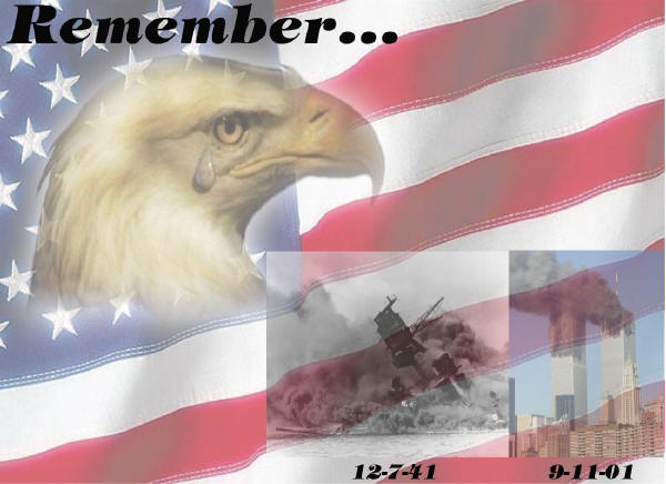
HAPPY 4TH OF JULY
GOD BLESS AMERICA!

15
posted on
07/04/2002 5:56:32 PM PDT
by
4TheFlag
Disclaimer:
Opinions posted on Free Republic are those of the individual
posters and do not necessarily represent the opinion of Free Republic or its
management. All materials posted herein are protected by copyright law and the
exemption for fair use of copyrighted works.
FreeRepublic.com is powered by software copyright 2000-2008 John Robinson