Skip to comments.
Super Cool Shuttle Photo
rushlimbaugh.com ^
| 03/04/03
| Rush Limbaugh
Posted on 03/04/2003 9:52:26 PM PST by Pokey78
click here to read article
Navigation: use the links below to view more comments.
first previous 1-20, 21-40, 41-60, 61-80, 81-93 next last
To: RussellStevens
That would be consistent with a bent shadow line, with what jlogajan said about the map type.
61
posted on
03/04/2003 11:16:10 PM PST
by
JoJo Gunn
(Help control the Leftist population. Have them spayed or neutered....)
To: Pokey78
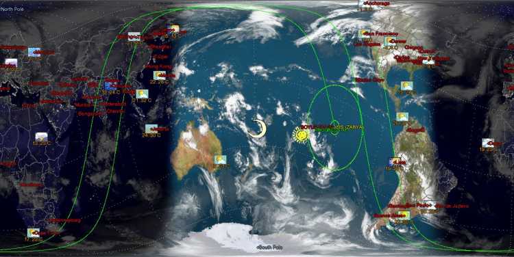
Its got to be a fake. There is not a single cloud over all of England and Scotland. When is the last time in January that there was not a single cloud over all of the British Isles. Never.
Plus the shuttle would have had to be at least 5000 miles out to take a picture at that angle. And the lights could only be taken like that with time exposed photography, something that would have resulted in smearing on a vehicle traveling 17000 miles per hour.
Finally it appears to be dusk over Africa for at least 1500 miles. Dusk lasts about 1/2 hour and thus the maximum that clouds over Africa could be visible in the dark would be about 500 miles.
Other than that, its a pretty cool picture.
To: John H K
The photo I posted is a combination of satellite photos and a topo map (for ocean). Here is a "thumbnail" (1% of resolution) of one of the large NASA photos I have with the topo ocean removed:

To: mikegi
But ya know...now that I think about it...
What is misisng from both photo's is "surf". Real photo's almost always have a line of white surf at the ocean/land boundary...both of these lack that.
It might be fake.
64
posted on
03/04/2003 11:24:31 PM PST
by
Starwind
To: JoJo Gunn
Did I say Elvis? I meant... um... Bigfoot! Yeah.. Bigfoot. That's the ticket. Bigfoot and... Princess Diana. In a big UFO, during an eclipse.
65
posted on
03/04/2003 11:26:14 PM PST
by
Redcloak
(All work and no FReep makes Jack a dull boy. All work and no FReep make s Jack a dul boy. Allwork an)
To: Starwind; mikegi
Well, if you look inside the shape of the city lights, it's clearly the same computer program generating both images. Anyone could then alter the raw export to increase its contrast and brightness, and email it to Rush. mikegi got it right on the money.
To: Pokey78
WOW, THE WORLD IS FLAT AFTER ALL....
67
posted on
03/04/2003 11:27:56 PM PST
by
illumini
To: Pokey78
NASA satellite image of the Korean peninsula taken at 1900Z 11.9.2003:

NASA satellite image of the Korean peninsula taken at 1903Z 11.9.2003:

68
posted on
03/04/2003 11:30:39 PM PST
by
Erasmus
To: Redcloak
That Princess sure could pick 'em, couldn't she? :)
69
posted on
03/04/2003 11:31:41 PM PST
by
JoJo Gunn
(Help control the Leftist population. Have them spayed or neutered....)
To: JoJo Gunn
That's an entirely plausible terminator for winter in the northern hemisphere.
(Don't forget to tilt your globe axis 22 degrees away from the sun.)
70
posted on
03/04/2003 11:34:09 PM PST
by
Erasmus
To: Cultural Jihad; mikegi
Well, if you look inside the shape of the city lights, it's clearly the same computer program generating both images. Not sure I follow your reasoning here. If faked, it would be generated from satellite photo's, as was mikegi's and because the locations of cities, towns, etc haven't changed, the shape of the lit areas would be identical in both (assuming both were generated from sat photo's).
So, while it could be faked, I don't think identical shaped light patterns is the proof. I would expect the light patterns in a recent shuttle photo to match prior satellite photo's....they're photo's of the same infrastructure.
71
posted on
03/04/2003 11:42:03 PM PST
by
Starwind
To: Pokey78
Fake, but informative.
To: Pokey78
Highly doctored, imo. It's a false color image for one. Forrests just don't show up as vibrant green swatches in true color pictures taken from space.
To: Erasmus
I still can't see it. To my eyes it's not to scale.
74
posted on
03/05/2003 12:16:58 AM PST
by
JoJo Gunn
(Help control the Leftist population. Have them spayed or neutered....)
To: Cultural Jihad; mikegi
Also, the mid-Atlantic Ridge would not be visible in any real photo...it's at too great a depth to be evident at the surface in a photo.
A very pretty fake. Had me fooled.
75
posted on
03/05/2003 12:26:27 AM PST
by
Starwind
To: Starwind; All
You've all got to check out XPlanet for the PC and Linux.
It generates an *almost* realtime pic of the earth with cloud data.
Heres a pic....

And heres the link....
http://xplanet.sourceforge.net
76
posted on
03/05/2003 12:57:31 AM PST
by
widgysoft
(< Woo and Yay! >)
To: Erasmus
77
posted on
03/05/2003 1:08:57 AM PST
by
JoJo Gunn
(Help control the Leftist population. Have them spayed or neutered....)
To: Pokey78
Look! They even got a picture of France! Look at the detail of the cheese!

78
posted on
03/05/2003 1:10:22 AM PST
by
metalboy
To: Pokey78
I got up this morning and read Andrew Sullivan. He linked to the "great photo" posted by Rush. I looked. My initial reaction was "cool". 5 seconds later my brow furrowed. 3 seconds later I was typing in www.FreeRepublic.com, 2 seconds later I typed in the search term "cool" 8 seconds later found someone that suggested it was fake. 20 later, I had read damning proof. Imagine what Isaac Newton would have done with the Internet.
To: Pokey78
bump
Navigation: use the links below to view more comments.
first previous 1-20, 21-40, 41-60, 61-80, 81-93 next last
Disclaimer:
Opinions posted on Free Republic are those of the individual
posters and do not necessarily represent the opinion of Free Republic or its
management. All materials posted herein are protected by copyright law and the
exemption for fair use of copyrighted works.
FreeRepublic.com is powered by software copyright 2000-2008 John Robinson