This is a map showing the structure and contour of the Bow City crater. Color variation shows meters above sea level. Credit: Alberta Geographic Survey/University of Alberta
Posted on 05/13/2014 3:39:36 PM PDT by SunkenCiv
"We know that the impact occurred within the last 70 million years, and in that time about 1.5 km of sediment has been eroded. That makes it really hard to pin down and actually date the impact."
Erosion has worn away all but the "roots" of the crater, leaving a semicircular depression eight kilometres across with a central peak. Schmitt says that when it formed, the crater likely reached a depth of 1.6 to 2.4 km—the kind of impact his graduate student Wei Xie calculated would have had devastating consequences for life in the area.
"An impact of this magnitude would kill everything for quite a distance," he said. "If it happened today, Calgary (200 km to the northwest) would be completely fried and in Edmonton (500 km northwest), every window would have been blown out. Something of that size, throwing that much debris in the air, potentially would have global consequences; there could have been ramifications for decades."
The impact site was first discovered in 2009 by geologist Paul Glombick, who at the time was working on a geological map of the area for the Alberta Geological Survey. Glombick relied on existing geophysical log data from the oil and gas industry when he discovered a bowl-shaped structure.
The Alberta Geological Survey contacted the U of A and Schmitt to explore further, peeking into the earth by analyzing seismic data donated by industry. Schmitt's student, Todd Brown, later confirmed a crater-like structure.
The research team's paper about the discovery was published in the journal Meteoritics & Planetary Science in an early online release.
(Excerpt) Read more at eurekalert.org ...
This is a map showing the structure and contour of the Bow City crater. Color variation shows meters above sea level. Credit: Alberta Geographic Survey/University of Alberta
|
“The measure of a man is what he does with power.” ~Plato
help support the most conservative online site
click the pic
I’ve had a theory for some years, the much of the Rockies was caused by an array of objects that came to earth, affecting a north-to-south axis, crumpling the earth’s crust. The crater mentioned in the article, would be in the northern range of these impacts.
One of the largest of the southern-most (within the U.S. states) impacts would be the Caldera, where Los Alamos is located (eastern slope), and Redondo is the roughly central peak that resulted from the splash.
I suspect that the earth in areas distantly around the Caldera, but not near and of the Caldera, prior to that impact, was a crust resting upon enormous caverns and voids, thru some of which flowed molten material consisting of very high concentrations of metal (particularly east of present day Los Alamos ... about 10 - 18 miles. (This material was *not* released by the impact.)
South of the Caldera, the land rested upon mostly hollow caverns and voids, which collapsed when the impact occurred -— because of vibration and because of the weight of the debris released by the impact.
Is there a reason why the coordinates of the crater center is not given?
A miles line would help too.
I reckon it is somewhere on Earth. 3rd rock from the Sun.
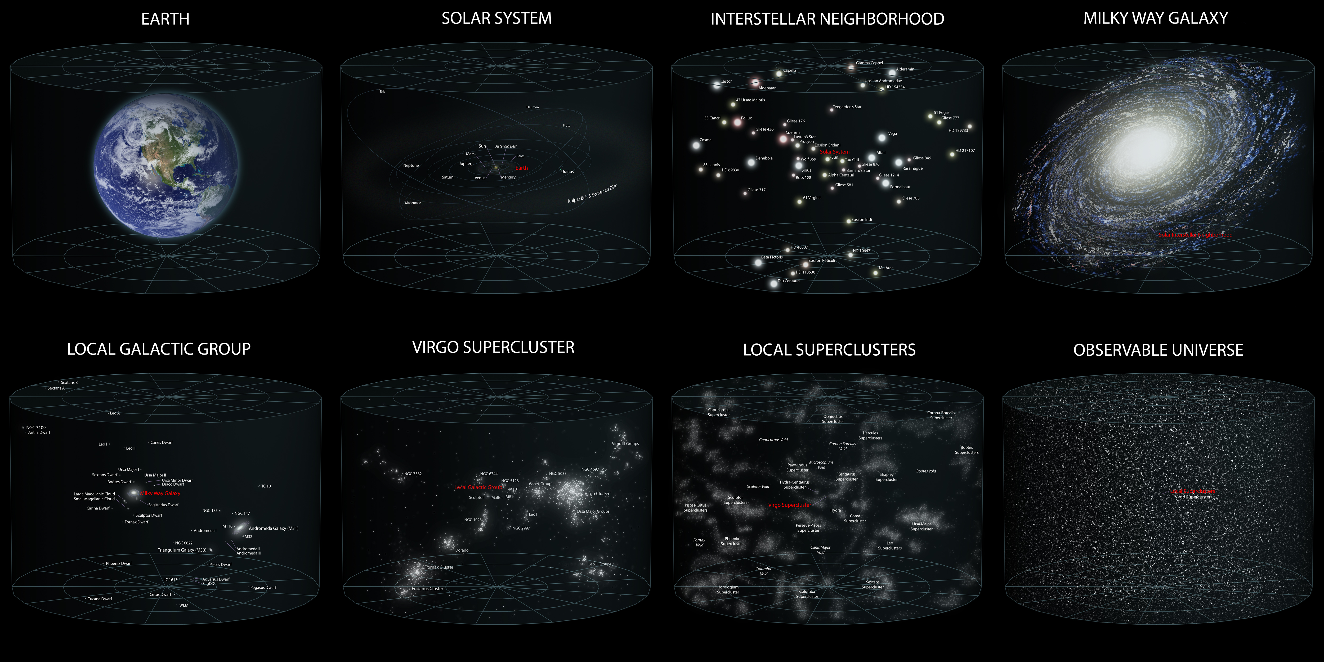
Earth location: http://upload.wikimedia.org/wikipedia/commons/0/0f/Earth%27s_Location_in_the_Universe_SMALLER_%28JPEG%29.jpg
Map showing crater loction near Calgary
http://www.cbc.ca/news/canada/calgary/huge-ancient-meteorite-crater-found-in-southern-alberta-1.2635289
Disclaimer: Opinions posted on Free Republic are those of the individual posters and do not necessarily represent the opinion of Free Republic or its management. All materials posted herein are protected by copyright law and the exemption for fair use of copyrighted works.

